
 United Kingdom
 France
 Germany
 Netherlands
 Sweden
 USA
USA
 Italy
Italy
 Spain
Spain
More From Contributor


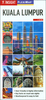
Kuala Lumpur
Street map of Kuala Lumpur at 1:10, 000 covering the city from the Sentul Terminal and the Setapak Park in the north to the Chinese Cemetery in the south, and from the Parliament House (Bangunan Paliament) in the west to the Royal Selangor Golf Club in the east.Two insets show the Kuala Lumpur surroundings at 1:437, 000 and a map of the Kuala Lumpur Transit system (metro, railway, mono-rail and inter-city rail lines).Detail includes markets, notable and public buildings, shopping malls, various religious buidings, accommodation, museums, theatres and cinemas, points of interest, post offices and police stations, bus terminals. Various railway systems and pedestrian roads are also indicated alongside land use, e.g. parks, markets, industrial areas, attractions, etc.Includes
an extensive index of place names.
an extensive index of place names.
Product Description
Reviews/Comments
Add New
Intelligent Comparison
Archived Product
Kuala Lumpur Stanfords
£4.99
Archived Product
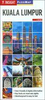
Kuala Lumpur Flexi Map Stanfords
£5.99
Vouchers
No voucher codes found.
Do you know a voucher code for this product or supplier? Add it to Insights for others to use.
Do you know a voucher code for this product or supplier? Add it to Insights for others to use.
 Denmark