
 United Kingdom
 France
 Germany
 Netherlands
 Sweden
 USA
USA
 Italy
Italy
 Spain
Spain
More From Contributor

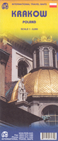
Krakow ITMB
Clear and easy to read tourist street plan of Kraków, with a detailed enlargement of the city’s historic centre including the old Jewish district of Kazimierz, plus a road map of the environs for day trips to the Wieliczka salt mine or to Auschwitz.The main plan at 1:8, 000 covers the city’s central area and the surrounding districts. Tram routes are shown with line numbers and stops. One way streets are marked and locations of petrol stations are indicated. Public buildings and various facilities or places of interest are highlighted, including numerous hotels, museums, churches and synagogues, etc.Kraków historic centre within the Planty park which replaced the city walls, and the area west of it, including the central railway stations and the old Jewish district of
Kazimierz are shown enlarged to 1:4, 000. The Old Town’s numerous churches are shown with names both in Polish and English, In Kazimierz the district’s many synagogues are marked. Also included is diagram of the city’s tram network, plus a road map of the surrounding region, showing road and rail networks, showing access to the Wieliczka salt mine and to the site of the Auschwitz-Birkenau concentration camp.
Kazimierz are shown enlarged to 1:4, 000. The Old Town’s numerous churches are shown with names both in Polish and English, In Kazimierz the district’s many synagogues are marked. Also included is diagram of the city’s tram network, plus a road map of the surrounding region, showing road and rail networks, showing access to the Wieliczka salt mine and to the site of the Auschwitz-Birkenau concentration camp.

Product Description
Reviews/Comments
Add New
Vouchers
No voucher codes found.
Do you know a voucher code for this product or supplier? Add it to Insights for others to use.
Do you know a voucher code for this product or supplier? Add it to Insights for others to use.
 Denmark