More From Contributor
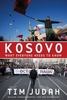
£18.99
This new fully updated 3rd edition of Bradt`s Kosovo is the only full-length English guidebook to this land rich in cultural heritage, generous hospitality & stunning scenery which is celebrating its 10th anniversary of unilateral independence from Serbia. Updated by two resident tourism experts, this new edition is an ideal companion for all visitors, offering maps, contacts & detailed information not easily accessible online, insider knowledge of one of Europe`s last unspoiled destinations, & comprehensive detail on sites, attractions & practical information. What was once a hub for adventurous backpackers & international organisations has become an outdoor adventure destination in its own right with a compelling buzz thanks in part to a vibrant & dynamic young population: the average age here is 26. Mega-hiking trails like the Via Dinarica & Peaks of the Balkans have brought attention to the country`s unmatched scenery & multitude of 2, 500+ metre peaks. New via ferratas
- climbing routes
- in the country`s north & west appeal to the adventurous set, while newly restored archaeological sites offer a haven for history buffs as well. This third edition contains a wealth of new tour operators & fully updated maps to key cities & regions that make it easier than ever to explore Europe`s youngest country. Ringed by high mountains & recovering from a turbulent past, Kosovo is enjoying a tourism renaissance. Following this guide, visitors can ski over pristine snowfields & hike among saw-toothed mountains, explore the ebb & flow of Islam & of Orthodox Christianity at beautiful shrines such as Gracanica Monastery or Prizren`s Sinan Pasha Mosque, sample raki at one of the vineyards, visit a traditional stone kulla, & be initiated into Prishtina`s coffee-drinking culture. Bradt`s Kosovo caters for all travellers. With detailed descriptions of the country`s lively cafes & wide-ranging restaurants, as well as the thriving outdoor adventure scene, plus accommodation to suit all budgets, this new edition is the ideal companion for tourists, NGOs & long-term visitors.

...
Archived Product
£11.99
On February 17, 2008, Kosovo declared its independence, becoming the seventh state to emerge from the break-up of the former Yugoslavia. A tiny country of just two million people, 90% of whom are ethnic Albanians, Kosovo is central
- geographically, historically, & politically
- to the future of the Western Balkans &, in turn, its potential future within the European Union. But the fate of both Kosovo, condemned by Serbian leaders as a ”fake state” & the region as a whole, remains uncertain. In Kosovo: What Everyone Needs to Know, Tim Judah provides a straight-forward guide to the complicated place that is Kosovo. Judah, who has spent years covering the region, offers succinct, penetrating answers to a wide range of questions: Why is Kosovo important? Who are the Albanians? Who are the Serbs? Why is Kosovo so important to Serbs? What role does Kosovo play in the region & in the world? Judah reveals how things stand now & presents the history & geopolitical dynamics that have led to it. The most important of these is the question of the right to self-determination, invoked by the Kosovo Albanians, as opposed to right of territorial integrity invoked by the Serbs. For many Serbs, Kosovo`s declaration of independence & subsequent recognition has been traumatic, a savage blow to national pride. Albanians, on the other h&, believe their independence rights an historical wrong: the Serbian conquest (Serbs say ”liberation”) of Kosovo in 1912. For anyone wishing to understand both the history & possible future of Kosovo at this pivotal moment in its history, this book offers a wealth of insight & information in a uniquely accessible format.

...
Archived Product
£15.99
Kosovo in the Travel Guide series from Bradt; encompassing a comprehensive range of titles to destinations worldwide, with a particular focus on Africa, Central & South America. Bradt are one of the country’s leading independent publishers & have an ethos that focuses on responsible travel, in alliance with a philosophy of sustainability; both in the destinations the guides cover but also in encouraging tourists to limit the impact they have on the local environment. Bradt guides have a reputation for appealing to more independent travelers & often cover destinations that are not available from other publishers. Each guide opens with two comprehensive chapters on Background & Practical Information, covering details of the country’s geography, culture, natural history, government & politics, economy, people, language, religion, education & culture. Important practical advice

Includes::
when to visit, highlights, suggested itineraries, tour operators, red tape, embassies & consulates, getting there & away, health, safety, what to take, money, budgeting, getting around, accommodation, eating & drinking, public holidays, shopping, arts & entertainment, media & communications, business, travel culture & cultural etiquette. Individual sections are organized geographically by region & typically open with information on practicalities & orientation, before focusing on what to see & where to go. Information on what to see, where to stay, where to eat & how to find your way around is provided, with a range of budgets catered for. Simple black & white maps locate key visitor sites & places of accommodation. Bradt Travel Guides include appendices that provide an in-depth introduction to the language of each country, a glossary of terms & a listing of books & internet resources providing further information on the destination.

...
Archived Product
£10.99
Kosovo at 1:150, 000 on a large map in Freytag & Berndt’s “ Top 10 Tips” series with the index booklet also providing multilingual descriptions of the country’s most interesting locations. Where appropriate, place names are bilingual, with Serbian names shown in Latin alphabet only (within Serbia itself & Macedonia place names are in both Cyrillic & Latin alphabets). The map is an enlargement of F&B’s mapping of the region at a smaller scale, so all names are in much larger print size than found on similar maps. Topography is presented by relief shading with colouring for forested areas, plus names of various mountain ranges & peaks. Road network

Includes::
small local roads & selected cart tracks. Driving distances are marked on main routes & scenic roads are highlighted. Railway lines are shown with stations. Various places of interest, including the publishers’ recommendations are highlighted. Latitude & longitude lines are drawn at 10’ intervals. Multilingual map legend

Includes::
English. The index, arranged by country, is in a separate booklet attached to the map cover &, where appropriate, shows locations with their postcodes. The booklet also

Includes::
a street plan of central Prishtina, plus publishers’ recommendations of Kosovo’s 10 top sights, each with a multilingual brief description.


...
Archived Product
£13.50
Kosovo Wall Map at 1:250, 000 from Gizi Map, size 100 x 68.5cm (39.5” x 27” approx)., showing place names in their Albanian & Serbian versions, with a separate index for each set of names. Serbian names, both in Kosovo & in the adjoining parts of Serbia & Macedonia, are given in the Latin alphabet. Bold altitude colouring with spot heights & names of mountain ranges, etc, indicates the country’s topography. Road network

Includes::
selected country tracks, indicates border crossings, & shows distances on main & many local routes. Railway lines are shown with stations. The map also shows the division of Kosovo into provinces. Symbols indicate various places of interest. The map has a latitude & longitude lines at 15’ intervals. The index, cross-referencing the Albanian & Serbian version of place names, is next to the map. Map legend

Includes::
English. Please note: this title is also available as a folded map.


...
Archived Product
£17.99
The 1:50 000 topographic map gives a more general picture of the ground features than a basic map. It shows settlements, houses, roads, cultivated areas, waterways, cutting areas, mires, rock exposures, & relief. One map sheet covers an area of 30 x 40 km & one centimetre corresponds to 500 metres on the ground. The 1:50, 000 topographic map is also an ideal complement to nautical charts as it provides useful information about the land areas adjacent to waterways. For example, all Finnish sea areas are covered by 1:50 000 topographic map sheets. ...
Archived Product
£6.99
Koszeg Hillsin a series of contoured hiking & recreational maps from the Budapest based Cartographia, with hiking routes & other tourist information, including in many titles street plans, cycling trails, etc. The maps have contours at 10m intervals with relief shading & spot heights, plus colouring and/or graphics to indicate different types of vegetation. An overprint highlights local hiking paths, with cycling routes also included in some titles. Symbols mark various places of interest, sport & recreational facilities, including campsites & other tourist accommodation, locations of petrol stations, etc. The maps show 1km lines of the country’s national grid. Map legends are in Hungarian & German only. On the reverse many titles include street plans of holiday centres & further information on the area, in Hungarian only. ...
Archived Product
£6.99
In 1998 & 1999 legendary explorer Colonel John Blashford-Snell led one of the most ambitious expeditions since Thor Heyerdahl's Kon-Tiki. This is the account of an amazing adventure which provided evidence that South Americans could have had trading contacts with Africa 1, 000 years before Christ. In recreating this epic journey, they built their own fleet of traditional craft
- the largest named Kota Mama & uncovered many archaeological sites along the way.
...
Archived Product
£17.99
The 1:50 000 topographic map gives a more general picture of the ground features than a basic map. It shows settlements, houses, roads, cultivated areas, waterways, cutting areas, mires, rock exposures, & relief. One map sheet covers an area of 30 x 40 km & one centimetre corresponds to 500 metres on the ground. The 1:50, 000 topographic map is also an ideal complement to nautical charts as it provides useful information about the land areas adjacent to waterways. For example, all Finnish sea areas are covered by 1:50 000 topographic map sheets. ...
Archived Product
£23.99
Karttakeskus’ Water touring maps are a completely new type of map series. The pre-folded maps made from waterproof & rip-proof material can fit into a small space on the boat, but when opened, they cover a wide area. In this way, the water touring map is e.g. an excellent planning tool alongside electronic navigation solutions, offering a wide overview for e.g. route planning. On the other h&, the waterproof material makes the map easy to handle in e.g. an open boat or sailing boat. Water touring maps: In land areas, the maps have been supplemented with the National Land Survey of Finland’s Topographic Database material. New map sheet division. Size 70 × 100 cm, folded 23.3 × 11.3 cm. Additional themes incl. slipways & camp fire sites & landfalls. Scale in maritime areas 1:60 000, inland waterways 1:50 000 Base map source: Finnish Transport Agency. Not for navigation use. Does not meet the requirements of an official nautical chart. ...
Archived Product

Kosovo SUPERCEDED

Now independent, this Bradt guide is a must-buy for visitors from the country's diaspora (believed to number over a million), for the many NGOs there and, as always, for those keen to explore off the beaten track. Ringed by high mountains crossed by a series of rulers over the centuries, the country boasts Ottoman mosques, Tito-esque administration buildings, Serbian Orthodox churches, monasteries, vineyards and extravagant KLA war memorials. Pristina offers a surprising contrast with its growing number of vibrant restaurants, bars and shops.
RIP - This product is no longer available on our network. It was last seen on 25.09.2019

This page now acts as a permanent archive for this product. Add more information using the comments box below to ensure it can still be found by future generations.

Use our search facility to see if it is available from an alternative contributor.
  • External links may include paid for promotion
  • Availability: Out Of Stock
  • Supplier: Stanfords
  • SKU: 9781841621999
Availability: In Stock
£14.99

Product Description

Now independent, this Bradt guide is a must-buy for visitors from the country's diaspora (believed to number over a million), for the many NGOs there &, as always, for those keen to explore off the beaten track. Ringed by high mountains crossed by a series of rulers over the centuries, the country boasts Ottoman mosques, Tito-esque administration buildings, Serbian Orthodox churches, monasteries, vineyards & extravagant KLA war memorials. Pristina offers a surprising contrast with its growing number of vibrant restaurants, bars & shops.

Reviews/Comments

Add New

Intelligent Comparison

Oooops!
We couldn't find anything!
Perhaps this product's unique.... Or perhaps we are still looking for comparisons!
Click to bump this page and we'll hurry up.

Price History

Vouchers

No voucher codes found.
Do you know a voucher code for this product or supplier? Add it to Insights for others to use.

Facebook

Jargon Buster

Supplier Information

Stanfords
Stanfords was established in 1853 and opened their iconic Covent Garden flagship store in 1901. They have become the top retailer of maps, travel books and accessories in the UK and arguably offer the largest selection of maps and travel books worldwide. Famous names such as Captain Robert Falcon Scott, Ranulph Fiennes and Michael Palin have purchased from Stanfords. They now have a shop in Bristol and both stores together with other venues operate a calendar of events including talks, book signings and exhibitions. As a specialist map retailer, the map selection is comprehensive and includes road maps, street maps and walking maps from worldwide destinations, as well as a selection of world atlases and wall maps. Books include travel guides and travel literature. Stanfords also stock globes, from miniatures made of blue marble to magnificent floor-standing globes. The website features a selection of interesting articles on travel topics.
Page Updated: 2023-11-12 20:15:36

Community Generated Product Tags

Oh No! The productWIKI community hasn't generated any tags for this product yet!
Menu