More From Contributor

£16.99
Topographic survey of Sweden at 1:50, 000, the Terrängkartan, from the Lantmäteriet, covering most of the country in 244 double-sided maps. Please note: the mountainous regions of central & northern Sweden are not covered by this series but presented in a separate “ Fjällkartan
- Mountain Map” series also listed on our website. Each 1:50, 000 topographic survey map covers an area of 37.5 x 40km. The maps have contours at 5 metre intervals, plus relief shading & graphics for rocky outcrops & boulders. Further graphics and/or colouring show different types of land use or vegetation (forests, arable l&, orchards, marshes, peat bogs, etc). An unusual feature of this survey is the colouring indicating buildings below or above two storeys high & “leisure/holiday homes”. The maps indicate privately maintained roads & include all other information expected of topographic survey at this scale. The maps have a 1-km UTM grid, plus latitude & longitude lines 5’ intervals. Map legend

Includes::
English. For coverage of the country’s most visited hiking areas in central & northern Sweden please see Lantmäteriet’s Mountain Map series, listed separately on our website.


...
Archived Product
£11.99
Korça & Environs area of southern Albania at 1:50, 000 in a series of GPS compatible contoured maps from Huber Verlag showing hiking & cycling routes, climbing sites, tourist accommodation, etc. Descriptions cover eight cycling routes & six hiking trails. Maps in this series, prepared in cooperation with the Albanian Alps Associations & the National Society for Mountainous Studies, have contours at 50m intervals, with spot heights, graphic relief for exposed rocky areas & colouring showing woodlands. Recommended hiking & cycling routes are prominently marked & cross-referenced to descriptions on the reverse side. Interesting towns & villages are highlighted & symbols indicate hotels & other tourist accommodation, sites for climbing and/or kayaking, museums, archaeological remains, medical facilities, etc. The maps have a 1-km UTM grid. On the reverse are detailed descriptions of the recommended hiking & cycling trails accompanied in some titles by route profiles. Map legend & all the text include English. To see other titles in this series please click on the series link. ...
Archived Product
£9.99
Korça Prefecture at 1:140, 000 in a series of handy size, waterproof & tear-resistant, contoured & GPS compatible road maps from the Tirana-based publishers Vektor. Landscape is presented by altitude colouring & contours lines at 100m intervals, with spot heights & a few more names of topographic features than found on Vektor’s 200K road maps of the country. National parks & nature reserves are prominently highlighted. The prefecture maps appear to show the same small local dirt roads as in the 200K series, but given the increase in scale do so with greater clarity & also provide more detailed GPS coordinates (latitude & longitude lines are drawn at 5’ intervals), useful when travelling across the more remote parts of the country. Railway lines are included & local airports are marked. Symbols highlight campsites, beaches, archaeological & historical sites, caves, etc. The maps also show subdivisions of prefectures & names of the communes, & indicate administrative status of towns. Map legend

Includes::
English. Please note: border crossings are prominently marked but beyond topographic colouring no road or other information is provided outside the country’s borders.

...
Archived Product
£24.95
Road map with relief shown by elevation colouring. The main towns are named in Farsi & Roman script, with the smaller settlements named in Farsi only. Main roads are differentiated by surface, & petrol stations are shown. On the reverse is a street plan of Sanandaj naming the main streets in Farsi & Roman script & marking major buildings. ...
Archived Product
£13.59
Korea in the Countries & Regions series from Lonely Planet, market-leading comprehensive guides aimed at independent travellers & serving a large range of international destinations. Frank & informal in style, the guides explore an extensive range of sights, activities, accommodation, restaurants & nightlife & are designed for practical use while travelling on the road. Written & researched by a team of experts, each book is independent in its recommendations & suggestions, often offering individual takes on individual destinations. Widely recognised for their reliability, each Lonely Planet country & region guide has the same layout. Introductory sections profile the destination with individual chapters on particular highlights, getting started, (including when to go) itineraries, history, culture, arts, food & drink & the environment. Each guide is organised geographically by region, with individual sections detailing an extensive range of sights, places of interest, attractions, restaurants, nightlife, accommodation & any local activities. The guides have detailed explanations of historical context where relevant. There is also practical guidance on ...
Archived Product
£5.00
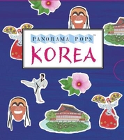
Bring Korea to life with this beautiful three-dimensional Panorama Pop, featuring the country`s most famous sites. Remember Korea for ever with this exquisite three-dimensional expanding pocket guide. Presented in a beautiful slipcase, the guide unfolds to a length of 1.5 metres & features 12 of Korea`s most famous sites, including Gyeongbokgung Palace, Changdeokgung Palace, Bukhansan National Park, Sungnyemun Gate, Han river, Gangnam District, Hwaseong Fortress, Ha Hoe Folk Village, Gyeonju Historic Area, Haneinsa Temple, Jeonju Hanok Village & Jeju Isl&. A perfect gift or souvenir for anyone wishing to remember a visit to the country. ...
Archived Product
£6.99
The Korea Travel Map from Periplus is designed as a convenient, easy-to-use tool for travelers. Created using durable coated paper, this map is made to open & fold multiple times, whether it`s the entire map that you want to view or one panel at a time. This 2nd edition

Includes::
maps & plans that are scaled to: Area Maps: South Korea 1:1, 000, 000 Jeju Island 1:600, 000 City Plans: Seoul 1:30, 000 Central Seoul 1:10, 000

...
Archived Product
£11.99
Korea in the Countries, Regions & Cities series from Rough Guides; comprehensively detailed guidebooks specifically designed for independent travellers & serving a range of worldwide destinations. Widely recognised for their free editorial style, Rough Guide authors are allowed to express their personal opinions on a range of subjects. Although sometimes controversial, this editorial stance allows readers to experience more detailed & personal takes on each destination, a feature often more limited in other guidebooks. Cultural & historical nuances are explored in significant depth throughout the text & descriptions on the ambience of individual settings alongside personal recommendations, particularly in cities, are notably prevalent. Each Rough Guide in the Countries, Regions & Cities series has a similar layout. A ...
Archived Product
£15.99
This is the only guidebook on the market to cover both South & North Korea. It

Includes::
a special Korea Outdoor

...
Archived Product
£16.99
Korea in the Countries & Regions series from Lonely Planet, market-leading comprehensive guides aimed at independent travellers & serving a large range of international destinations. Frank & informal in style, the guides explore an extensive range of sights, activities, accommodation, restaurants & nightlife & are designed for practical use while travelling on the road. Written & researched by a team of experts, each book is independent in its recommendations & suggestions, often offering individual takes on individual destinations. Widely recognised for their reliability, each Lonely Planet country & region guide has the same layout. Introductory sections profile the destination with individual chapters on particular highlights, getting started, (including when to go) itineraries, history, culture, arts, food & drink & the environment. Each guide is organised geographically by region, with individual sections detailing an extensive range of sights, places of interest, attractions, restaurants, nightlife, accommodation & any local activities. The guides have detailed explanations of historical context where relevant. There is also practical guidance on ...
Archived Product

Korea

Korea in the Countries, Regions and Cities series from Rough Guides; comprehensively detailed guidebooks specifically designed for independent travellers and serving a range of worldwide destinations. Widely recognised for their free editorial style, Rough Guide authors are allowed to express their personal opinions on a range of subjects. Although sometimes controversial, this editorial stance allows readers to experience more detailed and personal takes on each destination, a feature often more limited in other guidebooks. Cultural and historical nuances are explored in significant depth throughout the text and descriptions on the ambience of individual settings alongside personal recommendations, particularly in cities, are notably prevalent. Each Rough Guide in the Countries,
Regions and Cities series has a similar layout. A
RIP - This product is no longer available on our network. It was last seen on 25.09.2019

This page now acts as a permanent archive for this product. Add more information using the comments box below to ensure it can still be found by future generations.

Use our search facility to see if it is available from an alternative contributor.
  • Availability: Out Of Stock
  • Supplier: Stanfords
  • SKU: 9781848368903
Availability: In Stock
£13.59

Product Description

Korea in the Countries, Regions & Cities series from Rough Guides; comprehensively detailed guidebooks specifically designed for independent travellers & serving a range of worldwide destinations. Widely recognised for their free editorial style, Rough Guide authors are allowed to express their personal opinions on a range of subjects. Although sometimes controversial, this editorial stance allows readers to experience more detailed & personal takes on each destination, a feature often more limited in other guidebooks. Cultural & historical nuances are explored in significant depth throughout the text & descriptions on the ambience of individual settings alongside personal recommendations, particularly in cities, are notably prevalent. Each Rough Guide in the Countries, Regions & Cities series has a similar layout. A

Reviews/Comments

Add New

Price History

Vouchers

No voucher codes found.
Do you know a voucher code for this product or supplier? Add it to Insights for others to use.

Facebook

Jargon Buster

Personal - Something that belongs more to an individual due to it affecting them more by relating to them.
Experience - To gain further knowledge by practising.
Feature - An attribute that makes something stand out.
Individual - A single separate item or person.

Supplier Information

Stanfords
Stanfords was established in 1853 and opened their iconic Covent Garden flagship store in 1901. They have become the top retailer of maps, travel books and accessories in the UK and arguably offer the largest selection of maps and travel books worldwide. Famous names such as Captain Robert Falcon Scott, Ranulph Fiennes and Michael Palin have purchased from Stanfords. They now have a shop in Bristol and both stores together with other venues operate a calendar of events including talks, book signings and exhibitions. As a specialist map retailer, the map selection is comprehensive and includes road maps, street maps and walking maps from worldwide destinations, as well as a selection of world atlases and wall maps. Books include travel guides and travel literature. Stanfords also stock globes, from miniatures made of blue marble to magnificent floor-standing globes. The website features a selection of interesting articles on travel topics.
Page Updated: 2023-11-12 20:15:36

Community Generated Product Tags

Oh No! The productWIKI community hasn't generated any tags for this product yet!
Menu