More From Contributor
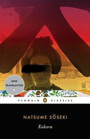
£9.99
Kohima was the turning point in the Japanese invasion of India, witnessing the end of their attempt to overthrow the British Raj. It was a bitter battle fought in three stages, spanning three months & ending with the siege of Imphal. Losses on both sides were heavy, with the Japanese suffering their greatest land defeat thus far in the war. Against the odds & an enemy who nearly refused to give in, the British Army resisted the Japanese & their victory paved the way for the reconquest of Burma. Battle Story: Kohima explores the historical context of this critical point in the war in Asia, the personalities of the opposing armies & offers a blow-by-blow account of the battle. ...
Archived Product
£17.99
The 1:50 000 topographic map gives a more general picture of the ground features than a basic map. It shows settlements, houses, roads, cultivated areas, waterways, cutting areas, mires, rock exposures, & relief. One map sheet covers an area of 30 x 40 km & one centimetre corresponds to 500 metres on the ground. The 1:50, 000 topographic map is also an ideal complement to nautical charts as it provides useful information about the land areas adjacent to waterways. For example, all Finnish sea areas are covered by 1:50 000 topographic map sheets. ...
Archived Product
£49.95
A set of three maps from the 1:100, 000 topographic survey of Papua New Guinea, covering the whole of the famous Kakoda Trail, a 96km route from Owers Corner in (50km east of Port Moresby to Kokoda. The trail is famous as the location of a World War II battle between Japanese & Australian forces in 1942. The three sheets, Port Moresby, Efogi & Kakoda, cover the whole of the trail, including the area between Port Moresby & Owers Corner. Topography is shown by contours at 40m intervals, with spot heights plus colouring & graphics to indicate different types of vegetation & terrain. The route of the Kakoda trail is marked, as well as local roads & tracks, settlements, airfields & landing strips, etc. The maps have a 1km UTM grid & margin ticks for latitude & longitude at intervals of 10’. Map legend is in English. ...
Archived Product
£6.95
Map No. 110, Kokorinsko, in a series of GPS compatible topographic maps of the Czech Republic at 1:75.000 from Shocart highlighting both signposted cycling routes & other local cycling paths, with route profiles & additional tourist information. Relief is shown by contour lines, spot heights, & subtle hill-shading. The maps show roads, tracks, railways, cable cars, chairlifts, & a range of natural landscape features & landmarks. Coloured symbols depict plenty of additional tourist features e.g. information centres, places of interest, antiquities, shelters, campsites, accommodation, bicycle services etc. An overprint highlights both signposted routes & other recommended routes which have no terrain markers. For all bike routes intermediate distances are shown. Hiking paths are also highlighted. Latitude & longitude margin ticks are at 5' intervals. Each map is accompanied by a booklet containing general information on the Czech cycle route network, elevation profile diagram for selected routes, plus an index for locations of historical & geographical interest, bicycle service workshops, information centres, & tourist attractions. Map legend & text are in English, German & Czech. ...
Archived Product
£6.99
The 15 classic essays collected in Kokoro examine the inner spiritual life of Japan. The title itself can be translated as heart, spirit or inner meaning, & that`s exactly what this collection teaches us about Japan. Sometimes touching & always compelling, the writings here tell the stories of the people & social codes that make Japan the unique place it is. Kimiko paints the portrait of a beautiful geisha; By Force of Karma tells the story of a Buddhist monk; & in A Conservative, we come to know the thoughts & actions of a Samurai. As an early interpreter of Japan to the West, Lafcadio Hearn was without parallel in his time. His numerous books about that country were read with a fascination that was a tribute to his keen powers of observation & the vividness of his descriptions. Today, even though Japan has changed greatly from what it was when he wrote about it, his writing is still valid, for it captures the essence of the country an essence that has actually changed a good deal less than outward appearances might suggest. In a word, the Japanese character & the Japanese tradition are still fundamentally the same as Hearn found them to be, & for this reason his books are still extremely revealing to readers in the West. ...
Archived Product
£29.99
Map No. 3028, Kokstad, in South Africa’s official topographic survey at 1:250, 000 from the country’s national survey organization, the Chief Directorate of Surveys & Mapping. The maps have altitude colouring & contours at 50m or 100m intervals, depending on the map edition, plus spot heights. Deserts, marshes, dry pans, perennial & seasonal water features, etc, as well as protected areas are shown. The maps present the country’s road & rail networks & include the usual information expected on topographic mapping at this scale, although in more rapidly developing areas road information may not necessarily be up to date. Also indicated are magisterial district & provincial boundaries. Latitude & longitude values are shown in the margins at 5` intervals together with South African grid co-ordinates. Typically, each sheet covers an area of one degree of latitude & two degrees of longitude. The projection used is Gauss Conformal. The legend is in English & Afrikaans. ...
Archived Product
£17.99
The 1:50 000 topographic map gives a more general picture of the ground features than a basic map. It shows settlements, houses, roads, cultivated areas, waterways, cutting areas, mires, rock exposures, & relief. One map sheet covers an area of 30 x 40 km & one centimetre corresponds to 500 metres on the ground. The 1:50, 000 topographic map is also an ideal complement to nautical charts as it provides useful information about the land areas adjacent to waterways. For example, all Finnish sea areas are covered by 1:50 000 topographic map sheets. ...
Archived Product
£19.99
Koli Ruunaa Patvinsuo Petkeljärvi area of Finland at 1:25, 000 in a series of beautiful & informative maps of popular outdoor leisure areas with cartography of the country’s topographic survey. Excellent use of colours, shading & symbols provides a very detailed picture of the terrain & vegetation. Extensive overprint highlights routes for hiking, and/or other outdoor pursuits, a wide variety of accommodation, from hotels & holiday villages to Lapland tepees, food & fuel supplies, etc. The maps have a UTM grid & margin ticks for latitude & longitude. Map legends include English. ...
Archived Product

Kokoro

Kokoro, meaning `heart`, is a tantalizing novel about the friendship between a young man and an enigmatic elder whom he calls Sensei. Set in the early twentieth century, when the death of the emperor Meiji gave way to a new era in Japanese politicial and cultural life, the novel enacts the transition from one generation to the next in the dynamic between Sensei, who is haunted by mysterious events in his past, and the unnamed young man, one of the new generation`s elite who will inherit the coming era.
RIP - This product is no longer available on our network. It was last seen on 25.09.2019

This page now acts as a permanent archive for this product. Add more information using the comments box below to ensure it can still be found by future generations.

Use our search facility to see if it is available from an alternative contributor.
  • External links may include paid for promotion
  • Availability: Out Of Stock
  • Supplier: Stanfords
  • SKU: 9780143106036
Availability: In Stock
£9.99

Product Description

Kokoro, meaning `heart`, is a tantalizing novel about the friendship between a young man & an enigmatic elder whom he calls Sensei. Set in the early twentieth century, when the death of the emperor Meiji gave way to a new era in Japanese politicial & cultural life, the novel enacts the transition from one generation to the next in the dynamic between Sensei, who is haunted by mysterious events in his past, & the unnamed young man, one of the new generation`s elite who will inherit the coming era.

Reviews/Comments

Add New

Price History

Vouchers

No voucher codes found.
Do you know a voucher code for this product or supplier? Add it to Insights for others to use.

Facebook

Jargon Buster

Set - a group of items usually related to one another. Some objects cannot function without the complete set of items.
Heart - An organ that pumps blood around the body. Usually related to love.

Supplier Information

Stanfords
Stanfords was established in 1853 and opened their iconic Covent Garden flagship store in 1901. They have become the top retailer of maps, travel books and accessories in the UK and arguably offer the largest selection of maps and travel books worldwide. Famous names such as Captain Robert Falcon Scott, Ranulph Fiennes and Michael Palin have purchased from Stanfords. They now have a shop in Bristol and both stores together with other venues operate a calendar of events including talks, book signings and exhibitions. As a specialist map retailer, the map selection is comprehensive and includes road maps, street maps and walking maps from worldwide destinations, as well as a selection of world atlases and wall maps. Books include travel guides and travel literature. Stanfords also stock globes, from miniatures made of blue marble to magnificent floor-standing globes. The website features a selection of interesting articles on travel topics.
Page Updated: 2023-11-12 20:15:36

Community Generated Product Tags

Oh No! The productWIKI community hasn't generated any tags for this product yet!
Menu