
 United Kingdom
 France
 Germany
 Netherlands
 Sweden
 USA
USA
 Italy
Italy
 Spain
Spain
More From Contributor

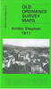

Kirkby Stephen 1911
Kirkby Stephen in 1911 in a fascinating series of reproductions of old Ordnance Survey plans in the Alan Godfrey Editions, ideal for anyone interested in the history of their neighbourhood or family. Selected towns in Great Britain and Ireland are covered by maps showing the extent of urban development in the last decades of the 19th and early 20th century.In this title: the map is double-sided. The main map includes the town centre, stretching southward to Stenkrith Bridge and eastward to Hellgill Howe, Birkett Lane and Low Out Wood. Features include the town centre, St Stephen's church, workhouse, Redman House, Edenbank Brewery, Frank's Bridge, Hartley Hill, Hartley, Merrygill Viaduct, Podgill Viaduct, Podgill Hole, Brockram Quarry. On the reverse is a good part of adjacent
sheet 23.14, extending coverage westward, and this includes the NER station, engine shed and railway sidings, Croglam Castle, Auction Mart. (Note that the Midland station is off the map.) About the Alan Godfrey Editions of the 25
sheet 23.14, extending coverage westward, and this includes the NER station, engine shed and railway sidings, Croglam Castle, Auction Mart. (Note that the Midland station is off the map.) About the Alan Godfrey Editions of the 25
Product Description
Reviews/Comments
Add New
Intelligent Comparison
Archived Product

Kirkby Stephen 1911 Stanfords
£3.50
Vouchers
No voucher codes found.
Do you know a voucher code for this product or supplier? Add it to Insights for others to use.
Do you know a voucher code for this product or supplier? Add it to Insights for others to use.
 Denmark