More From Contributor
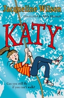
£17.99
The 1:50, 000 topographic map gives a more general picture of the ground features than a basic map. It shows settlements, houses, roads, cultivated areas, waterways, cutting areas, mires, rock exposures, & relief. One map sheet covers an area of 30 x 40 km & one centimetre corresponds to 500 metres on the ground. The 1:50, 000 topographic map is also an ideal complement to nautical charts as it provides useful information about the land areas adjacent to waterways. For example, all Finnish sea areas are covered by 1:50, 000 topographic map sheets. ...
Archived Product
£9.99
Map No. 248, Katmai National Park & Preserve, AK, in an extensive series of GPS compatible, contoured hiking maps of USA’s national & state parks or forests & other popular recreational areas. Cartography based on the national topographic survey, with additional tourist information. The maps, with most titles now printed on light, waterproof & tear-resistant plastic paper, highlight walking trails along with campsites & other accommodation, picnic sites, areas for various recreational pursuits such as horse riding or skiing, drinking water sources, & many other facilities of interest to the outdoor enthusiast. Cartography is based on information from the USGS (United States Geological Survey
- the country’s national survey organization), revised by the National Geographic Maps in cooperation with the National Park Service, USDA Forest Service, etc. Topography is excellently presented by contours (interval varies according to scale), enhanced by relief shading & colouring/graphics for wood cover, glaciers, etc. All heights are given in feet. The maps have a UTM grid plus latitude & longitude margin ticks & GPS waypoints for selected important locations. Each map is double-sided to give either maximum coverage of the chosen area or additional enlargements of its important sections. Accompanying notes provide useful information on relevant regulations, safety precautions, contact addresses, etc.* *IMPORTANT
- PLEASE NOTE: the series is very extensive, ranging in scale from 1:400, 000 for the vast national parks of Alaska to 1:25, 000 for local map in several states. We recommend, therefore, viewing the series by state rather than the whole list.*

...
Archived Product
£5.99
Katowice on an indexed, double-sided street plan at 1:20, 000 from Express Map with an enlargement showing the town centre in greater detail, a map of the night bus & tram lines, & a large road map of the Upper Silesia mining region at 1:100, 000, including Gliwice, Zabrze, Chorzów, Bytom, Sosmowiec, Dabrowa Górnicza, etc. Express Map street plans provide coverage of cities within their administrative boundary, spread across the two sides of the map. Bus & tram routes are shown with stops & line numbers. For drivers, main traffic arteries are highlighted, one way streets are marked & the plans also show traffic lights, petrol stations, car parks & restricted entry streets or zones. Streets are annotated with selected house numbers for easier identification of addresses. Names of suburbs & of larger housing estates are clearly marked. Symbols highlight various facilities & places of interest, including museums & other cultural institutions & historical sites, 24-hrs pharmacies, campsites & youth hostels, etc. Where more than one town is covered, each has a separate index. Map legend

Includes::
English.

...
Archived Product
£16.99
Topographic survey of Sweden at 1:50, 000, the Terrängkartan, from the Lantmäteriet, covering most of the country in 244 double-sided maps. Please note: the mountainous regions of central & northern Sweden are not covered by this series but presented in a separate “ Fjällkartan
- Mountain Map” series also listed on our website. Each 1:50, 000 topographic survey map covers an area of 37.5 x 40km. The maps have contours at 5 metre intervals, plus relief shading & graphics for rocky outcrops & boulders. Further graphics and/or colouring show different types of land use or vegetation (forests, arable l&, orchards, marshes, peat bogs, etc). An unusual feature of this survey is the colouring indicating buildings below or above two storeys high & “leisure/holiday homes”. The maps indicate privately maintained roads & include all other information expected of topographic survey at this scale. The maps have a 1-km UTM grid, plus latitude & longitude lines 5’ intervals. Map legend

Includes::
English. For coverage of the country’s most visited hiking areas in central & northern Sweden please see Lantmäteriet’s Mountain Map series, listed separately on our website.


...
Archived Product
£16.99
Sverigeserien is an outdoor map series consisting of 116 sheets with coverage of southern & central Sweden & the northern coastline. The map is suitable for outdoor activities such as hiking, excursions, trail running, hunting, fishing, riding, cycling, mountain biking, paddling, skating & much more. Every sheet covers an area of 45x 68km. These topographical maps in scale 1:50 000 contain all the information needed for outdoor activities: Terrain information, hiking trails, illuminated tracks, camping, shelters, golf courses, leisure baths, historical remains, roads in different categories, railway lines & much more. Easy to read topography with contour lines, vertical interval 5 m. Sverigeserien is a high-quality map series & is durable for frequent use! Updated content with map data from Lantmäteriet (National Land Survey of Sweden) & printed on Polyart which is water & tear resistant. This means that the map can be folded repeatedly without breaking & can withstand the challenging weather in Sweden during both winter & summer. Legend is in Swedish, English & German. ...
Archived Product
£6.99
This is a fabulous flap-filled book from the best-selling creator of ” Maisy”! Katy Cat, a marmalade kitten, has whiskers. Katy Cat asks her puffin friend, ” What do you have Beaky Boo?” Is it a trunk? Maybe it`s long ears? Ooh, could it be a beak? Let`s lift the flap & see! With a simple question & answer formula, this vibrant, fun-filled book encourages little children to seek the answers for themselves by exploring & playing with the pages. Cheery, bright colours! Over forty fabulous flaps! HOURS of fun! This title teaches children a whole range of first concepts including colours, patterns, counting & animal noises! ...
Archived Product
£6.99
It`s summertime at Barton Farm in Victoria Eveleigh`s latest Exmoor Pony adventure. Katy is looking forward to a carefree summer on the farm, riding & having fun with her best friend, Alice. But all that changes when an injured foal leads to a mystery that no one can solve. It`s up to Katy & her friends to discover exactly what`s going on. The latest adventure in Victoria Eveleigh`s Exmoor Pony series. Perfect for fans of animal stories, Michael Morpurgo & Lauren St John. ...
Archived Product
£11.99
Kaua'i in the Countries & Regions series from Lonely Planet, market-leading comprehensive guides aimed at independent travellers & serving a large range of international destinations. Frank & informal in style, the guides explore an extensive range of sights, activities, accommodation, restaurants & nightlife & are designed for practical use while travelling on the road. Written & researched by a team of experts, each book is independent in its recommendations & suggestions, often offering individual takes on individual destinations. Widely recognised for their reliability, each Lonely Planet country & region guide has the same layout. Introductory sections profile the destination with individual chapters on particular highlights, getting started, (including when to go) itineraries, history, culture, arts, food & drink & the environment. Each guide is organised geographically by region, with individual sections detailing an extensive range of sights, places of interest, attractions, restaurants, nightlife, accommodation & any local activities. The guides have detailed explanations of historical context where relevant. There is also practical guidance on ...
Archived Product
£10.95
About this series: Contoured trekking maps detailing maintained & unmaintained trails. Visitor centres & campgrounds are marked with symbols. Advice for hikers & information about the park is printed around the edge of the map. Advice for hikers & information about the park is printed around the edge of the map. ...
Archived Product
£13.99
Kaufbeuren
- Ostallgäu (No. 188), a detailed, GPS compatible map at 1:50, 000 from Kompass with local & long-distance footpaths,
...
Archived Product

Katy

Katy Carr is a lively, daredevil oldest sister in a big family. She loves messing around outdoors, climbing on the garage roof, or up a tree, cycling, skateboarding, swinging...But her life changes in dramatic and unexpected ways after a serious accident. Inspired by the classic novel, What Katy Did, Jacqueline Wilson creates an irresistible modern version for the twenty-first-century. This title is suitable for fans of Hetty Feather and Tracy Beaker will fall in love with Katy and her family too.
RIP - This product is no longer available on our network. It was last seen on 25.09.2019

This page now acts as a permanent archive for this product. Add more information using the comments box below to ensure it can still be found by future generations.

Use our search facility to see if it is available from an alternative contributor.
  • External links may include paid for promotion
  • Availability: Out Of Stock
  • Supplier: Stanfords
  • SKU: 9780141353982
Availability: In Stock
£6.99

Product Description

Katy Carr is a lively, daredevil oldest sister in a big family. She loves messing around outdoors, climbing on the garage roof, or up a tree, cycling, skateboarding, swinging... But her life changes in dramatic & unexpected ways after a serious accident. Inspired by the classic novel, What Katy Did, Jacqueline Wilson creates an irresistible modern version for the twenty-first-century. This title is suitable for fans of Hetty Feather & Tracy Beaker will fall in love with Katy & her family too.

Reviews/Comments

Add New

Intelligent Comparison

Oooops!
We couldn't find anything!
Perhaps this product's unique.... Or perhaps we are still looking for comparisons!
Click to bump this page and we'll hurry up.

Price History

Vouchers

No voucher codes found.
Do you know a voucher code for this product or supplier? Add it to Insights for others to use.

Facebook

Jargon Buster

Love - Someone who shows deep affection for someone else.
Classic - Something that is still like it was originally a high quality standard.
Family - A group of people that live together made up from parents and children.

Supplier Information

Stanfords
Stanfords was established in 1853 and opened their iconic Covent Garden flagship store in 1901. They have become the top retailer of maps, travel books and accessories in the UK and arguably offer the largest selection of maps and travel books worldwide. Famous names such as Captain Robert Falcon Scott, Ranulph Fiennes and Michael Palin have purchased from Stanfords. They now have a shop in Bristol and both stores together with other venues operate a calendar of events including talks, book signings and exhibitions. As a specialist map retailer, the map selection is comprehensive and includes road maps, street maps and walking maps from worldwide destinations, as well as a selection of world atlases and wall maps. Books include travel guides and travel literature. Stanfords also stock globes, from miniatures made of blue marble to magnificent floor-standing globes. The website features a selection of interesting articles on travel topics.
Page Updated: 2023-11-12 20:15:36

Community Generated Product Tags

Oh No! The productWIKI community hasn't generated any tags for this product yet!
Menu