More From Contributor
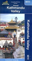
£11.99
Topographical survey of Belgium at 1:20, 000 from Nationaal Geografisch Instituut / Institut Géographique National, the country’s national survey organization. Each 20K map covers one quarter of the corresponding 1:50, 000 map (with adjustments in the border & coastal areas). The maps provide all the information expected of topographic mapping at this scale & in addition have an unusually large amount of vegetation and/or land use information (different types of woodlands, gardens, orchards, heath, etc). The maps have a 1-km UTM grid, with margin ticks for latitude & longitude at intervals of 1`. Map legend & a glossary of terms used on the maps include English. Stanfords keeps as regular stock 20K maps for the World War I battlefields around the Ypres, Messines & Passchendaele, & for the area of the Battle of Waterloo. The 1:20, 000 survey covers the whole of Belgium & maps for other regions can be supplied as special orders. To see the list of titles in this series please click on the series link.PLEASE NOTE: the Long-Distance Footpaths Map of Belgium at 1:300, 000 which shows the division of Belgium into the 50K survey sheets can also be used to see in more detail coverage by the 20K maps. ...
Archived Product
£12.99
Kaszuby Lake District in a series covering Poland’s best hiking areas on waterproof & tear-resistant, laminated maps, specially designed to withstand repeated re-folding & even the worst weather conditions. Each map is double-sided & has clear, well presented cartography with a contoured base (20m interval) &, where appropriate, relief shading, graphic relief in rocky areas, & spot heights. Extensive overprint highlights waymarked hiking trails & on many titles also cycling, skiing or canoeing routes. Symbols show accommodation facilities including hotels, campsites, youth hostels, mountain refuges, etc., restaurants & bars in more remote areas, local bus stops, petrol stations, medical facilities, etc. Many titles include street plans of holiday resorts. The maps have either a UTM or latitude/longitude grid. * Map legend

Includes::
English.** In this title:* the beautiful Kaszuby lake district including the Kaszuby Regional Park, covering an area from Tluczewo to Koscierzyna, & from Mausz Lake to Kartuzy. Place names are also given in the local dialect. Overprint

Includes::
cycling & canoeing routes. Also included are street plans of Sierakowice, Koscierzyna & Kartuzy.


...
Archived Product
£6.99
The northern part of the Kaszuby Lake District in a series of recreational maps from Poland’s Army Cartographic Service. The maps use as their base the military topographic survey, with contours at intervals varying from 5m to 20m according to the terrain & contoured depths shown on lakes. An overprint highlights waymarked hiking, cycling & canoeing routes. A wide range of symbols indicate various sport & recreational facilities, places of interest, special natural features, etc. The maps have latitude & longitude grid at 1’ intervals. * Map legend

Includes::
English.* On the reverse there are useful addresses & description, in Polish only.

...
Archived Product
£6.99
The southern part of the Kaszuby Lake District in a series of recreational maps from Poland’s Army Cartographic Service. The maps use as their base the military topographic survey, with contours at intervals varying from 5m to 20m according to the terrain & contoured depths shown on lakes. An overprint highlights waymarked hiking, cycling & canoeing routes. A wide range of symbols indicate various sport & recreational facilities, places of interest, special natural features, etc. The maps have latitude & longitude grid at 1’ intervals. * Map legend

Includes::
English.* On the reverse there are useful addresses & description, in Polish only.* In this title:* Kaszuby Lake Districts south of Koscierzyna & part of the vast Bory Tucholskie forest.

...
Archived Product
£7.99
*A Sunday Times Top Ten Bestseller* Katherine of Aragon: The True Queen by bestselling historian Alison Weir, author of The Lost Tudor Princess, is the first in a spellbinding six novel series about Henry VIII`s Queens. Alison takes you on an engrossing journey at Katherine`s side & shows her extraordinary strength of character & intelligence. Ideal for fans of Philippa Gregory & Elizabeth Chadwick. ` Shatters the many myths about Henry VIII`s long-suffering first wife` Tracy Borman ` Weir is excellent on the little details that bring a world to life` Guardian A Spanish princess. Raised to be modest, obedient & devout. Destined to be an English Queen. Six weeks from home across treacherous seas, everything is different: the language, the food, the weather. & for her there is no comfort in any of it. At sixteen-years-old, Catalina is alone among strangers. She misses her mother. She mourns her lost brother. She cannot trust even those assigned to her protection. KATHERINE OF ARAGON. The first of Henry`s Queens. Her story. History tells us how she died. This captivating novel shows us how she lived. SIX TUDOR QUEENS. SIX NOVELS. SIX YEARS. Praise for Alison Weir & Katherine of Aragon: `A tender understanding of & genuine sympathy for this proud, much-loved & honourable Queen...I was gripped [from] start to finish` Mavis Cheek ` Well-researched & engrossing` Good Housekeeping ` Yet again, Alison Weir has managed to intertwine profound historical knowledge with huge emotional intelligence, to compose a work that throws light on an endlessly fascinating historical figure. Yet her real gift in all of this is making it feel so fresh & alive` Earl Spencer ` This exquisite book charts the rise & fall of Henry VIII`s first wife, Katherine...A fascinating insight into this period of our history. Weir`s undeniable strength is her immaculate description, enabling the reader to be transported back to Tudor England` Sun ` Katherine of Aragon, The True Queen is a true tour de force. Finely crafted, this novel is wonderful historical fiction & an outstanding introduction to the Six Tudor Queens series` Queen Anne Boleyn Blog ` Known for bestselling historical biographies, Alison Weir is in command of her detail.. .her handling of Katherine`s misery & dignified response to her predicament is very touching` Elizabeth Buchan, Daily Mail ...
Archived Product
£12.99
One of the greatest cities of the Himalaya, Kathmandu, Nepal, is a unique blend of thous&-year-old cultural practices & accelerated urban development. In this book, Thomas Bell recounts his experiences from his many years in the city--exploring in the process the rich history of Kathmandu & its many instances of self-reinvention. Closed to the outside world until 1951 & trapped in a medieval time warp, Kathmandu is, as Bell argues, a jewel of the art world, a carnival of sexual license, a hotbed of communist revolution, a paradigm of failed democracy, a case study in bungled western intervention, & an environmental catastrophe. In important ways, Kathmandu`s rapid modernization can be seen as an extreme version of what is happening in other traditional societies. Bell also discusses the ramifications of the recent Nepal earthquake. A comprehensive look at a top global destination, Kathmandu is an entertaining & accessible chronicle for anyone eager to learn more about this fascinating city. ...
Archived Product
£8.50
Kathmandu, Patan & nearby centres on a detailed indexed street plans from Nepa maps, all extensively annotated with numerous facilities & places of interest, plus enlargements for main temples complexes, etc. The main plan at 1: 15, 000 covers the whole of Kathmandu & Patan, extending out to the Tribhuvan Intrenational Airport. Ths plan is annotated with names and/or colour-coded symbols indicating locations of numerous hotels, restaurants, banks, shopping centres, airline offices, trekking agencies, monasteries & temples, governmental & municipal offices, etc., listed in an extensive index. On the reverse, the central Thamel area & Durbar Marg are shown in greater detail, again with details of shops, banks, travel agencies & other facilities plus an index. Also included are plans of central Bhaktapur, Thimi (Madhyapur) & Bouddhanath, detailed plans of the Kathmandu, Patan & Bhaktapur Durbar Squares & Swayambhunath, plus a map of the Kathmandu Valley at 1:145, 000. All the information & names are in English. ...
Archived Product
£8.99
Kathmandu with Patan at 1:15, 000 on an indexed street plan from Nepa Maps, plus on the reverse several panels providing more detailed coverage of the Thamel area, the Durbar Squares including Bhaktapur’s, etc. On one side is a Kathmandu
- Patan area, extending beyond the ring road to include the Tribhuvan University Campus &, east of the city, Boudha. The map highlights numerous places of interest & sights including accommodation, banks, government & NGO offices, bus connections, fuel suppliers, etc. Very extensive, colour-coded index in addition to locations also lists institutions & services highlighted on the plan. The reverse side is covered by more detailed street plans, all extensively annotated with various sights & facilities: a large, indexed plan the Thamel area, a smaller plan of the Durbar Marg, a street plan of Bhaktapur, plus detailed plans of the Durbar Squares in Kathmandu, Patan & Bhaktapur. Also provided is a map highlighting various sights in Kathmandu Valley, plus a small map of Nepal.
...
Archived Product
£12.50
Kathamndu to Lhasa on an indexed, contoured map from Nepa Maps, showing the network of roads & tracks in southern Tibet, including the Friendship Highway connecting the two capitals. Also provided is a street plan of central Lhasa annotated with places of interest. The map has contours at 100m intervals enhanced by relief shading with spot heights, peaks & passes. Along the border, including the section between Nepal & northern Sikkim, numerous peaks & passes are named. Road network

Includes::
tracks & local airfields are shown. Also marked are administrative boundaries. Symbols highlight various places of interest, including temples, hot springs, caves, etc. Margin ticks give latitude & longitude at intervals of 30

...
Archived Product

Kathmandu

Kathmandu area on a double-sided map from Periplus, highlighting numerous places of interest and enlarged street plans of Central Kathmandu and Bhaktapur. Suitable for touring and trekking in the area.Includes: An overview of the Kathmandu Valley area at 1:55, 500, with relief shading, contour lines at intervals of 200 metres, spot heights and many footpaths. Also shows main roads, surrounding towns and villages and many places of interest, some of which are indexed and described. The Kathmandu and Patan urban area on an enlarged, indexed street plan at 17, 000. Street plans of Central Kathmandu at 1:10, 000 and Bhaktapur at 1:8, 000.Street plans show districts, bus terminals, places of interest, temples, museums and many hotels and restaurants, etc. Further insets provide
travel tips, background information and descriptions of main sites for anyone touring in the area.
RIP - This product is no longer available on our network. It was last seen on 25.09.2019

This page now acts as a permanent archive for this product. Add more information using the comments box below to ensure it can still be found by future generations.

Use our search facility to see if it is available from an alternative contributor.
  • External links may include paid for promotion
  • Availability: Out Of Stock
  • Supplier: Stanfords
  • SKU: 9789625930633
Availability: In Stock
£7.99

Product Description

Kathmandu area on a double-sided map from Periplus, highlighting numerous places of interest & enlarged street plans of Central Kathmandu & Bhaktapur. Suitable for touring & trekking in the area.
Includes:: An overview of the Kathmandu Valley area at 1:55, 500, with relief shading, contour lines at intervals of 200 metres, spot heights & many footpaths. Also shows main roads, surrounding towns & villages & many places of interest, some of which are indexed & described. The Kathmandu & Patan urban area on an enlarged, indexed street plan at 17, 000. Street plans of Central Kathmandu at 1:10, 000 & Bhaktapur at 1:8, 000. Street plans show districts, bus terminals, places of interest, temples, museums & many hotels & restaurants, etc. Further insets provide travel tips, background information & descriptions of main sites for anyone touring in the area.

Reviews/Comments

Add New

Price History

Vouchers

No voucher codes found.
Do you know a voucher code for this product or supplier? Add it to Insights for others to use.

Facebook

Jargon Buster

Metres - A unit of measure, one metre equals 100 centimetres

Supplier Information

Stanfords
Stanfords was established in 1853 and opened their iconic Covent Garden flagship store in 1901. They have become the top retailer of maps, travel books and accessories in the UK and arguably offer the largest selection of maps and travel books worldwide. Famous names such as Captain Robert Falcon Scott, Ranulph Fiennes and Michael Palin have purchased from Stanfords. They now have a shop in Bristol and both stores together with other venues operate a calendar of events including talks, book signings and exhibitions. As a specialist map retailer, the map selection is comprehensive and includes road maps, street maps and walking maps from worldwide destinations, as well as a selection of world atlases and wall maps. Books include travel guides and travel literature. Stanfords also stock globes, from miniatures made of blue marble to magnificent floor-standing globes. The website features a selection of interesting articles on travel topics.
Page Updated: 2023-11-12 20:15:36

Community Generated Product Tags

Oh No! The productWIKI community hasn't generated any tags for this product yet!
Menu