
 United Kingdom
 France
 Germany
 Netherlands
 Sweden
 USA
USA
 Italy
Italy
 Spain
Spain
More From Contributor


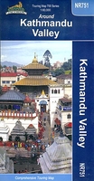
Kathmandu Valley
Kathmandu Valley at 1:60, 000 on an indexed, contoured touring and trekking map from Nepa Maps (Himalayan MapHouse), highlighting places of interest including the Shivapuri National Park, and showing bus connections, etc.Topography of the area is shown by contours are at 20m intervals, enhanced by relief shading and colouring/graphics for different types of vegetation. Names of locations visited by tourists are prominently marked. Road network clearly differentiates between main, secondary and local roads; the map also indicates locations with petrol stations and/or served by bus services. The area`s trekking routes are marked, with the main ones, particularly in the Shivapuri National Park, highlighted. Symbols indicate places with hotels and restaurants, various places of
interest including UNESCO World Heritage sites, temples and monasteries, etc. Margin ticks show latitude and longitude at intervals of 2’30’’. The index lists towns/villages, hotels and tourist resorts, medical centres, religious sites, plus lakes and mountain passes. Brief descriptions are provided for main attractions. All the information is in English.
interest including UNESCO World Heritage sites, temples and monasteries, etc. Margin ticks show latitude and longitude at intervals of 2’30’’. The index lists towns/villages, hotels and tourist resorts, medical centres, religious sites, plus lakes and mountain passes. Brief descriptions are provided for main attractions. All the information is in English.

Product Description
Reviews/Comments
Add New
Vouchers
No voucher codes found.
Do you know a voucher code for this product or supplier? Add it to Insights for others to use.
Do you know a voucher code for this product or supplier? Add it to Insights for others to use.
 Denmark