More From Contributor
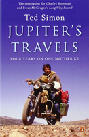
£7.99
William S. Burroughs, legendary drug addict, founder member of the Beats & author of Naked Lunch, relates with unflinching realism the addict`s life: from initial heroin bliss to an unabated hunger for the needle, & the horrors of cold turkey & back again. An original, first-hand account which outraged fifties America, Junky remains one of the most raw & mesmerizing accounts of heroin addiction ever written. ...
Archived Product
£7.99
Burroughs` first novel, a largely autobiographical account of the constant cycle of drug dependency, cures & relapses, remains the most unflinching, unsentimental account of addiction ever written. Through junk neighbourhoods in New York, New Orleans & Mexico City, through time spent kicking, time spent dealing & time rolling drunks for money, through junk sickness & a sanatorium, ” Junky” is a field report (by a writer trained in anthropology at Harvard) from the American post-war drug underground. A cult classic, it has influenced generations of writers with its raw, sparse & unapologetic tone. This definitive edition painstakingly recreates the author`s original text word for word. ...
Archived Product
£9.99
By June 1944, Juno Beach was a key part of Hitler's vaunted Atlantic Wall, with no less than four major strong points along its length. German pillboxes were sited to sweep the beaches with machine gun fire & were surrounded by belts of barbed wire & mines. Leading the attack were the 3rd Canadian Division, supported by the specialist assault tanks of the 79th Armoured Division (Hobart's ' Funnies'). Despite careful planning, poor D-Day weather led to a piecemeal landing & heroic individual battles in the streets of the seaside towns. ...
Archived Product
£16.99
Topographic survey of Sweden at 1:50, 000, the Terrängkartan, from the Lantmäteriet, covering most of the country in 244 double-sided maps. Please note: the mountainous regions of central & northern Sweden are not covered by this series but presented in a separate “ Fjällkartan
- Mountain Map” series also listed on our website. Each 1:50, 000 topographic survey map covers an area of 37.5 x 40km. The maps have contours at 5 metre intervals, plus relief shading & graphics for rocky outcrops & boulders. Further graphics and/or colouring show different types of land use or vegetation (forests, arable l&, orchards, marshes, peat bogs, etc). An unusual feature of this survey is the colouring indicating buildings below or above two storeys high & “leisure/holiday homes”. The maps indicate privately maintained roads & include all other information expected of topographic survey at this scale. The maps have a 1-km UTM grid, plus latitude & longitude lines 5’ intervals. Map legend

Includes::
English. For coverage of the country’s most visited hiking areas in central & northern Sweden please see Lantmäteriet’s Mountain Map series, listed separately on our website.


...
Archived Product
£17.99
The 1:50, 000 topographic map gives a more general picture of the ground features than a basic map. It shows settlements, houses, roads, cultivated areas, waterways, cutting areas, mires, rock exposures, & relief. One map sheet covers an area of 30 x 40 km & one centimetre corresponds to 500 metres on the ground. The 1:50, 000 topographic map is also an ideal complement to nautical charts as it provides useful information about the land areas adjacent to waterways. For example, all Finnish sea areas are covered by 1:50, 000 topographic map sheets. ...
Archived Product
£102.99
Second title of a series of 8 DVDs covering the whole country. About this series: The Swiss Map 25 series covers the whole of the country at 1:25, 000,

Includes::
the complete official Swiss footpath network & it is compatible with both Swiss Map 50 & 100, & with the Dufour Map. There are 8 DVD titles in the series, each also including the Swiss Map 500 covering the whole country. The cartography of Swiss Map 25 is equivalent to that of the printed Swiss Survey maps & the individually selectable map extracts can be easily printed & exported. The diversity of the graphic tools makes it possible to show political & administrative boundaries (including municipalities, districts & cantons), highlight castles, heritage sites & other tourist information, & search for all displayed place names. It is also possible to calculate distances, hiking times & profiles' elevation, to enter individual routes or add personal data to a map. Up-to-date information from the Switzerland Tourism organisation about holiday destinations, hotels, events & excursions can also be accessed from the map via the Internet. Each DVD is compatible with Windows, Mac & GPS (NMEA, Garmin & Magellan). All data is available in English, German, French & Italian. System requirements:1 GB free hard disk space Screen 1024 x 768 pixels Thousands of colours (16 bits) Internet Browser 4.x (or higher) Windows
- 2000 or XP
- Pentium processor III
- 256 MB RAMMacintosh
- Mac OS X 10.1.5 (or higher)
- G3 500 MHz
- 256 MB RAM


...
Archived Product
£8.99
Paper version of map No. 61 from the Ordnance Survey’s Landranger series at 1:50, 000, with contoured & GPS compatible topographic mapping plus tourist information.MOBILE DOWNLOADS: As well as the physical edition of the map, each Landranger title now

Includes::
a code for downloading after purchase its digital version onto your smartphone or tablet for viewing on the OS smartphone app.OS LANDRANGER SERIES: to see the list of all the titles in the OS Landranger series, both paper & waterproof versions, please click on the series link. Maps in the Landranger series provide plenty of recreational & tourist information, indicating the traditional public right of way paths (except in Scotland where different laws apply), including bridleways & byways restricted or open to motorized traffic. National Trails & selected other long-distance paths are marked, as well as on-road & traffic-free cycle routes with their National/ Regional Cycle Network numbers. National Trust/ National Trust for Scotland & Forestry Commission land is clearly marked, indicating open or restricted access. A range of symbols highlights camping & caravanning sites, youth hostels, tourist information offices & visitors’ centres, parking & picnicking places, World Heritage sites, sport & recreational facilities, etc. The maps provide detailed presentation of topography with contours at 10m intervals, numerous spot heights & additional colouring and/or graphics for different types of woodlands, orchards or parkl&, rock features including scree & cliffs, water features inland & along the sea shore with marshl&, dunes, s&, mud, shingle & the high water mark. All the standard information expected of survey mapping at this scale is included: finely graded road network, railway lines with stations, cuttings, embankments, etc; individual isolated buildings; archaeological & historical sites, etc. For GPS users the British National Grid is shown at 1km intervals, with latitude & longitude given by margin ticks at 1` & cross hairs on the map at 5`. Each map covers an area of 40 x 40km, (approx. 25 x 25 miles).

...
Archived Product
£14.99
Waterproof & tear-resistant OS Active version of map No. 61 from the Ordnance Survey’s Landranger series at 1:50, 000, with contoured & GPS compatible topographic mapping plus tourist information.MOBILE DOWNLOADS: As well as the physical edition of the map, each Landranger title now

Includes::
a code for downloading after purchase its digital version onto your smartphone or tablet for viewing on the OS smartphone app.OS LANDRANGER SERIES: to see the list of all the titles in the OS Landranger series, both paper & waterproof versions, please click on the series link. Maps in the Landranger series provide plenty of recreational & tourist information, indicating the traditional public right of way paths (except in Scotland where different laws apply), including bridleways & byways restricted or open to motorized traffic. National Trails & selected other long-distance paths are marked, as well as on-road & traffic-free cycle routes with their National/ Regional Cycle Network numbers. National Trust/ National Trust for Scotland & Forestry Commission land is clearly marked, indicating open or restricted access. A range of symbols highlights camping & caravanning sites, youth hostels, tourist information offices & visitors’ centres, parking & picnicking places, World Heritage sites, sport & recreational facilities, etc. The maps provide detailed presentation of topography with contours at 10m intervals, numerous spot heights & additional colouring and/or graphics for different types of woodlands, orchards or parkl&, rock features including scree & cliffs, water features inland & along the sea shore with marshl&, dunes, s&, mud, shingle & the high water mark. All the standard information expected of survey mapping at this scale is included: finely graded road network, railway lines with stations, cuttings, embankments, etc; individual isolated buildings; archaeological & historical sites, etc. For GPS users the British National Grid is shown at 1km intervals, with latitude & longitude given by margin ticks at 1` & cross hairs on the map at 5`. Each map covers an area of 40 x 40km, (approx. 25 x 25 miles).

...
Archived Product
£6.39
A detailed topographic map of Jura & Scarba from the Ordnance Survey Explorer series. Edition A1; Publication date October 2006 About this series: These highly detailed maps show all the administrative boundaries, settlements as small as isolated farms, the road network down to unfenced roads & country tracks, & field boundaries (hedges & drystone walls) which make navigation across the countryside much easier. Steep gradients on roads are indicated. Various landmarks, e.g. powerlines, archaeological sites, windmills, churches & lighthouses are shown & additional graphics indicate natural terrain features such as cliffs, scree, mud & vegetation variations. The contour interval is 5 metres in the lower parts of the country & 10 metres in the uplands, & spot heights are marked. Each map covers an area of 30 x 20km (i.e. approx. 19 x 12 miles), with some double-sided maps covering more, as indicated in the individual descriptions. The maps are fully GPS compatible, with the National Grid shown at 1km intervals & latitude & longitude indicated by margin ticks at 1'. The Explorer series has replaced the earlier, green-cover Pathfinder maps. The Explorer series is now complete & covers all of Engl&, Wales & Scotl&. Some sheets for popular areas like the National Parks are still branded as Outdoor Leisure (OL) maps, but are now included in this series as the cartography is the same as that in the Explorer Maps. The Explorer maps offer a substantial improvement on the Pathfinder series, with greater use of colour, larger area per map, & stronger emphasis on information for ramblers & tourists. This series is ideal for walking & other outdoor pursuits & each map shows a large amount of information for ramblers & tourists. Public rights of way are shown (except in Scotland), together with other routes with public access: National Trails & Recreational Paths, permitted paths & bridleways, & selected cycle routes. Open access land created under the Countryside & Rights of Way Act 2000 is marked. Tourist information

Includes::
caravan & camp sites, Park & Ride locations, recreation/leisure/sport centres, museums, historic buildings, English Heritage & National Trust sites, rural pubs, etc. The map legend is in English only, except for the tourist information content which is also in French & German.

...
Archived Product
£11.19
Laminated waterproof edition of a detailed topographic map of Jura & Scarba from the Ordnance Survey Explorer series, Edition A1; Publication date November 2006 About this series: These highly detailed maps show all the administrative boundaries, settlements as small as isolated farms, the road network down to unfenced roads & country tracks, & field boundaries (hedges & drystone walls) which make navigation across the countryside much easier. Steep gradients on roads are indicated. Various landmarks, e.g. powerlines, archaeological sites, windmills, churches & lighthouses are shown & additional graphics indicate natural terrain features such as cliffs, scree, mud & vegetation variations. The contour interval is 5 metres in the lower parts of the country & 10 metres in the uplands, & spot heights are marked. Each map covers an area of 30 x 20km (i.e. approx. 19 x 12 miles), with some double-sided maps covering more, as indicated in the individual descriptions. The maps are fully GPS compatible, with the National Grid shown at 1km intervals & latitude & longitude indicated by margin ticks at 1'. The Explorer series has replaced the earlier, green-cover Pathfinder maps. The Explorer series is now complete & covers all of Engl&, Wales & Scotl&. Some sheets for popular areas like the National Parks are still branded as Outdoor Leisure (OL) maps, but are now included in this series as the cartography is the same as that in the Explorer Maps. The Explorer maps offer a substantial improvement on the Pathfinder series, with greater use of colour, larger area per map, & stronger emphasis on information for ramblers & tourists. This series is ideal for walking & other outdoor pursuits & each map shows a large amount of information for ramblers & tourists. Public rights of way are shown (except in Scotland), together with other routes with public access: National Trails & Recreational Paths, permitted paths & bridleways, & selected cycle routes. Open access land created under the Countryside & Rights of Way Act 2000 is marked. Tourist information

Includes::
caravan & camp sites, Park & Ride locations, recreation/leisure/sport centres, museums, historic buildings, English Heritage & National Trust sites, rural pubs, etc. The map legend is in English only, except for the tourist information content which is also in French & German.

...
Archived Product

Jupiter`s Travels

”Jupiter`s Travels” - Ted Simon`s astonishing 4 year motorbike journey around the world. It is the book that inspired Ewan McGregor`s ”Long Way Round”. In the late 1970s Ted Simon set off on a Triumph and rode 63, 000 miles over four years through fifty-four countries in a journey that took him around the world. Through breakdowns, prison, war, revolutions, disasters and a Californian commune, he travelled into the depths of fear and reached the heights of euphoria. He met astonishing people and was treated as a spy, a welcome stranger and even a god. For Simon the trip became a journey into his own soul, and for many others - including bikers Charley Boorman and Ewan McGrergor - it provides an inspiration they will never forget. This classic text, which has informed a
whole genre of travel writing in the thirty years since it was first published, will never be bettered for sheer adventure, passion, humour and honesty. Brought up in England by a German mother and a Romanian father, Ted Simon found himself impelled by an insatiable desire to explore the world.It led him to abandon an early scientific career in favour of journalism, and he has worked for several newspapers and magazines on Fleet Street and elsewhere. Ted Simon is also the author of ”Riding Home” and ”The Gypsy in Me”.
RIP - This product is no longer available on our network. It was last seen on 25.09.2019

This page now acts as a permanent archive for this product. Add more information using the comments box below to ensure it can still be found by future generations.

Use our search facility to see if it is available from an alternative contributor.
  • Availability: Out Of Stock
  • Supplier: Stanfords
  • SKU: 9780140054101
Availability: In Stock
£9.99

Product Description

” Jupiter`s Travels”
- Ted Simon`s astonishing 4 year motorbike journey around the world. It is the book that inspired Ewan Mc Gregor`s ” Long Way Round”. In the late 1970s Ted Simon set off on a Triumph & rode 63, 000 miles over four years through fifty-four countries in a journey that took him around the world. Through breakdowns, prison, war, revolutions, disasters & a Californian commune, he travelled into the depths of fear & reached the heights of euphoria. He met astonishing people & was treated as a spy, a welcome stranger & even a god. For Simon the trip became a journey into his own soul, & for many others
- including bikers Charley Boorman & Ewan Mc Grergor
- it provides an inspiration they will never forget. This classic text, which has informed a whole genre of travel writing in the thirty years since it was first published, will never be bettered for sheer adventure, passion, humour & honesty. Brought up in England by a German mother & a Romanian father, Ted Simon found himself impelled by an insatiable desire to explore the world. It led him to abandon an early scientific career in favour of journalism, & he has worked for several newspapers & magazines on Fleet Street & elsewhere. Ted Simon is also the author of ” Riding Home” & ” The Gypsy in Me”.

Reviews/Comments

Add New

Intelligent Comparison

Oooops!
We couldn't find anything!
Perhaps this product's unique.... Or perhaps we are still looking for comparisons!
Click to bump this page and we'll hurry up.

Price History

Vouchers

No voucher codes found.
Do you know a voucher code for this product or supplier? Add it to Insights for others to use.

Facebook

Jargon Buster

LED - Light Emitting Diode - a small light source
Humour - Something either verbal of physical that provides amusement and can provoke laughter
England - A country within the United Kingdom.
World - A physical grouping, commonly used to describe earth and everything associated with ti
Jupiter - The largest planet to orbit the sun. It is fifth planet from the sun and is around 12 times as wide as the planet earth. It is known as a gas giant due to its thick atmosphere. Four of its moons were first spotted by Galileo Galilei
Year - The time it takes the planet earth to orbit the sun. This takes around 365.25 days.
Set - a group of items usually related to one another. Some objects cannot function without the complete set of items.
Adventure - an undertaking of an exciting challenge or experience.
LED - Light Emitting Diode. A bulb that is very efficient at producing light. Often small.
Home - A place of permanent residence for families.
Favour - Doing a task for another person our of kindness. Also a small gift at a wedding for the guests.
Year - 365 days (366 days in a leap year), the time taken for planet earth to make one full revolution around the sun.
Classic - Something that is still like it was originally a high quality standard.

Supplier Information

Stanfords
Stanfords was established in 1853 and opened their iconic Covent Garden flagship store in 1901. They have become the top retailer of maps, travel books and accessories in the UK and arguably offer the largest selection of maps and travel books worldwide. Famous names such as Captain Robert Falcon Scott, Ranulph Fiennes and Michael Palin have purchased from Stanfords. They now have a shop in Bristol and both stores together with other venues operate a calendar of events including talks, book signings and exhibitions. As a specialist map retailer, the map selection is comprehensive and includes road maps, street maps and walking maps from worldwide destinations, as well as a selection of world atlases and wall maps. Books include travel guides and travel literature. Stanfords also stock globes, from miniatures made of blue marble to magnificent floor-standing globes. The website features a selection of interesting articles on travel topics.
Page Updated: 2023-11-12 20:15:36

Community Generated Product Tags

Oh No! The productWIKI community hasn't generated any tags for this product yet!
Menu