More From Contributor
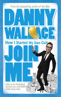
£7.99
`A delight` Stephen Fry BLUNDERTo mistake, grossly, to err very widely.` Someone has blundered` (Alfred, Lord Tennyson, ` Charge of the Brexit Brigade`)EUTHANASIAAn easy death. Strangulation by EU regulations, according to Brexiters.` Brexit` seems to mean many things, but none of them is clear. Fortunately, help is at hand from Harry Eyres & George Myerson, who offer us pithy & incisive definitions of the key terms associated with this momentous process. From `COCK-UP` to `WRETCHED` via `BUFOON` & `MAY`, Johnson`s Brexit Dictionary is a delightful, witty & essential compendium inspired by Dr Johnson`s original, & updated for our turbulent times. ...
Archived Product
£3.50
Johnstone in 1895 in a fascinating series of reproductions of old Ordnance Survey plans in the Alan Godfrey Editions, ideal for anyone interested in the history of their neighbourhood or family. The map covers central Johnstone & the area to the south, stretching from Gas Street & Johnstone Mill southward to Johnstone Castle. Features include GSWR railway with station, the town centre, iron foundries, Johnstone Castle, saw mills, cottage hospital, Barbush Mill, Old Mill, Hagg Mill, Nether Johnstone, Quarrellton, Greenend, Houston Square, Ludovic Square, Thornhill House, etc. On the reverse are extracts from a trade directory. About the Alan Godfrey Editions of the 25” OS Series: Selected towns in Great Britain & Ireland are covered by maps showing the extent of urban development in the last decades of the 19th & early 20th century. The plans have been taken from the Ordnance Survey mapping & reprinted at about 15 inches to one mile (1:4, 340). On the reverse most maps have historical notes & many also include extracts from contemporary directories. Most maps cover about one mile (1.6kms) north/south, one & a half miles (2.4kms) across; adjoining sheets can be combined to provide wider coverage.FOR MORE INFORMATION & A COMPLETE LIST OF ALL AVAILABLE TITLES PLEASE CLICK ON THE SERIES LINK. ...
Archived Product
£6.99
The southern part of Peninsular Malaysia on a double-sided map from the Singapore based Periplus, combining detailed road maps with of the region with street plans of central Johor Bahru & Melaka. On one side is a more general map of the whole region at 1:500, 000 extending from north of Kuala Lumpur to Singapore. The map shows the region’s road & rail network & highlights various places of interest. The map is accompanied by a distance table, an enlargement showing the Melaka area in greater detail at 1:75, 000, plus a street plan of Melaka Town at 1:15, 000. In addition to places of interest the street plan also indicates locations of several hotels. On the reverse is a detailed road map at 1:70, 000 covering the Johor Bahru area with the northern part of the Singapore Isl&. Also included here is a street plan of central Johor Bahru, with hotels, sights, etc. Only the street plan of Johor Bahru is indexed. ...
Archived Product
£7.99
The southern part of Peninsular Malaysia on a double-sided map from the Singapore based Periplus, combining detailed road maps with of the region with street plans of central Johor Bahru & Melaka. On one side is a more general map of the whole region at 1:500, 000 extending from north of Kuala Lumpur to Singapore. The map shows the region ...
Archived Product
£12.99
Topographic survey of France at 1:25, 000 in IGN`s excellent TOP25 / Série Bleue series. All the maps are GPS compatible, with a 1km UTM grid plus latitude & longitude lines at 5’ intervals. Contours are at 5m intervals except for mountainous areas where the maps have contours at 10m intervals, vividly enhanced by hill shading & graphics for rocky terrain. Colouring with graphics indicates different types of vegetation or land use (deciduous or coniferous forests, moors, orchards, vineyards, etc). PLEASE NOTE: coverage of France at this scale is currently being revised – the format & the presentation of each title are indicated by the letters at the end of its Sheet Reference number (e.g. 0416ET, 3531ETR, 1923SB, etc.)MAPS WITH FULL TOURIST OVERPRINT & AN ENGLISH MAP LEGEND: all TOP25 maps & the SB editions of Série Bleue have an overprint highlighting waymarked walking trails including long-distance GR routes &, where appropriate, ski routes. Symbols indicate campsites, gîtes d’etape, refuges, equestrian centres & other recreational facilities or sites, tourist information centres, cultural heritage, etc. Towns & locations of particular interest are highlighted.- ET or OT = single-sided TOP25 map covering approx. 29x 21 km / 18x 13 miles.- ETR or OTR = waterproof & tear resistant TOP25 map covering the same area as the corresponding ET or OT number, but double-sided, printed on a smaller size sheet with a good overlap between the sides.- SB = Série Bleue map with full tourist overprint; these maps, first introduced in summer 2014, each cover approx. 29x 24km / 18x 15 miles.SÉRIE BLEUE maps with numbers ending in E (Est) or O (Ouest): most editions now indicate the GR routes, but do not show any other tourist information. Map legend is in French only. Each map covers approx. 14x 20km / 9x 12 miles. ...
Archived Product
£6.99
Joinville Island in the Weddell Sea off the coast of the Antarctic Peninsula on a contoured map published by the British Antarctic Survey in 1973 as part of their topographic survey of the area at 1:250, 000. Full BAS ref. Series BAS 250, sheet SP 21-22/14.PLEASE NOTE: to see the list of other detailed topographic & specialist maps from BAS please click on the series link. BAS maps of wider general interest are listed on our website in a separate series. ...
Archived Product
£16.99
Topographic survey of Sweden at 1:100, 000, the Vägkartan, from the Lantmäteriet, covering most of the country in 79 double-sided maps. Please note: the mountainous regions of central & northern Sweden are not covered by this series but presented in a separate “ Fjällkartan
- Mountain Map” series also listed on our website. Each 1:100, 000 topographic survey map covers an area of 75 x 80km. The maps have contours at 10 metre intervals, plus relief shading & colouring for different types of landscape: open l&, forests, alvar, marshes, etc. Boundaries of national parks & nature reserves, areas prohibited to cross-country vehicles, & restricted entry military zones are marked. The maps indicate privately maintained local roads, cycle paths with wind shelters, footpaths, etc, & include all other information expected of topographic survey at this scale. The maps have a 2-km UTM grid, plus latitude & longitude lines 10’ intervals. Map legend

Includes::
English. For coverage of the country’s most visited hiking areas in central & northern Sweden please see Lantmäteriet’s Mountain Map series, listed separately on our website.


...
Archived Product
£6.99
This is the fantastic new mystery from the author of Murder Most Unladylike. Daisy Wells & Hazel Wong have returned to Deepdean for a new school term, but nothing is the same. There`s a new Head Girl, Elizabeth Hurst, & a team of Prefects
- & these bullying Big Girls are certainly not good eggs. Then, after the fireworks display on Bonfire Night, Elizabeth is found
- murdered. Many girls at Deepdean had reason to hate Elizabeth, but who might have committed such foul play? Could the murder be linked to the secrets & scandals, scribbled on scraps of paper, that are suddenly appearing around the school? & with their own friendship falling to pieces, how will Daisy & Hazel solve this mystery? Praise for the Murder Most Unladylike series: ” Ripping good fun”. (The Times). ” Thrilling”. (Guardian). ” Top class”. (Financial Times). ”A delight”. (Daily Mail).

...
Archived Product
£12.99
The perfect festive, noisy book for preschoolers with lots of sounds & flaps! Jolly Jingly Christmas is an exciting board book with five sturdy flaps for preschoolers to lift, & five festive noises including a laughing Santa & a crunching reindeer. Develop your child`s language with the rhythmic read-aloud rhymes, then work together to guess who or what could be hiding under each flap. This high-quality Christmas adventure encourages interaction & hands-on play by rewarding curiosity with surprise sounds & delightful characters. ...
Archived Product

Join Me

Danny Wallace was bored. Just to see what would happen, he placed a whimsical ad in a local London paper. It said, simply, `Join Me`. Within a month, he was receiving letters and emails from teachers, mechanics, sales reps, vicars, schoolchildren and pensioners - all pledging allegiance to his cause. But no one knew what his cause was. Soon he was proclaimed Leader. Increasingly obsessed and possibly power-crazed Danny risked losing his sanity and his loyal girlfriend. But who could deny the attraction of a global following of devoted joinees? A book about dreams, ambition and the responsibility that comes with power, Join Me is the true story of a man who created a cult by accident, and is proof that whilst some men were born to lead, others really haven`t got a clue.
RIP - This product is no longer available on our network. It was last seen on 25.09.2019

This page now acts as a permanent archive for this product. Add more information using the comments box below to ensure it can still be found by future generations.

Use our search facility to see if it is available from an alternative contributor.
  • External links may include paid for promotion
  • Availability: Out Of Stock
  • Supplier: Stanfords
  • SKU: 9780091895822
Availability: In Stock
£6.99

Product Description

Danny Wallace was bored. Just to see what would happen, he placed a whimsical ad in a local London paper. It said, simply, ` Join Me`. Within a month, he was receiving letters & emails from teachers, mechanics, sales reps, vicars, schoolchildren & pensioners
- all pledging allegiance to his cause. But no one knew what his cause was. Soon he was proclaimed Leader. Increasingly obsessed & possibly power-crazed Danny risked losing his sanity & his loyal girlfriend. But who could deny the attraction of a global following of devoted joinees? A book about dreams, ambition & the responsibility that comes with power, Join Me is the true story of a man who created a cult by accident, & is proof that whilst some men were born to lead, others really haven`t got a clue.

Reviews/Comments

Add New

Intelligent Comparison

Oooops!
We couldn't find anything!
Perhaps this product's unique.... Or perhaps we are still looking for comparisons!
Click to bump this page and we'll hurry up.

Price History

Vouchers

No voucher codes found.
Do you know a voucher code for this product or supplier? Add it to Insights for others to use.

Facebook

Jargon Buster

Paper - A thin sheet mainly used for writing. Available in a variety of colours. Made mainly from wood pulp.
Month - A period of time originally related to the phases of the earths moon.
Teachers - A person who educates others, typically in a school.

Supplier Information

Stanfords
Stanfords was established in 1853 and opened their iconic Covent Garden flagship store in 1901. They have become the top retailer of maps, travel books and accessories in the UK and arguably offer the largest selection of maps and travel books worldwide. Famous names such as Captain Robert Falcon Scott, Ranulph Fiennes and Michael Palin have purchased from Stanfords. They now have a shop in Bristol and both stores together with other venues operate a calendar of events including talks, book signings and exhibitions. As a specialist map retailer, the map selection is comprehensive and includes road maps, street maps and walking maps from worldwide destinations, as well as a selection of world atlases and wall maps. Books include travel guides and travel literature. Stanfords also stock globes, from miniatures made of blue marble to magnificent floor-standing globes. The website features a selection of interesting articles on travel topics.
Page Updated: 2023-11-12 20:15:36

Community Generated Product Tags

Oh No! The productWIKI community hasn't generated any tags for this product yet!
Menu