More From Contributor

£27.99
Unusual & beautiful wall map showing bird’s-eye view plan of Jerusalem, extending westwards from the Mount of Olives, across the Old City & the central area, to the government districts around the Knesset, Israel Museum & the Shrine of the Book, & the Hebrew University. The buildings are drawn to scale with full architectural detail, viewed at a slightly oblique perspective looking northwards. All the important buildings are identified, using their English names, & the map also provides an excellent picture of the city’s unique topography. The map was drawn in 1969, so any changes since that date will not, of course, be reflected. Coverage of the Old City is also available separately in an enlarged version, both as a wall map & in a folded format. ...
Archived Product
£11.99
Beautiful wall map showing bird’s-eye view plan of Jerusalem’s Old City & its immediate surrounding area, including Mount Zion, the City of David & Gethsemane. The buildings are drawn to scale with full architectural detail, viewed at a slightly oblique perspective looking northwards. All the important buildings are identified, using their English names, & the map provides a particularly good picture of the Western Wall & the Temple Mount with the Dome of the Rock & the El Aqsa Mosque. The map provides an excellent picture of this fascinating area, but it is not recommended as a street plan to be used whilst navigating the narrow lanes & alleyways of the Old City. The map was drawn in 1969, so any changes since that date, particularly in the area west of the Jaffa Gate will not, of course, be reflected. This title is also available as a wall map. ...
Archived Product
£12.99
Jerusalem, Israel, Petra & Sinai Eyewitness travel guide from Dorling Kindersley is a lavishly illustrated book concerned with providing the visitor with detailed background information to sightseeing in the country & a broad cultural introduction. Popular historical buildings & museums are often described with cutaway diagrams allowing you to view ...
Archived Product
£14.99
Jerusalem, Israel, Petra & Sinai Eyewitness travel guide from Dorling Kindersley is a lavishly illustrated book concerned with providing the visitor with detailed background information to sightseeing in the country & a broad cultural introduction. Popular historical buildings & museums are often described with cutaway diagrams allowing you to view ...
Archived Product
£15.99
The DK Eyewitness Jerusalem, Israel, Petra & Sinai Travel Guide is your indispensable guide to this beautiful part of the world. The fully updated guide

Includes::
unique cutaways, floorplans & reconstructions of the must-see sites, plus street-by-street maps of all the fascinating cities & towns. The new-look guide is also packed with photographs & illustrations leading you straight to the best attractions on offer. The uniquely visual DK Eyewitness Travel guide will help you to discover everything region-by-region; from local festivals & markets to day trips around the countryside. Detailed listings will guide you to the best hotels, restaurants, bars & shops for all budgets, whilst detailed practical information will help you to get around, whether by train, bus or car. Plus, DK`s excellent insider tips & essential local information will help you explore every corner of Jerusalem, Israel, Petra & Sinai effortlessly. DK Eyewitness Jerusalem, Israel, Petra & Sinai Travel Guide
- showing you what others only tell you. Ed. September 2014.


...
Archived Product
£19.99
Beautiful wall map showing bird’s-eye view plan of Jerusalem’s Old City & its immediate surrounding area, including Mount Zion, the City of David & Gethsemane. The buildings are drawn to scale with full architectural detail, viewed at a slightly oblique perspective looking northwards. All the important buildings are identified, using their English names, & the map provides a particularly good picture of the Western Wall & the Temple Mount with the Dome of the Rock & the El Aqsa Mosque. The map was drawn in 1969, so any changes since that date, particularly in the area west of the Jaffa Gate will not, of course, be reflected. This title is also available in a folded format (see below). ...
Archived Product
£11.50
Excellent detailed, contoured map of the Old City of Jerusalem, including Mt Zion, David’s City, the tombs, Gethsemane & the Tomb of the Virgin south & east of the city walls. Contours at 5m intervals indicate the area’s interesting topography. Covered passages & archways are marked. All the main places of interest, from the Western Wall, Dome of the Rock & the Church of the Holy Sepulchre to numerous smaller places of worship & historical monuments are highlighted & either named or numbered & listed. All the names are given in English versions. The map also has an index of main streets & alleyways within the city walls. ...
Archived Product
£6.95
Map No. 118, Jeseniki, Kralicky Sneznik, in a series of GPS compatible topographic maps of the Czech Republic at 1:75.000 from Shocart highlighting both signposted cycling routes & other local cycling paths, with route profiles & additional tourist information. Relief is shown by contour lines, spot heights, & subtle hill-shading. The maps show roads, tracks, railways, cable cars, chairlifts, & a range of natural landscape features & landmarks. Coloured symbols depict plenty of additional tourist features e.g. information centres, places of interest, antiquities, shelters, campsites, accommodation, bicycle services etc. An overprint highlights both signposted routes & other recommended routes which have no terrain markers. For all bike routes intermediate distances are shown. Hiking paths are also highlighted. Latitude & longitude margin ticks are at 5' intervals. Each map is accompanied by a booklet containing general information on the Czech cycle route network, elevation profile diagram for selected routes, plus an index for locations of historical & geographical interest, bicycle service workshops, information centres, & tourist attractions. Map legend & text are in English, German & Czech. ...
Archived Product
£2.95
Jesmond in 1895 in a fascinating series of reproductions of old Ordnance Survey plans in the Alan Godfrey Editions, ideal for anyone interested in the history of their neighbourhood or family. Selected towns in Great Britain & Ireland are covered by maps showing the extent of urban development in the last decades of the 19th & early 20th century. In this title: two maps have been published for this area to show how it has changed over the years. Features on the 1895 version show St Andrew's & Jesmond Cemetery, Northern Counties Orphanage, Moor Edge Farm, Coxlodge Hall, St George's Church, Jesmond Dene House, Town Moor, Newcastle & Tynemouth Railway Line & the Small Pox Hospital. Coverage stretches east to Manor House & Jesmond Gardens, & west to Kenton Lodge. On the reverse of both maps are extracts from a street directory for Jesmond. About the Alan Godfrey Editions of the 25 ...
Archived Product
£3.50
Jesmond in 1895 in a fascinating series of reproductions of old Ordnance Survey plans in the Alan Godfrey Editions, ideal for anyone interested in the history of their neighbourhood or family. Two maps have been published for this area to show how it has changed over the years. Features on the 1895 version show St Andrew`s & Jesmond Cemetery, Northern Counties Orphanage, Moor Edge Farm, Coxlodge Hall, St George`s Church, Jesmond Dene House, Town Moor, Newcastle & Tynemouth Railway Line & the Small Pox Hospital. Coverage stretches east to Manor House & Jesmond Gardens, & west to Kenton Lodge. On the reverse of both maps are extracts from a street directory for Jesmond. About the Alan Godfrey Editions of the 25” OS Series: Selected towns in Great Britain & Ireland are covered by maps showing the extent of urban development in the last decades of the 19th & early 20th century. The plans have been taken from the Ordnance Survey mapping & reprinted at about 15 inches to one mile (1:4, 340). On the reverse most maps have historical notes & many also include extracts from contemporary directories. Most maps cover about one mile (1.6kms) north/south, one & a half miles (2.4kms) across; adjoining sheets can be combined to provide wider coverage.FOR MORE INFORMATION & A COMPLETE LIST OF ALL AVAILABLE TITLES PLEASE CLICK ON THE SERIES LINK. ...
Archived Product

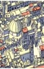
Jerusalem, Palestine And Jordan

Dr Hisham Khatib has spent almost 40 years amassing the vast and historically valuable collection of representations of the Near East featured in this book. The artworks included here (paintings, prints, maps, books, photographs, and even postcards) depict the Holy Land during the Ottoman period (1517-1917). The stunning images are accompanied by an engaging and deeply informative text.
RIP - This product is no longer available on our network. It was last seen on 25.09.2019

This page now acts as a permanent archive for this product. Add more information using the comments box below to ensure it can still be found by future generations.

Use our search facility to see if it is available from an alternative contributor.
  • Availability: Out Of Stock
  • Supplier: Stanfords
  • SKU: 9781908531094
Availability: In Stock
£30.00

Product Description

Dr Hisham Khatib has spent almost 40 years amassing the vast & historically valuable collection of representations of the Near East featured in this book. The artworks included here (paintings, prints, maps, books, photographs, & even postcards) depict the Holy Land during the Ottoman period (1517-1917). The stunning images are accompanied by an engaging & deeply informative text.

Reviews/Comments

Add New

Intelligent Comparison

Oooops!
We couldn't find anything!
Perhaps this product's unique.... Or perhaps we are still looking for comparisons!
Click to bump this page and we'll hurry up.

Price History

Vouchers

No voucher codes found.
Do you know a voucher code for this product or supplier? Add it to Insights for others to use.

Facebook

Jargon Buster

Supplier Information

Stanfords
Stanfords was established in 1853 and opened their iconic Covent Garden flagship store in 1901. They have become the top retailer of maps, travel books and accessories in the UK and arguably offer the largest selection of maps and travel books worldwide. Famous names such as Captain Robert Falcon Scott, Ranulph Fiennes and Michael Palin have purchased from Stanfords. They now have a shop in Bristol and both stores together with other venues operate a calendar of events including talks, book signings and exhibitions. As a specialist map retailer, the map selection is comprehensive and includes road maps, street maps and walking maps from worldwide destinations, as well as a selection of world atlases and wall maps. Books include travel guides and travel literature. Stanfords also stock globes, from miniatures made of blue marble to magnificent floor-standing globes. The website features a selection of interesting articles on travel topics.
Page Updated: 2023-11-12 20:15:36

Community Generated Product Tags

Oh No! The productWIKI community hasn't generated any tags for this product yet!
Menu