
 United Kingdom
 France
 Germany
 Netherlands
 Sweden
 USA
USA
 Italy
Italy
 Spain
Spain
More From Contributor


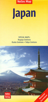
Japan Nelles
Japan at 1:1, 500, 000 on a double-sided, waterproof and tear-resistant map from Nelles, with its smaller size sheet offering a convenient format for use when travelling. Enlargements show in greater detail the environs of Tokyo - Yokohama, Osaka - Kobe, and Nagoya. The map divides the country north/south with Tokyo shown on both sides. On one side two panels cover the northern part of Honshu and Hokkaido, with an enlargement for the environs of the Tokyo -Yokohama area. On the reverse is southern part of Honshu and Kyushu Island, plus separate panels showing the smaller groups of islands including Okinawa and the Sakishima Archipelago. Insets show the environs of Osaka and Nagoya in greater detail. Topography is shown by relief shading with spot heights and names of mountain ranges.
The map presents the country’s road and rail networks, with a separate list of expressways on each side. Local airports and ferry connections are also marked. Overprint highlights various places of interest. The map has latitude and longitude margin ricks at intervals of 1° and is not indexed. Map legend includes English.
The map presents the country’s road and rail networks, with a separate list of expressways on each side. Local airports and ferry connections are also marked. Overprint highlights various places of interest. The map has latitude and longitude margin ricks at intervals of 1° and is not indexed. Map legend includes English.

Product Description
Reviews/Comments
Add New
Vouchers
No voucher codes found.
Do you know a voucher code for this product or supplier? Add it to Insights for others to use.
Do you know a voucher code for this product or supplier? Add it to Insights for others to use.
 Denmark