More From Contributor
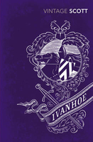
£6.95
It`s Not How Good You Are, It`s How Good You Want to Be is a handbook of how to succeed in the world: a pocket bible for the talented & timid alike to help make the unthinkable thinkable & the impossible possible. The world`s top advertising guru, Paul Arden, offers up his wisdom on issues as diverse as problem solving, responding to a brief, communicating, playing your cards right, making mistakes, & creativity
- all endeavours that can be applied to aspects of modern life. This uplifting & humorous little book provides a unique insight into the world of advertising & is a quirky compilation of"es, facts, pictures, wit & wisdom
- all packed into easy-to-digest, bite-sized spreads. If you want to succeed in life or business, this book is a must.

...
Archived Product
£8.99
When three friends
- Paul, Johno & Leigh
- clicked `buy` on an iconic London cab, little did they know what they were letting

...
Archived Product
£9.99
A gripping account of both an individual caught on the horns of an excruciating moral dilemma & a continent at a turning point. When Michela Wrong`s Kenyan friend John Githongo appeared one cold February morning on the doorstep of her London flat, carrying a small mountain of luggage, it was clear something had gone very wrong in a country regarded until then as one of Africa`s few budding success stories. Two years earlier, in the wave of euphoria that followed the election defeat of long-serving President Daniel arap Moi, John had been appointed Kenya`s new anti-corruption czar. In choosing this giant of a man, respected as a longstanding anti-corruption crusader, the new government was signalling that it was set on ending the practices that had made Kenya an international by-word for sleaze. Now John was on the run, having realised that the new administration, far from breaking with the past, was using near-identical techniques to pilfer public funds. John`s tale, which has all the elements of a political thriller, is the story of how a brave man came to make a lonely decision with huge ramifications. But his story transcends the personal, touching as it does on the cultural, historical & social themes that lie at the heart of the continent`s continuing crisis. Tracking this story of an African whistleblower, Michela Wrong seeks answers to the questions that have puzzled outsiders for decades. What is it about African society that makes corruption so hard to eradicate, so sweeping in its scope, so destructive in its impact? Why have so many African presidents found it so easy to reduce all political discussion to the self-serving calculation of which tribe gets to `eat`? & at what stage will Africans start placing the wider interests of their nation ahead of the narrow interests of their tribe? ...
Archived Product
£12.99
In It`s Your World: Get Informed, Get Inspired & Get Going, Chelsea Clinton tackles some of the biggest challenges facing our world today, especially for kids. Using data, charts & stories she unpacks challenges related to Poverty, Climate Change, Gender Equality, Health, Endangered Species & more. She also talks about what`s being done to make a difference in each area, particularly by kids & teenagers. With lots of suggestions & ideas for action, Chelsea Clinton shares her passion for helping others & shows readers that the world belongs to every single one of us, & every one of us counts. The book will have three main thrusts: Informing young readers using facts & research; Inspiring them with stories of hope & empowerment; and; Suggesting practical ways that young readers can make a difference in their own communities & in the larger world. Filled with visuals including charts, graphs & photographs, this book has the potential to influence an entire generation`s activism & involvement in local & global issues. ...
Archived Product
£17.99
The 1:50, 000 topographic map gives a more general picture of the ground features than a basic map. It shows settlements, houses, roads, cultivated areas, waterways, cutting areas, mires, rock exposures, & relief. One map sheet covers an area of 30 x 40 km & one centimetre corresponds to 500 metres on the ground. The 1:50, 000 topographic map is also an ideal complement to nautical charts as it provides useful information about the land areas adjacent to waterways. For example, all Finnish sea areas are covered by 1:50, 000 topographic map sheets. ...
Archived Product
£5.99
Administrative provinces of the Ukraine on indexed road maps at 1:250, 000, each with a town centre street plan of its capital city. All place names are in Cyrillic only, but the map legend

Includes::
English. Coverage of the larger provinces is divided between the two sides of the map. Road network is presented in great detail, from international roads, shown with their E numbers, to dirt roads & country paths. Driving distances are marked on main, secondary & selected local roads; the maps also show border crossings, fuel stations, car service stations, & traffic patrol service points. Railway lines are shown with stations & local airports are marked. The maps also show boundaries of districts into which each region (oblast) is subdivided, & indicate their administrative headquarters. Topography is indicated by spot height, plus boundaries of national parks & other protected areas, & colouring and/or graphics for forests, orchards, vineyards, swamps & salt marshes. The maps have latitude & longitude lines at 10’ & 15’ respectively, & are indexed. Map legend

Includes::
English. Each title also

Includes::
a local table of driving distances & a street plan of the region’s administrative capital annotated with locations of selected hotels, car parks & petrol stations, museums & monuments, etc. In some titles more street plans are included.IMPORTANT
- PLEASE NOTE: supplies of all maps published by the Kartografija in Kiev are irregular & we cannot guarantee a definite delivery time for titles currently not in stock. To see the list of other titles in this series please click on the series link.


...
Archived Product
£25.00
This comprehensive study documents the archaeological richness of the Iveragh Peninsula from the Stone Age to the end of the medieval period. The survey covers a broad range of archaeological field monuments, over 1, 500 sites in all. The vast majority are previously unlisted & are described & categorized in separate chapters. Each chapter features a general introduction to the type of monument dealt with, giving an overview of the current state of knowledge of its origins, purpose & date. The descriptions of many of the sites & monuments are accompanied by drawings, plans, profiles, black-&-white photographs & colour plates, & will prove invaluable to anyone wishing to explore the legacy of man on the wild & rugged landscape of south Kerry. ...
Archived Product
£12.95
Ivittuut, map no. 4, in a series of waterproof & tear-resistant topographic maps of popular coastal areas of southern & central Greenl&. Countours are shown at 25-metre intervals, with additional altitude colouring. The maps show settlements, farms, shepherds' huts, water supply areas, roads & tracks, fords, rivers & streams, etc. Tourist information

Includes::
marked or partly marked hiking routes, recommended kayak routes, information centres, hotels, campsites, youth hostels, general stores, places of interest, etc. A grid gives UTM co-ordinates plus latitude in steps of 5' & longitude in 10'. Map legend

Includes::
English. On the reverse of selected titles there are notes, in English, with advice on hiking in Greenl&, as well as descriptions of the area, including plans of main settlements highlighting important buildings & institutions.


...
Archived Product
£16.95
Ivittuut, map no. 4, in a series of topographic maps of popular coastal areas of southern & central Greenl&. Countours are shown at 25-metre intervals, with additional altitude colouring. The maps show settlements, farms, shepherds` huts, water supply areas, roads & tracks, fords, rivers & streams, etc. Tourist information

Includes::
marked or partly marked hiking routes, recommended kayak routes, information centres, hotels, campsites, youth hostels, general stores, places of interest, etc. A grid gives UTM co-ordinates plus latitude in steps of 5` & longitude in 10`. Map legend

Includes::
English. On the reverse of selected titles there are notes, in English, with advice on hiking in Greenl&, as well as descriptions of the area, including plans of main settlements highlighting important buildings & institutions.


...
Archived Product
£13.95
Topographic survey of Greenland at 1:250, 000 from Sagamaps in a series which along the western coast extends past Thule to the latitude of 78°, plus covers selected areas of the east coast including the Stauning Alps. Relief is shown by contours at 50m intervals, augmented by frequent spot heights. Main peaks are named, along with many other physical features, e.g. bays & islands. Glaciers, moraine & low-lying coastal plains are also indicated & contours continue for a limited extent into the icecap region. The maps show settlements, roads, airstrips & heliports, anchorages & selected other landmarks. Lines of longitude & latitude are drawn at 1° & 15` intervals respectively. Map legend which

Includes::
English is provided in a separate sheet. Saga’s topographic mapping of Greenland at 1:250, 000 is available either as 22 smaller sheets, sold separately or in sets of four maps, plus as three larger maps covering the western coast up to approx 65°. Selected titles are also published with a historical guide on the reverse illustrated with old photos, drawings & maps; all the text is in English. To see the full list of titles in this series please click on the series link.

...
Archived Product

Ivanhoe

It is the dark days of King Richard`s reign, when the beloved king is fighting in far-off lands, leaving his corrupt brother John in charge of his kingdom. Tensions between Saxon and Norman lords erupt in bouts of bloodshed or foul play; good men are banished, forced to turn outlaw and serve the true king in secrecy and disguise. In this dangerous world, the brave Wilfred of Ivanhoe must grapple with the claims of family, crown, truth and justice if he is ever to win the hand of his true love, the beautiful Lady Rowena.
RIP - This product is no longer available on our network. It was last seen on 25.09.2019

This page now acts as a permanent archive for this product. Add more information using the comments box below to ensure it can still be found by future generations.

Use our search facility to see if it is available from an alternative contributor.
  • External links may include paid for promotion
  • Availability: Out Of Stock
  • Supplier: Stanfords
  • SKU: 9780099589624
Availability: In Stock
£7.99

Product Description

It is the dark days of King Richard`s reign, when the beloved king is fighting in far-off lands, leaving his corrupt brother John in charge of his kingdom. Tensions between Saxon & Norman lords erupt in bouts of bloodshed or foul play; good men are banished, forced to turn outlaw & serve the true king in secrecy & disguise. In this dangerous world, the brave Wilfred of Ivanhoe must grapple with the claims of family, crown, truth & justice if he is ever to win the hand of his true love, the beautiful Lady Rowena.

Reviews/Comments

Add New

Intelligent Comparison

Oooops!
We couldn't find anything!
Perhaps this product's unique.... Or perhaps we are still looking for comparisons!
Click to bump this page and we'll hurry up.

Price History

Vouchers

No voucher codes found.
Do you know a voucher code for this product or supplier? Add it to Insights for others to use.

Facebook

Jargon Buster

Hand - A part of the body at the end of the arm
Hand - A pointer which indicates time on a clock face
Dark - A colour which absorbs visable ligt so apears less light than objects that reflect light
World - A physical grouping, commonly used to describe earth and everything associated with ti
King - The figure head of a monarch
Love - Someone who shows deep affection for someone else.
Family - A group of people that live together made up from parents and children.

Supplier Information

Stanfords
Stanfords was established in 1853 and opened their iconic Covent Garden flagship store in 1901. They have become the top retailer of maps, travel books and accessories in the UK and arguably offer the largest selection of maps and travel books worldwide. Famous names such as Captain Robert Falcon Scott, Ranulph Fiennes and Michael Palin have purchased from Stanfords. They now have a shop in Bristol and both stores together with other venues operate a calendar of events including talks, book signings and exhibitions. As a specialist map retailer, the map selection is comprehensive and includes road maps, street maps and walking maps from worldwide destinations, as well as a selection of world atlases and wall maps. Books include travel guides and travel literature. Stanfords also stock globes, from miniatures made of blue marble to magnificent floor-standing globes. The website features a selection of interesting articles on travel topics.
Page Updated: 2023-11-12 20:15:36

Community Generated Product Tags

Oh No! The productWIKI community hasn't generated any tags for this product yet!
Menu