More From Contributor
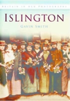
£8.99
The Isles of Scilly on a detailed topographic & GPS compatible map No. 101, paper version, from the Ordnance Survey’s 1:25, 000 Explorer series. MOBILE DOWNLOADS: this title & all the other OS Explorer maps include a code for downloading after purchase the digital version onto your smartphone or tablet for viewing on the OS smartphone app.OS EXPLORER SERIES: to see the list of all the titles in the OS Explorer series, both paper & waterproof versions, please click on the series link. The Explorer series, Ordnance Survey’s most detailed maps recommended for anyone enjoying outdoor activities, provides topographic coverage of Great Britain at 1:25, 000 on GPS compatible maps with hiking trails, cycling routes & extensive tourist information. Each printed map is available either on paper or as a waterproof & tear-resistant OS Active Map, as indicated in its title. Britain’s National Parks & other areas of particular tourist interest are presented on often double-sided OL (Outdoor Leisure) maps, whilst most standard format Explorers cover an area of 30 x 20km (approx. 19 x 12 miles). All three versions (paper, waterproof & digital) are the same & provide plenty of recreational & tourist information, indicating the traditional public right of way paths (except in Scotland where different laws apply), including bridleways & byways. National Trails & other long-distance paths are marked, as well as permissive footpaths or bridleways & on-road or traffic-free cycle routes with, where appropriate, their National/ Regional Cycle Network numbers. Boundaries of access land are clearly marked. A wide range of symbols provides additional tourist information, highlighting camping & caravanning sites, information offices & visitors’ centres, parking & picnicking places, country pubs, sport & recreational facilities including cycle hire locations & mountain biking trails, historic buildings & museums, etc. Exceptionally clear presentation of the landscape is provided by contours at 5m or in the uplands at 10m intervals, with additional spot heights plus colouring and/or graphics for different types of woodlands, orchards, heath, marshl&, scree or boulders, & other topographic features. For GPS users the maps have British National Grid lines at 1km intervals, with latitude & longitude given by margin ticks at 1`. Clearly laid out map legend

Includes::
French & German translations for the tourist information symbols.

...
Archived Product
£8.95
Walking in the Isles of Scilly is legendary walker Paddy Dillon’s Cicerone guide to the best rambling opportunities in the islands. The guide covers 11 walks on the main islands such as St Mary’s St Agnes & Bryher in addition to four boat trips to outlying islands including Annet, the Norrard Rocks, St Helen’s & Tean & the Eastern Isles. The islands, located off the south-west tip of Engl&, are fringed by rugged cliffs & sandy beaches & allow easy access between each isl&. A detailed introduction provides useful information on geology, ancient history & island flowers, birds & animals in addition to practical tips on getting to Scilly & travelling around, boat trips, tourist information & safety matters. Detailed route descriptions are accompanied by Ordnance Survey extracts mapping the route in addition to colour photographs illustrating some of the magical highlights of the islands. ...
Archived Product
£7.99
Isles of Skye & Raasay in the Landmark Visitor Guides series, exploring a range of places in Britain, Europe & the Caribbean, with a particular expertise in UK destinations. Each guide presents the reader with detailed, wide-ranging & accessible overview of the region or area, with a particular focus on history & culture, notable local attractions, the landscape, local events & family activities. A series of recommended walks & guided car tours exploring the region are also included in each title. The guides are arranged geographically by region & are ideal both for short & longer breaks, with practical guidance on recommended routes & tourist attractions, in addition to insightful inset boxes into local history, culture & traditions. Information on accommodation, restaurants & day-to-day information are more limited, though a compact Directory at the end of each guide provides basic listings of recommended accommodation & restaurants, as well as tourist information contacts & regional event calendars. International destinations also carry climate & country facts, basic phrases & other general travel practical guidance for travelling to the region. The British titles in the Landmark Visitor Guides series are highly recommended, covering titles that are rarely available from other publishers. ...
Archived Product
£3.50
Isleworth in 1894 in a fascinating series of reproductions of old Ordnance Survey plans in the Alan Godfrey Editions, ideal for anyone interested in the history of their neighbourhood or family. Two versions for this area have been published, covering the village centre of Isleworth with Lower Square, South Street, Manor Mill, Gumley House convent, Nazareth House convent, Isleworth Brewery, & extending north to include Brentford workhouse, Smallbury Green, Syon House & much of Syon Park; also site of Battle of Brentford. East of the Thames on the 1894 map is part of the Old Deer Park, Kew Observatory, a few streets of Richmond around Kew Foot Road; in the north-east is part of Kew Gardens, including Queen`s Cottage Grounds. About the Alan Godfrey Editions of the 25” OS Series: Selected towns in Great Britain & Ireland are covered by maps showing the extent of urban development in the last decades of the 19th & early 20th century. The plans have been taken from the Ordnance Survey mapping & reprinted at about 15 inches to one mile (1:4, 340). On the reverse most maps have historical notes & many also include extracts from contemporary directories. Most maps cover about one mile (1.6kms) north/south, one & a half miles (2.4kms) across; adjoining sheets can be combined to provide wider coverage.FOR MORE INFORMATION & A COMPLETE LIST OF ALL AVAILABLE TITLES PLEASE CLICK ON THE SERIES LINK. ...
Archived Product
£3.50
Isleworth in 1935 in a fascinating series of reproductions of old Ordnance Survey plans in the Alan Godfrey Editions, ideal for anyone interested in the history of their neighbourhood or family. Two versions for this area have been published, covering the village centre of Isleworth with Lower Square, South Street, Manor Mill, Gumley House convent, Nazareth House convent, Isleworth Brewery, & extending north to include Brentford workhouse, Smallbury Green, Syon House & much of Syon Park; also site of Battle of Brentford. Please note that, as with most 1930s maps, the area east & south of the river in Surrey is left blank on the 1935 version. About the Alan Godfrey Editions of the 25” OS Series: Selected towns in Great Britain & Ireland are covered by maps showing the extent of urban development in the last decades of the 19th & early 20th century. The plans have been taken from the Ordnance Survey mapping & reprinted at about 15 inches to one mile (1:4, 340). On the reverse most maps have historical notes & many also include extracts from contemporary directories. Most maps cover about one mile (1.6kms) north/south, one & a half miles (2.4kms) across; adjoining sheets can be combined to provide wider coverage.FOR MORE INFORMATION & A COMPLETE LIST OF ALL AVAILABLE TITLES PLEASE CLICK ON THE SERIES LINK. ...
Archived Product
£15.95
A more concise work than Mary Cosh`s History of Islington, this was the first of the ` Past` series & is now in its third printing. It describes Islington`s beginnings as a village catering for livestock drovers (and their animals) on their way to Smithfield. Later it became a residential adjunct to the City, home to lawyers & small businesses. With the escape to the suburbs by affluent residents, the grim days came, even in the handsome squares, with overcrowding, dereliction & slums, only for Islington to rise again with the boost of the Victoria line & become a restored area with a wealth of theatres, restaurants & bars. ...
Archived Product
£8.99
ISLOMANIA is not really about the famous fictional castaway at all
- it is more about the place he was forced to make his temporary
...
Archived Product
£20.00
The International Safety Management (ISM) Code with guidelines for its implementation provides an international standard for the safe management & operation of ships & for pollution prevention. It is an essential reference for maritime administrations, shipowners & operators, shipping companies, training providers & education institutes, shipbuilders, engine & equipment manufacturers & others with interest in ensuring safety at sea & prevention of damage to the environment. This publication

Includes::
the texts of SOLAS chapter IX & the ISM Code. in addition, Guidelines for the operational implementation of the International Safety Management (ISM) Code by Companies, Guidance on the qualifications, training & experience necessary for undertaking the role of the designated person under the provisions of the ISM Code, Guidance on near-miss reporting, Guidelines on Maritime Cyber Risk Management & resolution MSC.428 (98) on Maritime Cyber Risk Management in Safety Management Systems are included.

...
Archived Product
£8.50
Map No. 187, Isny
- Wangen
- Leutkirch, in a series of hiking maps from Kompass providing extensive coverage of Austria &

...
Archived Product
£11.99
Isny
- Wangen
- Leutkirch area of the Bavarian Alps on a detailed, GPS compatible map at 1:50, 000 from Kompass with local

...
Archived Product

Islington

Islington retains a distinct personality which dates back to the days when it was a villages in the countryside visited by Londoners for leisure pursuits. This fascinating collection of nearly 200 old photographs of the Borough takes a nostalgic look back at some of the changes of the last hundred years. We see the old shops, street markets and theatres, including the music halls, and some of the people who lived and worked in the area. Dramatic changes in public transport can be seen, from horse-drawn bus and tramcar to the arrival of the Underground and the motorbus. This book includes early scenes of Holloway and Canonbury, Finsbury Park, the construction of the Highgate Archway and the new stand for Arsenal at Highbury in the 1930s. These old scenes will bring back strong
memories for some and enlighten others about an Islington that is now history. This book takes us on a journey through Islington`s past, sometime quite recognizable, sometimes unfamiliar, but in a time of rapid change, it is all the more interesting look at what has gone before. Gavin Smith is a keen local historian and his numerous books on local history include Barking and Dagenham (THe History Press, 1996).He lives in Brentwood, Essex.
RIP - This product is no longer available on our network. It was last seen on 25.09.2019

This page now acts as a permanent archive for this product. Add more information using the comments box below to ensure it can still be found by future generations.

Use our search facility to see if it is available from an alternative contributor.
  • Availability: Out Of Stock
  • Supplier: Stanfords
  • SKU: 9780752449609
Availability: In Stock
£12.99

Product Description

Islington retains a distinct personality which dates back to the days when it was a villages in the countryside visited by Londoners for leisure pursuits. This fascinating collection of nearly 200 old photographs of the Borough takes a nostalgic look back at some of the changes of the last hundred years. We see the old shops, street markets & theatres, including the music halls, & some of the people who lived & worked in the area. Dramatic changes in public transport can be seen, from horse-drawn bus & tramcar to the arrival of the Underground & the motorbus. This book

Includes::
early scenes of Holloway & Canonbury, Finsbury Park, the construction of the Highgate Archway & the new stand for Arsenal at Highbury in the 1930s. These old scenes will bring back strong memories for some & enlighten others about an Islington that is now history. This book takes us on a journey through Islington`s past, sometime quite recognizable, sometimes unfamiliar, but in a time of rapid change, it is all the more interesting look at what has gone before. Gavin Smith is a keen local historian & his numerous books on local history include Barking & Dagenham (THe History Press, 1996). He lives in Brentwood, Essex.

Reviews/Comments

Add New

Intelligent Comparison

Oooops!
We couldn't find anything!
Perhaps this product's unique.... Or perhaps we are still looking for comparisons!
Click to bump this page and we'll hurry up.

Price History

Vouchers

No voucher codes found.
Do you know a voucher code for this product or supplier? Add it to Insights for others to use.

Facebook

Jargon Buster

Arsenal - A football team from London
strong - A descriptive word for an item that has physical strength
History - Anything that happens in the past. An acedemic subject.
Horse - A large animal with four legs that tends to be ridden.
Nostalgic - A memory for familiar things and wanting to get it back.
Distinct - Something that can be seen to be slightly different.
Transport - Something that carries people or goods.

Supplier Information

Stanfords
Stanfords was established in 1853 and opened their iconic Covent Garden flagship store in 1901. They have become the top retailer of maps, travel books and accessories in the UK and arguably offer the largest selection of maps and travel books worldwide. Famous names such as Captain Robert Falcon Scott, Ranulph Fiennes and Michael Palin have purchased from Stanfords. They now have a shop in Bristol and both stores together with other venues operate a calendar of events including talks, book signings and exhibitions. As a specialist map retailer, the map selection is comprehensive and includes road maps, street maps and walking maps from worldwide destinations, as well as a selection of world atlases and wall maps. Books include travel guides and travel literature. Stanfords also stock globes, from miniatures made of blue marble to magnificent floor-standing globes. The website features a selection of interesting articles on travel topics.
Page Updated: 2023-11-12 20:15:36

Community Generated Product Tags

Oh No! The productWIKI community hasn't generated any tags for this product yet!
Menu