More From Contributor

£8.99
Isle of Axholme, Scunthorpe & Gainsborough area on a detailed topographic & GPS compatible map No. 280, paper version, from the Ordnance Survey’s 1:25, 000 Explorer series. MOBILE DOWNLOADS: this title & all the other OS Explorer maps include a code for downloading after purchase the digital version onto your smartphone or tablet for viewing on the OS smartphone app.OS EXPLORER SERIES: to see the list of all the titles in the OS Explorer series, both paper & waterproof versions, please click on the series link. The Explorer series, Ordnance Survey’s most detailed maps recommended for anyone enjoying outdoor activities, provides topographic coverage of Great Britain at 1:25, 000 on GPS compatible maps with hiking trails, cycling routes & extensive tourist information. Each printed map is available either on paper or as a waterproof & tear-resistant OS Active Map, as indicated in its title. Britain’s National Parks & other areas of particular tourist interest are presented on often double-sided OL (Outdoor Leisure) maps, whilst most standard format Explorers cover an area of 30 x 20km (approx. 19 x 12 miles). All three versions (paper, waterproof & digital) are the same & provide plenty of recreational & tourist information, indicating the traditional public right of way paths (except in Scotland where different laws apply), including bridleways & byways. National Trails & other long-distance paths are marked, as well as permissive footpaths or bridleways & on-road or traffic-free cycle routes with, where appropriate, their National/ Regional Cycle Network numbers. Boundaries of access land are clearly marked. A wide range of symbols provides additional tourist information, highlighting camping & caravanning sites, information offices & visitors’ centres, parking & picnicking places, country pubs, sport & recreational facilities including cycle hire locations & mountain biking trails, historic buildings & museums, etc. Exceptionally clear presentation of the landscape is provided by contours at 5m or in the uplands at 10m intervals, with additional spot heights plus colouring and/or graphics for different types of woodlands, orchards, heath, marshl&, scree or boulders, & other topographic features. For GPS users the maps have British National Grid lines at 1km intervals, with latitude & longitude given by margin ticks at 1`. Clearly laid out map legend

Includes::
French & German translations for the tourist information symbols.

...
Archived Product
£7.00
Set of two double-sided maps to cover the whole of the Isle of Man. Roads, tracks & footpaths are shown, as are field boundaries. Hill country with public access is clearly marked, & the map also shows car parks & picnic sites. The TT course is shown in detail with its bends & other landmarks named. Contours are shown at 100ft intervals. The base cartography is reduced from 6 inches to the mile scale, which makes some of the lettering very small, but the names of the main features are reset at a larger size for clarity. The British National Grid is shown at 1km intervals (latitude & longitude are not shown). ...
Archived Product
£7.99
Isle of Man in the Landmark Visitor Guides series, exploring a range of places in Britain, Europe & the Caribbean, with a particular expertise in UK destinations. Each guide presents the reader with detailed, wide-ranging & accessible overview of the region or area, with a particular focus on history & culture, notable local attractions, the landscape, local events & family activities. A series of recommended walks & guided car tours exploring the region are also included in each title. The guides are arranged geographically by region & are ideal both for short & longer breaks, with practical guidance on recommended routes & tourist attractions, in addition to insightful inset boxes into local history, culture & traditions. Information on accommodation, restaurants & day-to-day information are more limited, though a compact Directory at the end of each guide provides basic listings of recommended accommodation & restaurants, as well as tourist information contacts & regional event calendars. International destinations also carry climate & country facts, basic phrases & other general travel practical guidance for travelling to the region. The British titles in the Landmark Visitor Guides series are highly recommended, covering titles that are rarely available from other publishers. ...
Archived Product
£10.95
Isle of Man at 1:30, 000 on a waterproof & tear-resistant, GPS compatible map from Harvey Map Services in their Superwalker series covering popular hiking areas of Great Britain & Irel&, annotated with additional information for walkers. The maps have contours at 15m intervals, with additional graphics for various types of terrain (crags, large boulders, scattered rocks) & colouring for different kinds of land use or vegetation (pastures, bogs, forests or woodl&, etc). The maps show local hiking paths, indicating, where appropriate, long-distance routes & boundaries of national parks or other protected areas. Scottish titles also indicate Munro, Corbett & Graham hills. Some maps in addition highlight local cycle routes.A range of symbols mark various facilities for walkers including youth or independent hostels, campsites & caravan sites, information points, etc. Each map has a 1-km with British or Irish national grid. ...
Archived Product
£6.75
Beautiful, unspoilt, deeply relaxing, self governing -- & in many ways different from anywhere else in the British Isles. Here in this expanded & completely revised edition of this best-selling guide is the full story of what makes the Isle of Man such an interesting & memorable place to visit. Contents include: Attractions & Activities; Beaches & Resorts; Churches; Day Drives; Events; Extraordinary Facts; Fishing & Golf; Glens & Gardens; History & Heritage; Lighthouses; Myths & Legends; Queenies & Kippers; Railways & Trams; Street Plans & Maps; TT & Motorsport; Visitor Centres; Walks & Cycle Trails; Yachting & Sailing. ...
Archived Product
£2.95
Isle of Man 1610 Replica Map by the Old Map Company is a reproduction of the map created for the famous atlas of the period by the master map maker John Speede Esq. The Old Map Company has recreated the antique maps of British counties, European cities & World countries originally crafted by master map maker John Speede Esq. whose work had accuracy & quality not surpassed for centuries. Each map is treated & presented on specially crafted paper then h&-treated giving it texture & an aged appearance before being beautifully engraved & detailed. ...
Archived Product
£9.99
Map No. 95, Isle of Man 1874, in the Cassini Historical Series of old Ordnance Survey mapping of England & Wales at 1:50, 000 in a format designed to offer a convenient comparison with the present day coverage from the OS, & most locations in three different editions. Old historical maps have been combined so that the sheet lines correspond to the current Landranger series & reproduced with the scale changed from one inch to one mile to 1:50, 000. Most locations are covered by three separate maps, showing how the area has changed over the decades, with selected major cities also presented in a fourth edition. * Old Series: the first detailed survey mapping dating for most areas from the first half of the 19th century, in black & white & with relief shown by hachuring.* Revised New Series from 1880s/1900s, with some colouring & a mixture of hachuring & contour lines.* Popular Edition from the inter-war years, with contour lines & colouring to indicate woodlands, parks, etc.* New Popular Edition from the late 1940s, reproduced in the Cassini series for the major cities. Each map

Includes::
notes on the development of Ordnance Survey & the various series produced by them. For those interested in maps & cartography in general, the Cassini series also provides a fascinating insight into how Ordnance Survey cartographic style has developed over a period of over 100 years. Coverage

Includes::
present day Douglas, Onchan, Laxey, Maughold, Ramsey, Bride, Sulby, Andreas, Jurby West, Kirk Michael, Ballaugh, Peel, St John’s, Glenmaye, Ballasalla, Castletown Port St Mary & Port Erin, with the Point of Ayre, the peak of Snaefell, & long distance paths: Millenium Way, Raad Ny Foillan & Bayr Ny Skeddan.* PLEASE NOTE: Stanfords can also print on request mapping from all four series *centring the map on a location of your choice.* For more information please click on the link below.


...
Archived Product
£9.99
Map No. 95, Isle of Man 1925, in the Cassini Historical Series of old Ordnance Survey mapping of England & Wales at 1:50, 000 in a format designed to offer a convenient comparison with the present day coverage from the OS, & most locations in three different editions. Old historical maps have been combined so that the sheet lines correspond to the current Landranger series & reproduced with the scale changed from one inch to one mile to 1:50, 000. Most locations are covered by three separate maps, showing how the area has changed over the decades, with selected major cities also presented in a fourth edition. * Old Series: the first detailed survey mapping dating for most areas from the first half of the 19th century, in black & white & with relief shown by hachuring.* Revised New Series from 1880s/1900s, with some colouring & a mixture of hachuring & contour lines.* Popular Edition from the inter-war years, with contour lines & colouring to indicate woodlands, parks, etc.* New Popular Edition from the late 1940s, reproduced in the Cassini series for the major cities. Each map

Includes::
notes on the development of Ordnance Survey & the various series produced by them. For those interested in maps & cartography in general, the Cassini series also provides a fascinating insight into how Ordnance Survey cartographic style has developed over a period of over 100 years. Coverage

Includes::
present day Douglas, Onchan, Laxey, Maughold, Ramsey, Bride, Sulby, Andreas, Jurby West, Kirk Michael, Ballaugh, Peel, St John’s, Glenmaye, Ballasalla, Castletown Port St Mary & Port Erin, with the Point of Ayre, the peak of Snaefell, & long distance paths: Millenium Way, Raad Ny Foillan & Bayr Ny Skeddan.* PLEASE NOTE: Stanfords can also print on request mapping from all four series *centring the map on a location of your choice.* For more information please click on the link below.


...
Archived Product
£12.95
Aileen Davies’ Cicerone guide to the Isle of Man Coastal Path is a comprehensive survey of the walking opportunities available on one of the Irish Sea’s few islands. The guide follows the Raad ny Foillan (‘ Way of the Gull’) on a 96 mile footpath around the coastline of the isl&, allowing walkers to enjoy the rugged sea cliffs & mountain moorland of the north & the glens, beaches & dunes of the south. Peel to Castletown & the Herring Way from Peel to Castletown are also featured. The guide is organized in three main sections dedicated to the three routes outlined above & each is divided into manageable stages with details of accommodation en route. A detailed introduction gives practical advice on the best time to walk, public transport on the isl&, climate, tides & times, maps & compasses, geology, history & the various elements of nature walkers are likely to encounter on their walk. Useful appendices provide a glossary of Manx words, selected bibliography, route summary & the Isle of Man Coastal Footpath Accommodation list. Detailed route descriptions are accompanied by colour sketch diagrams mapping the route as well as colour photographs illustrating some of the highlights of the isl&. ...
Archived Product
£12.95
Raad ny Foillan (The Way of the Gull) is a 98 mile footpath around the Isle of Man. The route description is set out as a circuit & split into stages, with the longest walk being 15.5 miles & the shortest being 7 miles. Any fast walkers may wish to complete two stages per day, while those progressing at a more leisurely pace may decide to amble along & take in the splendid attractions along the way. There are two other walks described in this guidebook. The 23 mile Millennium Way, which follows the ancient route of the kings, from Ramsey to Castletown, & the 14 mile Herring Way, which takes a more traditional route from Peel to Castletown. Both these routes cross the hills of the island`s interior & can be combined to make an interesting longer walk. ...
Archived Product

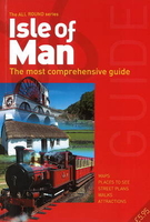
Isle Of Man - All Round Guide

Beautiful, unspoilt, deeply relaxing, self governing -- and in many ways different from anywhere else in the British Isles. Here in this expanded and completely revised edition of this best-selling guide is the full story of what makes the Isle of Man such an interesting and memorable place to visit. Contents include: Attractions & Activities; Beaches & Resorts; Churches; Day Drives; Events; Extraordinary Facts; Fishing & Golf; Glens & Gardens; History & Heritage; Lighthouses; Myths & Legends; Queenies & Kippers; Railways & Trams; Street Plans & Maps; TT & Motorsport; Visitor Centres; Walks & Cycle Trails; Yachting & Sailing.
RIP - This product is no longer available on our network. It was last seen on 25.09.2019

This page now acts as a permanent archive for this product. Add more information using the comments box below to ensure it can still be found by future generations.

Use our search facility to see if it is available from an alternative contributor.
  • Availability: Out Of Stock
  • Supplier: Stanfords
  • SKU: 9781907945656
Availability: In Stock
£5.95

Product Description

Beautiful, unspoilt, deeply relaxing, self governing -- & in many ways different from anywhere else in the British Isles. Here in this expanded & completely revised edition of this best-selling guide is the full story of what makes the Isle of Man such an interesting & memorable place to visit. Contents include: Attractions & Activities; Beaches & Resorts; Churches; Day Drives; Events; Extraordinary Facts; Fishing & Golf; Glens & Gardens; History & Heritage; Lighthouses; Myths & Legends; Queenies & Kippers; Railways & Trams; Street Plans & Maps; TT & Motorsport; Visitor Centres; Walks & Cycle Trails; Yachting & Sailing.

Reviews/Comments

Add New

Intelligent Comparison

Oooops!
We couldn't find anything!
Perhaps this product's unique.... Or perhaps we are still looking for comparisons!
Click to bump this page and we'll hurry up.

Price History

Vouchers

No voucher codes found.
Do you know a voucher code for this product or supplier? Add it to Insights for others to use.

Facebook

Jargon Buster

History - Anything that happens in the past. An acedemic subject.
Railways - A set of tracks that have been laid for the purpose of trains to travel up and down them
Day - The time it takes a planet or other space objects to complete one rotation.
Golf - A sport played on a large outside grass course, the aim to hit a small ball with a club into small holes.

Supplier Information

Stanfords
Stanfords was established in 1853 and opened their iconic Covent Garden flagship store in 1901. They have become the top retailer of maps, travel books and accessories in the UK and arguably offer the largest selection of maps and travel books worldwide. Famous names such as Captain Robert Falcon Scott, Ranulph Fiennes and Michael Palin have purchased from Stanfords. They now have a shop in Bristol and both stores together with other venues operate a calendar of events including talks, book signings and exhibitions. As a specialist map retailer, the map selection is comprehensive and includes road maps, street maps and walking maps from worldwide destinations, as well as a selection of world atlases and wall maps. Books include travel guides and travel literature. Stanfords also stock globes, from miniatures made of blue marble to magnificent floor-standing globes. The website features a selection of interesting articles on travel topics.
Page Updated: 2023-11-12 20:15:36

Community Generated Product Tags

Oh No! The productWIKI community hasn't generated any tags for this product yet!
Menu