More From Contributor

£12.50
This new 7th edition is published in conjunction with Ordnance Survey Northern Ireland & the Road Safety Authority (RSA) & features Collision Zones, Speed Detection Zones & Tolled Roads. (This product is produced with the co-operation of Ordnance Survey Northern Irel&, OSNI). ...
Archived Product
£4.99
Philip`s Ireland Road Map shows the whole of Ireland at a scale of 9 miles to 1 inch (1 cm on the map = 5.5 km on the ground). The map

Includes::
a comprehensive index of place names, plus detailed town plans of Belfast, Cork, Derry/ Londonderry & Dublin, with tourist information clearly marked. The map has been specially prepared for touring, picking out major routes & destinations in bold colours for easy journey planning & route-finding, & is a convenient size for use in a vehicle. The digital mapping gives excellent clarity, showing road networks in exceptional detail for this scale. High-quality travel information

Includes::
a wealth of useful detail marking car ferries, national parks, historic houses & gardens, museums, cathedrals, castles, ancient monuments, theme parks, & many other places of interest. A comprehensive index

Includes::
all towns & villages shown on the map.


...
Archived Product
£4.99
Ireland in the Pocket Guide series from Berlitz; a collection of handy, pocket-sized guides dedicated to an extensive range of cities, regions & countries worldwide. Written in narrative form, individual guides explore the history, main sights & attractions, food & drink, accommodation & local culture of the destination in detail. Each Berlitz pocket guide has a similar format, with colour-coded sections helping readers locate information quickly in addition to distinctive chapters exploring the city or region. An introduction outlines the destination for visitors & a section dedicated to 'A Brief History' actually explores the area in relative depth. A where to go chapter is organized by region & city & is written in prose form with references to individual sites highlighted in bold for clarity. There are also further suggestions on where & when to eat. Recommendations for leisure activities in the region, including sport, nightlife & shopping, are also provided & tailored accordingly for each destination. Handy travel tips are listed alphabetically in a dedicated section, providing practical guidance & helping visitors make the most of their stay. The main hotels, particularly for cities, are also listed in an accommodation section, offering a brief overview with approximate price bandings & relevant contact details. ...
Archived Product
£4.49
Ireland in the Pocket Guide series from Berlitz; a collection of handy, pocket-sized guides dedicated to an extensive range of cities, regions & countries worldwide. Written in narrative form, individual guides explore the history, main sights & attractions, food & drink, accommodation & local culture of the destination in detail. Each Berlitz pocket guide has a similar format, with colour-coded sections helping readers locate information quickly in addition to distinctive chapters exploring the city or region. An introduction outlines the destination for visitors & a section dedicated to 'A Brief History' actually explores the area in relative depth. A where to go chapter is organized by region & city & is written in prose form with references to individual sites highlighted in bold for clarity. There are also further suggestions on where & when to eat. Recommendations for leisure activities in the region, including sport, nightlife & shopping, are also provided & tailored accordingly for each destination. Handy travel tips are listed alphabetically in a dedicated section, providing practical guidance & helping visitors make the most of their stay. The main hotels, particularly for cities, are also listed in an accommodation section, offering a brief overview with approximate price bandings & relevant contact details. ...
Archived Product
£5.99
Ireland is a perennial favourite. Good to visit hail, rain or shine, it`s a year-round destination with plenty to offer. From its stunning natural setting, sweeping views over the Atlantic on the west coast, verdant farmland with grazing livestock to its colourful seaside towns & bustling capital city, take a queue from the locals & just go with the flow. Be inspired to visit by the brand new Berlitz Pocket Guide Irel&, a concise, full-color guide to this small island that combines lively text with vivid photography to highlight the best that Ireland has to offer. Berlitz Pocket Guide Ireland:· Where To Go covers the Republic as well as Northern Irel&.· Top 10 Attractions gives a run-down of the best sights to take in on your trip, including the Dingle Peninsula, Trinity & The Book of Kells, Temple Bar, Newgrange & Cork.· A Perfect Tour provides an itinerary for a good tour of the country.· What To Do is a snapshot of ways to spend your spare time; try cycling, horseriding or even surfing, & then there`s walking trails & shopping, plus nightlife.· Essential information on Ireland`s culture, including a brief history.· Eating Out covers the country`s best cuisine.· Curated listings of the best hotels & restaurants.· A-Z of all the practical information you`ll need. ...
Archived Product
£8.99
Ireland presented in an indexed, spiral bound, A4 road atlas from Collins at 1:20, 000 (3.2 miles to 1 inch), with town & city plans & route-planning maps. Main mapping shows motorways, primary routes, A & B roads, minor roads & junctions, with road distances marked in miles & kilometres; car & passenger ferry routes, railway lines & stops, & airports are indicated. National, district, & county boundaries are overprinted clearly. Topography is shown through spot heights & steep hill markings on some roads. Points of interest & local facilities are shown through a wide range of symbols, with Blue Flag & Green Coast beaches also marked. The beginning of the atlas

Includes::
route-planning maps of Ireland at 1:200, 000, & a section with descriptions of major places of interest, such as castles, national parks, & museums. There are town & city plans of: Bangor, Belfast, Cork, Drogheda, Dublin, D

...
Archived Product
£12.50
Ireland Road Atlas at 1:210, 000, 2012-2013 edition in an A4 spiral-bound format, produced jointly by the Ordnance Surveys of Ireland & Northern Irel&, with enlargement for 11 city areas, motorway diagrams, etc. The atlas presents the topography by altitude colouring, with plenty of names of mountain ranges, peaks, etc, & boundaries of national parks. Road network clearly shows road numbers, motorway interchanges & services, & speed detection zones. Driving distances are given on national & regional routes. Railway lines are shown with stations; ferry routes & local airports are marked. A wide range of symbols provides additional tourist information: tourist information offices, An Taisce/ National Trust sites indicating seasonal opening, historical sites, Blue Flag beaches, nature reserves, golf courses, viewpoints, etc. Also marked are caravan & camping sites, youth hostels & holiday hostels. The maps also show internal administrative boundaries &, where appropriate give Irish & English place names, both listed in the accompanying index. The maps have no geographical coordinates. The atlas

Includes::
detailed enlargements at 1:85, 000 or 1:30, 000 highlighting main transit routes across 11 towns: Dublin, Belfast, Cork, Londonderry, Armagh, Galway, Kilkenny, Limerick, Lisburn, Newry & Waterford. Each one is accompanied by a street plan of the town centre. Also provided are motorway diagrams showing distance between exits, services & toll booths; a distance table; plus main motoring regulations & road signs.

...
Archived Product
£7.99
Ireland Road Atlas 2010
- A4 indexed paperback, at 1:200, 000 / 3 miles to 1 from the AA, covering the road network & related
...
Archived Product
£4.50
Ireland Touring Map from a selection of four road maps from Collins, presenting the two countries on a different base (colouring to show topography, administrative counties or white) & with different selection of additional road & tourist information:GEOGRAPHIC BASE: 6.5 miles to 1 ...
Archived Product
£5.50
Ireland Touring Map from a selection of four road maps from Collins, presenting the two countries on a different base (colouring to show topography, administrative counties or white) & with different selection of additional road & tourist information:GEOGRAPHIC BASE (this title): 6.5 miles to 1 ...
Archived Product

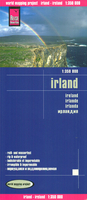
Ireland Reise Know-How

Ireland – Irish Republic and Northern Ireland – at 1:350, 000 on a light, waterproof and tear-resistant, indexed map from Reise-Know How, published as part of their highly acclaimed World Mapping project. The map divides Ireland north/south, with Dublin included on both sides. Landscape is presented by light altitude colouring with names of hill ranges and other topographic features and highlighting for national parks and other protected areas. Road network includes local roads, gives driving distances (in kms) on main and secondary roads, and shows locations of petrol stations. Railway lines, ferry links, and local airports are included. Symbols highlight various places of interest including campsites and caravan parks, UNESCO World Heritage sites, archaeological remains,
etc. The map has a latitude and longitude grid at intervals of 20’ and an index of place names which includes a separate list of places of interest. Map legend includes English.
RIP - This product is no longer available on our network. It was last seen on 25.09.2019

This page now acts as a permanent archive for this product. Add more information using the comments box below to ensure it can still be found by future generations.

Use our search facility to see if it is available from an alternative contributor.
  • External links may include paid for promotion
  • Availability: Out Of Stock
  • Supplier: Stanfords
  • SKU: 9783831773473
Availability: In Stock
£11.50

Product Description

Ireland – Irish Republic & Northern Ireland – at 1:350, 000 on a light, waterproof & tear-resistant, indexed map from Reise-Know How, published as part of their highly acclaimed World Mapping project. The map divides Ireland north/south, with Dublin included on both sides. Landscape is presented by light altitude colouring with names of hill ranges & other topographic features & highlighting for national parks & other protected areas. Road network

Includes::
local roads, gives driving distances (in kms) on main & secondary roads, & shows locations of petrol stations. Railway lines, ferry links, & local airports are included. Symbols highlight various places of interest including campsites & caravan parks, UNESCO World Heritage sites, archaeological remains, etc. The map has a latitude & longitude grid at intervals of 20’ & an index of place names which

Includes::
a separate list of places of interest. Map legend

Includes::
English.

Reviews/Comments

Add New

Intelligent Comparison

Oooops!
We couldn't find anything!
Perhaps this product's unique.... Or perhaps we are still looking for comparisons!
Click to bump this page and we'll hurry up.

Price History

Vouchers

No voucher codes found.
Do you know a voucher code for this product or supplier? Add it to Insights for others to use.

Facebook

Jargon Buster

Waterproof - Resistant to water, usualy specified by depth in metres
World - A physical grouping, commonly used to describe earth and everything associated with ti
Network - A link and communication between things. Often computers or people.
Road - a manmade lane or a path that is used to speed up travel.
Resistant - Something that can repel against something.
Altitude - Something that can be quite high in relation to sea or ground level.

Supplier Information

Stanfords
Stanfords was established in 1853 and opened their iconic Covent Garden flagship store in 1901. They have become the top retailer of maps, travel books and accessories in the UK and arguably offer the largest selection of maps and travel books worldwide. Famous names such as Captain Robert Falcon Scott, Ranulph Fiennes and Michael Palin have purchased from Stanfords. They now have a shop in Bristol and both stores together with other venues operate a calendar of events including talks, book signings and exhibitions. As a specialist map retailer, the map selection is comprehensive and includes road maps, street maps and walking maps from worldwide destinations, as well as a selection of world atlases and wall maps. Books include travel guides and travel literature. Stanfords also stock globes, from miniatures made of blue marble to magnificent floor-standing globes. The website features a selection of interesting articles on travel topics.
Page Updated: 2023-11-12 20:15:36

Community Generated Product Tags

Oh No! The productWIKI community hasn't generated any tags for this product yet!
Menu