
 United Kingdom
 France
 Germany
 Netherlands
 Sweden
 USA
USA
 Italy
Italy
 Spain
Spain
More From Contributor


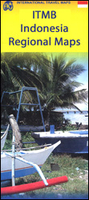
Indonesia ITMB
Indonesia at 1:2, 400, 000 on a double-sided indexed map from ITMB and cartography designed to show the country’s topography through bright altitude colouring and spot heights (elevation shown in feet). The map divides Indonesia west/east, with Sumatra, Borneo, Java, Bali, Lombok and Sumbawa on one side, and Sulawesi with the remaining islands and West Papua on the reverse. Individual small islands and groups are named, as are the surrounding seas, straights and bays.The map shows ferry connections between the islands and on the larger ones shows their road network with distances on main routes. Various places of interest are highlighted: national parks and other protected areas, cultural and religious places, beaches, snorkeling/diving/fishing sites, etc. some annotated with
brief notes. Latitude and longitude lines are drawn at 2° intervals. Each side has a separate index.
brief notes. Latitude and longitude lines are drawn at 2° intervals. Each side has a separate index.

Product Description
Reviews/Comments
Add New
Vouchers
No voucher codes found.
Do you know a voucher code for this product or supplier? Add it to Insights for others to use.
Do you know a voucher code for this product or supplier? Add it to Insights for others to use.
 Denmark