More From Contributor
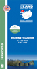
£11.50
Topographic survey of France at 1:25, 000 in IGN`s excellent TOP25 / Série Bleue series. All the maps are GPS compatible, with a 1km UTM grid plus latitude & longitude lines at 5’ intervals. Contours are at 5m intervals except for mountainous areas where the maps have contours at 10m intervals, vividly enhanced by hill shading & graphics for rocky terrain. Colouring with graphics indicates different types of vegetation or land use (deciduous or coniferous forests, moors, orchards, vineyards, etc). PLEASE NOTE: coverage of France at this scale is currently being revised – the format & the presentation of each title are indicated by the letters at the end of its Sheet Reference number (e.g. 0416ET, 3531ETR, 1923SB, etc.)MAPS WITH FULL TOURIST OVERPRINT & AN ENGLISH MAP LEGEND: all TOP25 maps & the SB editions of Série Bleue have an overprint highlighting waymarked walking trails including long-distance GR routes &, where appropriate, ski routes. Symbols indicate campsites, gîtes d’etape, refuges, equestrian centres & other recreational facilities or sites, tourist information centres, cultural heritage, etc. Towns & locations of particular interest are highlighted.- ET or OT = single-sided TOP25 map covering approx. 29x 21 km / 18x 13 miles.- ETR or OTR = waterproof & tear resistant TOP25 map covering the same area as the corresponding ET or OT number, but double-sided, printed on a smaller size sheet with a good overlap between the sides.- SB = Série Bleue map with full tourist overprint; these maps, first introduced in summer 2014, each cover approx. 29x 24km / 18x 15 miles.SÉRIE BLEUE maps with numbers ending in E (Est) or O (Ouest): most editions now indicate the GR routes, but do not show any other tourist information. Map legend is in French only. Each map covers approx. 14x 20km / 9x 12 miles. ...
Archived Product
£3.50
Hornsea in 1926 in a fascinating series of reproductions of old Ordnance Survey plans in the Alan Godfrey Editions, ideal for anyone interested in the history of their neighbourhood or family. The map is double-sided & covers the small town of Hornsea, a few miles east of Hull. Features on the main map include the Old Hall, railway terminus, St Nicholas church, Market Place, The Oval, Grosvenor Gardens, The Hall, Victoria Gardens, Cliff Road, etc. On the reverse is part of the adjacent sheet 197.07, extending coverage south to include Hornsea Bridge & Edenfield; features here include Hornsea Bridge station, part of the Mere, Kirkholme, cemetery, Trinity House Farm, etc. About the Alan Godfrey Editions of the 25” OS Series: Selected towns in Great Britain & Ireland are covered by maps showing the extent of urban development in the last decades of the 19th & early 20th century. The plans have been taken from the Ordnance Survey mapping & reprinted at about 15 inches to one mile (1:4, 340). On the reverse most maps have historical notes & many also include extracts from contemporary directories. Most maps cover about one mile (1.6kms) north/south, one & a half miles (2.4kms) across; adjoining sheets can be combined to provide wider coverage.FOR MORE INFORMATION & A COMPLETE LIST OF ALL AVAILABLE TITLES PLEASE CLICK ON THE SERIES LINK. ...
Archived Product
£3.50
Hornsey in 1894 in a fascinating series of reproductions of old Ordnance Survey plans in the Alan Godfrey Editions, ideal for anyone interested in the history of their neighbourhood or family. Three versions have been published to cover this area, stretching from Middle Lane & Nightingale Lane eastward to Langham Road & Etherley Road, & from Pemberton Road northward to Coburg Road. Features include Ducketts Green, Coleraine Park, Hornsey Park, Moselle Park, Hornsey Glebe, Lister Park, Hornsey Vale, part of Alexandra Park racecourse, stretch of GNR main line with Hornsey station, Ferme Park Sidings, Rathcoole, Harringay Park area, a stretch of GER Alexandra Park branch, Christ Church, St Mary`s church Hornsey, Holy Innocents church etc. About the Alan Godfrey Editions of the 25” OS Series: Selected towns in Great Britain & Ireland are covered by maps showing the extent of urban development in the last decades of the 19th & early 20th century. The plans have been taken from the Ordnance Survey mapping & reprinted at about 15 inches to one mile (1:4, 340). On the reverse most maps have historical notes & many also include extracts from contemporary directories. Most maps cover about one mile (1.6kms) north/south, one & a half miles (2.4kms) across; adjoining sheets can be combined to provide wider coverage.FOR MORE INFORMATION & A COMPLETE LIST OF ALL AVAILABLE TITLES PLEASE CLICK ON THE SERIES LINK. ...
Archived Product
£3.50
Hornsey in 1912 in a fascinating series of reproductions of old Ordnance Survey plans in the Alan Godfrey Editions, ideal for anyone interested in the history of their neighbourhood or family. Three versions have been published to cover this area, stretching from Middle Lane & Nightingale Lane eastward to Langham Road & Etherley Road, & from Pemberton Road northward to Coburg Road. Features include Ducketts Green, Coleraine Park, Hornsey Park, Moselle Park, Hornsey Glebe, Lister Park, Hornsey Vale, part of Alexandra Park racecourse, stretch of GNR main line with Hornsey station, Ferme Park Sidings, Rathcoole, Harringay Park area, a stretch of GER Alexandra Park branch, Christ Church, St Mary`s church Hornsey, Holy Innocents church etc. About the Alan Godfrey Editions of the 25” OS Series: Selected towns in Great Britain & Ireland are covered by maps showing the extent of urban development in the last decades of the 19th & early 20th century. The plans have been taken from the Ordnance Survey mapping & reprinted at about 15 inches to one mile (1:4, 340). On the reverse most maps have historical notes & many also include extracts from contemporary directories. Most maps cover about one mile (1.6kms) north/south, one & a half miles (2.4kms) across; adjoining sheets can be combined to provide wider coverage.FOR MORE INFORMATION & A COMPLETE LIST OF ALL AVAILABLE TITLES PLEASE CLICK ON THE SERIES LINK. ...
Archived Product
£3.50
Hornsey & Green Lanes in 1935 in a fascinating series of reproductions of old Ordnance Survey plans in the Alan Godfrey Editions, ideal for anyone interested in the history of their neighbourhood or family. Three versions have been published to cover this area, stretching from Middle Lane & Nightingale Lane eastward to Langham Road & Etherley Road, & from Pemberton Road northward to Coburg Road. Features include Ducketts Green, Coleraine Park, Hornsey Park, Moselle Park, Hornsey Glebe, Lister Park, Hornsey Vale, part of Alexandra Park racecourse, stretch of GNR main line with Hornsey station, Ferme Park Sidings, Rathcoole, Harringay Park area, a stretch of GER Alexandra Park branch, Christ Church, St Mary`s church Hornsey, Holy Innocents church etc. About the Alan Godfrey Editions of the 25” OS Series: Selected towns in Great Britain & Ireland are covered by maps showing the extent of urban development in the last decades of the 19th & early 20th century. The plans have been taken from the Ordnance Survey mapping & reprinted at about 15 inches to one mile (1:4, 340). On the reverse most maps have historical notes & many also include extracts from contemporary directories. Most maps cover about one mile (1.6kms) north/south, one & a half miles (2.4kms) across; adjoining sheets can be combined to provide wider coverage.FOR MORE INFORMATION & A COMPLETE LIST OF ALL AVAILABLE TITLES PLEASE CLICK ON THE SERIES LINK. ...
Archived Product
£15.99
Hornstrandir area of Iceland at 1:100, 000 in a series of detailed hiking & recreational topographic maps from Mál og menning
-
...
Archived Product
£9.99
Filled with all the festive facts every HORRIBLE HISTORIES reader wants to know! The complete horrible history of Christmas tells tales from the dark days when the Puritans tried to abolish Christmas, to Christmas in the trenches whenthe British & Germans traded bullets for footballs. Plus dreadful jokes, rotten recipes & a Christmas quiz! ...
Archived Product
£9.99
HORRIBLE CHRISTMAS is filled with all the festive facts every HORRIBLE HISTORIES reader wanted to know, but were too stuffed full of mince pies to ask! The complete horrible history of Christmas tells tales from the dark days when the Puritans tried to abolish Christmas, to Christmas in the trenches when the British & Germans traded bullets for footballs. Plus dreadful jokes, rotten recipes, & a Christmas quiz! ...
Archived Product
£9.99
History with the nasty bits left in! Horrible Christmas tells you all the festive facts you ever wanted to find out but were too stuffed full of mince pies to ask. Want to know: a very rude pantomime song? why making Christmas pudding used to be a crime? how to get rid of carol singers? Read on for foul but festive food, seasonal stories to send shivers down your spine, & cruel yule disasters. History has never been so horrible! ...
Archived Product
£4.99
A new series of Horrible Histories sticker activity books, crammed with quick quizzes, foul facts & savage stickers, the Horrible Christmas Sticker Activity Book covers all things horrible about Christmas time. From terrible trees & putrid puddings, to rotten reindeer, perilous pantomimes & other curious customs
- there are tons of foul festive facts inside. With over 500 stickers, get ready to have one cruel Yule!
...
Archived Product

Hornstrandir

Hornstrandir area at 1:100, 000 in a series of special detailed hiking and touring maps, based on the Icelandic topographic survey, covering the most visited parts of the country. Contours at 20m intervals and bright colouring show different types of vegetation and terrain. Local footpaths indicate sections with waymarking and coastal routes passable only at low tide. Road network shows locations of river fords. Symbols mark emergency shelters, tourist huts and shelters, fishing lodges, museums, swimming pools, etc. The map has a grid showing latitude at 5’ and longitude at 10’, plus UTM margin ticks. Map legend includes English.To see the list of titles in this series please click on the series link.
RIP - This product is no longer available on our network. It was last seen on 25.09.2019

This page now acts as a permanent archive for this product. Add more information using the comments box below to ensure it can still be found by future generations.

Use our search facility to see if it is available from an alternative contributor.
  • External links may include paid for promotion
  • Availability: Out Of Stock
  • Supplier: Stanfords
  • SKU: 9789979672036
Availability: In Stock
£20.99

Product Description

Hornstrandir area at 1:100, 000 in a series of special detailed hiking & touring maps, based on the Icelandic topographic survey, covering the most visited parts of the country. Contours at 20m intervals & bright colouring show different types of vegetation & terrain. Local footpaths indicate sections with waymarking & coastal routes passable only at low tide. Road network shows locations of river fords. Symbols mark emergency shelters, tourist huts & shelters, fishing lodges, museums, swimming pools, etc. The map has a grid showing latitude at 5’ & longitude at 10’, plus UTM margin ticks. Map legend

Includes::
English. To see the list of titles in this series please click on the series link.

Reviews/Comments

Add New

Intelligent Comparison

Oooops!
We couldn't find anything!
Perhaps this product's unique.... Or perhaps we are still looking for comparisons!
Click to bump this page and we'll hurry up.

Price History

Vouchers

No voucher codes found.
Do you know a voucher code for this product or supplier? Add it to Insights for others to use.

Facebook

Jargon Buster

Hiking - An outdoor activity envolving walking in nature
Network - A link and communication between things. Often computers or people.
Road - a manmade lane or a path that is used to speed up travel.

Supplier Information

Stanfords
Stanfords was established in 1853 and opened their iconic Covent Garden flagship store in 1901. They have become the top retailer of maps, travel books and accessories in the UK and arguably offer the largest selection of maps and travel books worldwide. Famous names such as Captain Robert Falcon Scott, Ranulph Fiennes and Michael Palin have purchased from Stanfords. They now have a shop in Bristol and both stores together with other venues operate a calendar of events including talks, book signings and exhibitions. As a specialist map retailer, the map selection is comprehensive and includes road maps, street maps and walking maps from worldwide destinations, as well as a selection of world atlases and wall maps. Books include travel guides and travel literature. Stanfords also stock globes, from miniatures made of blue marble to magnificent floor-standing globes. The website features a selection of interesting articles on travel topics.
Page Updated: 2023-11-12 20:15:36

Community Generated Product Tags

Oh No! The productWIKI community hasn't generated any tags for this product yet!
Menu