
 United Kingdom
 France
 Germany
 Netherlands
 Sweden
 USA
USA
 Italy
Italy
 Spain
Spain
More From Contributor


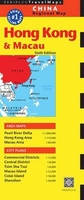
Hong Kong & Macau Periplus Travel Map
Hong Kong and Macau street plans from Periplus on a double-sided map which combines detailed street plans with more general maps, including the whole of the Hong Kong Special Administrative Region with the Shenzhen Economic Zone. The map provides for:HONG KONG & the adjoining areas: an indexed street plan of Hong Kong’s and Kowloon’s Central Commercial Districts; enlargements showing in greater detail Hong Kong’s Central District and Kowloon’s Tsim Sha Tsui area; a general road map at 1:110, 000 of the Hong Kong SAR with the Shenzhen Special Economic Zone; a diagram of Hong Kong’s Railway System; a street plan of central Shenzhen.MACAU & COTAI: detailed street plans of the Macau Island (1:12, 500) and Cotai Island (1:18, 000); an overview map of the Macau area at (1:60, 000)Also
included is an overview road map of the Pearl River Delta region (1:1, 000, 000), extending inland to Guangzhou. All the maps and street plans indicate, as appropriate, metro and railway connections, ferry routes, and various places of interest. The street plans additionally highlight locations of numerous hotels. All place names are in Latin alphabet only, except for larger streets and selected locations within the Hong Kong SAR which are also shown in Chinese.
included is an overview road map of the Pearl River Delta region (1:1, 000, 000), extending inland to Guangzhou. All the maps and street plans indicate, as appropriate, metro and railway connections, ferry routes, and various places of interest. The street plans additionally highlight locations of numerous hotels. All place names are in Latin alphabet only, except for larger streets and selected locations within the Hong Kong SAR which are also shown in Chinese.

Product Description
Reviews/Comments
Add New
Vouchers
No voucher codes found.
Do you know a voucher code for this product or supplier? Add it to Insights for others to use.
Do you know a voucher code for this product or supplier? Add it to Insights for others to use.
 Denmark