More From Contributor
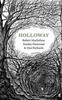
£3.50
Holland Park & Shepherds Bush in 1871 in a fascinating series of reproductions of old Ordnance Survey plans in the Alan Godfrey Editions, ideal for anyone interested in the history of their neighbourhood or family. Three versions cover this area, stretching from Iffley Road, Hammersmith eastward to Phillimore Gardens, Kensington; & from Royal Crescent & the Uxbridge Road southward to Pembroke Road. Features include Olympia, Holland Park, Holland House, Shepherds Bush Common, Brook Green, part of Kensington High Street, Shepherds Bush Road, Addison Road. Several railways cross the map & stations include Uxbridge Road & Addison Road (later Kensington Olympia) on the West London Railway; Shepherds Bush, Goldhawk Road & Hammersmith on the Hammersmith & City; Shepherds Bush & Hammersmith on the LSWR Kensington & Richmond line. About the Alan Godfrey Editions of the 25” OS Series: Selected towns in Great Britain & Ireland are covered by maps showing the extent of urban development in the last decades of the 19th & early 20th century. The plans have been taken from the Ordnance Survey mapping & reprinted at about 15 inches to one mile (1:4, 340). On the reverse most maps have historical notes & many also include extracts from contemporary directories. Most maps cover about one mile (1.6kms) north/south, one & a half miles (2.4kms) across; adjoining sheets can be combined to provide wider coverage.FOR MORE INFORMATION & A COMPLETE LIST OF ALL AVAILABLE TITLES PLEASE CLICK ON THE SERIES LINK. ...
Archived Product
£3.50
Holland Park & Shepherds Bush in 1894 in a fascinating series of reproductions of old Ordnance Survey plans in the Alan Godfrey Editions, ideal for anyone interested in the history of their neighbourhood or family. Three versions cover this area, stretching from Iffley Road, Hammersmith eastward to Phillimore Gardens, Kensington; & from Royal Crescent & the Uxbridge Road southward to Pembroke Road. Features include Olympia, Holland Park, Holland House, Shepherds Bush Common, Brook Green, part of Kensington High Street, Shepherds Bush Road, Addison Road. Several railways cross the map & stations include Uxbridge Road & Addison Road (later Kensington Olympia) on the West London Railway; Shepherds Bush, Goldhawk Road & Hammersmith on the Hammersmith & City; Shepherds Bush & Hammersmith on the LSWR Kensington & Richmond line. About the Alan Godfrey Editions of the 25” OS Series: Selected towns in Great Britain & Ireland are covered by maps showing the extent of urban development in the last decades of the 19th & early 20th century. The plans have been taken from the Ordnance Survey mapping & reprinted at about 15 inches to one mile (1:4, 340). On the reverse most maps have historical notes & many also include extracts from contemporary directories. Most maps cover about one mile (1.6kms) north/south, one & a half miles (2.4kms) across; adjoining sheets can be combined to provide wider coverage.FOR MORE INFORMATION & A COMPLETE LIST OF ALL AVAILABLE TITLES PLEASE CLICK ON THE SERIES LINK. ...
Archived Product
£3.50
Holland Park & Shepherds Bush in 1913 in a fascinating series of reproductions of old Ordnance Survey plans in the Alan Godfrey Editions, ideal for anyone interested in the history of their neighbourhood or family. Three versions cover this area, stretching from Iffley Road, Hammersmith eastward to Phillimore Gardens, Kensington; & from Royal Crescent & the Uxbridge Road southward to Pembroke Road. Features include Olympia, Holland Park, Holland House, Shepherds Bush Common, Brook Green, part of Kensington High Street, Shepherds Bush Road, Addison Road. Several railways cross the map & stations include Uxbridge Road & Addison Road (later Kensington Olympia) on the West London Railway; Shepherds Bush, Goldhawk Road & Hammersmith on the Hammersmith & City; Shepherds Bush & Hammersmith on the LSWR Kensington & Richmond line. About the Alan Godfrey Editions of the 25” OS Series: Selected towns in Great Britain & Ireland are covered by maps showing the extent of urban development in the last decades of the 19th & early 20th century. The plans have been taken from the Ordnance Survey mapping & reprinted at about 15 inches to one mile (1:4, 340). On the reverse most maps have historical notes & many also include extracts from contemporary directories. Most maps cover about one mile (1.6kms) north/south, one & a half miles (2.4kms) across; adjoining sheets can be combined to provide wider coverage.FOR MORE INFORMATION & A COMPLETE LIST OF ALL AVAILABLE TITLES PLEASE CLICK ON THE SERIES LINK. ...
Archived Product
£11.50
Hollfeld in a series of GPS compatible recreational editions of the Bavarian topographic survey at 1:25, 000, with waymarked hiking trails & cycling routes, campsites & youth hostels, etc. Coverage

Includes::
Aufseß, Kasendorf, Königsfeld, Stadelhofen, Thurnau, Wonsees. Contours used in this map vary between 5 to 20m according to the terrain, with 20m interval predominantly used for hilly areas. Varied colouring show different types of landscape: woods, vineyards, fields etc. Maps in this series feature extensive overprint highlighting local & long-distance footpaths & cycle routes, including King Ludwig Way or different variants of the Way of St James, indicating their waymarking. Symbols highlight different types of accommodation (campsites, youth hostels, refuges, etc), sport & recreational facilities, various places of interest, etc. The maps have a 1-km UTM grid. Map legend & all the text are in German only. To see other titles in this series please click on the series link.

...
Archived Product
£8.99
This second novel begins in 1940, immediately after the first book ended. Having escaped Miss Peregrine`s island by the skin of their teeth, Jacob & his new friends must journey to London, the peculiar capital of the world. Along the way, they encounter new allies, a menagerie of peculiar animals, & other unexpected surprises. Complete with dozens of newly discovered (and thoroughly mesmerizing) vintage photographs, this new adventure will delight readers of all ages. ...
Archived Product
£9.99
Holloway
- a hollow way, a sunken path. A route that centuries of foot-fall, hoof-hit, wheel-roll & rain-run have harrowed deep
...
Archived Product
£15.00
This gorgeous linen lavender bag is hand embroidered with pretty hollyhocks & filled with delicately-scented organic lavender, it makes the perfect gift. Please note that the lavender bags are sold individually &, like the garden flower, colours vary. Size (inches): 3 x 4 Size (cms): 8 x 10 Embroidery on 100% linen. Do not wash, scrunching the bag will release more lavender scent. ...
Archived Product
£6.50
Hollywood with West Hollywood on a detailed indexed street plan from Global Graphics with lists of selected hotels & restaurants, theatres, museums & other places of interest. The plan indicates main traffic routes & shows metro stations. Longer streets are annotated with block numbers. Symbols show locations of selected hotels & restaurants, theatres, shopping centres, etc. Important buildings are highlighted by small drawings. On the reveres street index is accompanied by lists of main sights, museums, theatres, & selected hotels & restaurants. ...
Archived Product
£1.99
Hollywood Stars Chart Poster – this fabulous star chart features constellations named after some of the most culturally significant films to have appeared on the silver screen from 1927
- 1960`s. The stars that make up the clusters are the Hollywood stars that appeared in them. The chart is based on the night sky over Los Angeles on October 6th 1927
- the release date of Al Jolson`s ` The Jazz Singer`, the first feature-length motion picture with synchronized dialogue which heralded a new era for cinema & the decline of the silent film. The 62 films featured include those chosen for preservation in the US National Film Registry due to their cultural, historical, or aesthetic significance; Academy Award winners; & a few personal favourites. Films include King Kong, The Wizard of Oz, It`s a Wonderful Life, Gone with the Wind, Casablanca & Rebel without a Cause.

...
Archived Product
£16.99
Topographic survey of Sweden at 1:50, 000, the Terrängkartan, from the Lantmäteriet, covering most of the country in 244 double-sided maps. Please note: the mountainous regions of central & northern Sweden are not covered by this series but presented in a separate “ Fjällkartan
- Mountain Map” series also listed on our website. Each 1:50, 000 topographic survey map covers an area of 37.5 x 40km. The maps have contours at 5 metre intervals, plus relief shading & graphics for rocky outcrops & boulders. Further graphics and/or colouring show different types of land use or vegetation (forests, arable l&, orchards, marshes, peat bogs, etc). An unusual feature of this survey is the colouring indicating buildings below or above two storeys high & “leisure/holiday homes”. The maps indicate privately maintained roads & include all other information expected of topographic survey at this scale. The maps have a 1-km UTM grid, plus latitude & longitude lines 5’ intervals. Map legend

Includes::
English. For coverage of the country’s most visited hiking areas in central & northern Sweden please see Lantmäteriet’s Mountain Map series, listed separately on our website.


...
Archived Product

Holloway

Holloway - a hollow way, a sunken path. A route that centuries of foot-fall, hoof-hit, wheel-roll and rain-run have harrowed deep down into bedrock. In July 2005, Robert Macfarlane and Roger Deakin travelled to explore the holloways of South Dorset's sandstone. They found their way into a landscape of shadows, spectres & great strangeness. Six years later, after Deakin's early death, Macfarlane returned to the holloway with the artist Stanley Donwood and writer Dan Richards. The book is about those journeys and that landscape.
RIP - This product is no longer available on our network. It was last seen on 25.09.2019

This page now acts as a permanent archive for this product. Add more information using the comments box below to ensure it can still be found by future generations.

Use our search facility to see if it is available from an alternative contributor.
  • External links may include paid for promotion
  • Availability: Out Of Stock
  • Supplier: Stanfords
  • SKU: 9780571302710
Availability: In Stock
£14.99

Product Description

Holloway
- a hollow way, a sunken path. A route that centuries of foot-fall, hoof-hit, wheel-roll & rain-run have harrowed deep down into bedrock. In July 2005, Robert Macfarlane & Roger Deakin travelled to explore the holloways of South Dorset's sandstone. They found their way into a landscape of shadows, spectres & great strangeness. Six years later, after Deakin's early death, Macfarlane returned to the holloway with the artist Stanley Donwood & writer Dan Richards. The book is about those journeys & that landscape.

Reviews/Comments

Add New

Intelligent Comparison

Oooops!
We couldn't find anything!
Perhaps this product's unique.... Or perhaps we are still looking for comparisons!
Click to bump this page and we'll hurry up.

Price History

Vouchers

No voucher codes found.
Do you know a voucher code for this product or supplier? Add it to Insights for others to use.

Facebook

Jargon Buster

Foot - A part of the body at the bottom end of the leg
Foot - or Feet - a measurement equivilent to 30cm
Hollow - Something that has an empty space inside.

Supplier Information

Stanfords
Stanfords was established in 1853 and opened their iconic Covent Garden flagship store in 1901. They have become the top retailer of maps, travel books and accessories in the UK and arguably offer the largest selection of maps and travel books worldwide. Famous names such as Captain Robert Falcon Scott, Ranulph Fiennes and Michael Palin have purchased from Stanfords. They now have a shop in Bristol and both stores together with other venues operate a calendar of events including talks, book signings and exhibitions. As a specialist map retailer, the map selection is comprehensive and includes road maps, street maps and walking maps from worldwide destinations, as well as a selection of world atlases and wall maps. Books include travel guides and travel literature. Stanfords also stock globes, from miniatures made of blue marble to magnificent floor-standing globes. The website features a selection of interesting articles on travel topics.
Page Updated: 2023-11-12 20:15:36

Community Generated Product Tags

Oh No! The productWIKI community hasn't generated any tags for this product yet!
Menu