More From Contributor
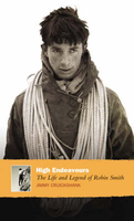
£16.99
Pack up your hiking gear & skis because we`re heading to the mountains. Marla Meridith, celebrity food & lifestyle blogger, travels the world looking for the best of the mountains. Inspired by Marla`s travels to the mountains of the Swiss Alps, Austria, Utah & Colorado, these recipes are perfect for stick-to-your-ribs comfort food that will fuel your active day at the same time it transports you to high culture resorts & panoramic mountain vistas. Warm up after a frosty day on the slopes, or cool down after a day of hiking with recipes such as Chamonix Onion Soup Gratinee, Alper Macaroni, Elk Spaghetti Bolognese, Pizokel, Krautfleckrl & Ski Chalet Bison Sliders. Featuring real ingredients, cured meats, game meats like bison, pheasant & fish, & local finds from hiking & easy foraging (like berries & mushrooms), you can create a hunter-gatherer meal bound to satisfy any adventurer. This book will have 75 recipes & 75 photographs. ...
Archived Product
£14.99
The High Atlas at 1:100, 000 on a laminated, waterproof & tear-resistant map from terra Quest, accompanied by a road map of Morocco & a street plan of Marrakesh. The map of the High Atlas, on a panel Approx. half of one side of the map, centres on Imlil & covers the whole of the Jbel Toubkal National Park. Contours at 25m intervals are enhanced by relief shading & colouring for forested areas, with spot heights & names of various mountain ranges. Trekking routes are highlighted. Symbols show locations of refuges & campsites, as well as locations with tourist accommodation, restaurant, shops/markets, bus or taxi facilities, cultural sites, etc. The map has latitude & longitude lines at intervals of 1 ...
Archived Product
£11.50
Double-sided contoured road map of the national parks, forests & other protected areas in the eastern part of Victoria, including the Alpine NP, Snowy River NP, & part of the Kosciuszko NP in New South Wales. Road information is divided into two groups: roads & tracks which were plotted with a GPS & computer during the fieldwork carried out by Hema, plus other tracks shown on the country ...
Archived Product
£12.99
High Eifel
- Vulkaneifel region of the Rhineland at 1:35, 000 from Kümmerly+ Frey in a series GPS compatible, double-sided maps
...
Archived Product
£8.99
This is the dual biography of a couple whose lives embraced a range of adventure on l&, sea & mountain, in peace & in war. The author portrays them as the most accomplished travelling & adventuring couple of the 20th century. Miles Smeeton has written nine books including Once is Enough, Because the Horn Was There, & The Sea Was Our Village, which earned him the reputation of adventurer, sailor, conservationist & storyteller. As a young army officer in 1934, he fell in love with the Commanding Officer's wife
- Beryl Boxer
- during a 6000-mile overland journey from India to Engl&. At that stage she had already travelled alone across four continents on foot & horseback. After the war, they mountaineered & sailed, cruising the oceans under sail, before settling in the Rockies in 1969 to spend their last 20 years breeding endangered Canadian wild animals.

...
Archived Product
£9.99
For generations of adventurers, from Mallory to Hilary, Norgay to Krakauer, Mount Everest & the world`s greatest peaks have provided the ultimate testing ground. But as the public`s fascination with mountaineering reaches an all-time high, the question remains
- why climb? In High Exposure, legendary rock climber. mountaineer & film-maker, David Breashears, answers with a captivating & intimate look at his life.
...
Archived Product
£15.99
The High Fens (Vennbahn) Cycle Route, a 230-km long cycle trail from Aachen across the Hoge Venen / Hautes Fagnes Natural Park in eastern Belgium & Luxembourg to Luxembourg City, presented by the Verlag Esterbauer in guide with maps at 1:50, 000 showing the route & its variants. Extensive information is conveyed by symbols, indicating road surface, campsites & other accommodation, repair workshops, recreational facilities, places of interest, etc. A list of various types of accommodation facilities is included. The High Fens (Vennbahn) Cycle Route was awarded in 2013 the ” European Greenways Award” & in 2014 at the ” Fiets en Wandelbeurs” exhibition in Amsterdam received the Audience Award as ” Bike Route of 2014”.IMPORTANT
- PLEASE NOTE BEFORE ORDERING
- ALL THE TEXT IN THIS TITLE IS GERMAN ONLY. MAP LEGEND

Includes::
ENGLISH (please see our sample image) & the information provided on the maps is sufficient to use this title without any knowledge of German.ABOUT THE BIKELINE SERIES: all the titles have been meticulously researched & are highly regarded in their native Germany. Most titles, as indicated in their individual descriptions, also include a separate section listing selected accommodation, from hotels to campsites, youth hostels & rooms in private houses, all with addresses, telephone numbers & price range. Information on towns along each route

Includes::
a list of places of interest, with opening hours, etc. Several of the guides also have street plans. To see the list of other titles in the Bikeline series please click on the series link.


...
Archived Product
£8.99
This is Nick Hornby's first novel, an international bestseller & instantly recognized by critics & readers alike as a classic, helps to explain men to women, & men to men. Rob is good on music: he owns a small record shop & has strong views on what's decent & what isn't. But he's much less good on relationships. In fact, he's not at all sure that he wants to commit himself to anyone. So it's hardly surprising that his girlfriend decides that enough is enough. ...
Archived Product
£3.50
High Green & Thorncliffe in 1903 in a fascinating series of reproductions of old Ordnance Survey plans in the Alan Godfrey Editions, ideal for anyone interested in the history of their neighbourhood or family. The map is double-sided. The main map covers the village of High Green, a few miles north of Sheffield in Ecclesfield parish. Features in High Green include Angram Bank Farm, High Green House, & the outlying hamlets of Mortomley, Thompson Hill, Near Potter Hill & Far Potter Hill. The map extends north-west to Hurst Green & south to Charltonbrook. Features at Mortomley include St Saviour`s church & Mortomley Hall. Near the eastern edge of the map is Thorncliffe Iron Works & numerous old ironstone pits are marked. On the reverse is part of the adjacent sheet 282.16 extending coverage east to include Thorncliffe Colliery, Warren, Lane End, Chapeltown Iron Works & part of Chapeltown with St John`s church. A section of the MR Thorncliffe High Level Ironstone Branch is included, also the Chapeltown Branch Extension through Tankersley Tunnel, plus the GCR Woodbourn Junction to Aldham Junction line with Chapeltown station. Coverage extends east to the hamlet of White Lane. About the Alan Godfrey Editions of the 25” OS Series: Selected towns in Great Britain & Ireland are covered by maps showing the extent of urban development in the last decades of the 19th & early 20th century. The plans have been taken from the Ordnance Survey mapping & reprinted at about 15 inches to one mile (1:4, 340). On the reverse most maps have historical notes & many also include extracts from contemporary directories. Most maps cover about one mile (1.6kms) north/south, one & a half miles (2.4kms) across; adjoining sheets can be combined to provide wider coverage.FOR MORE INFORMATION & A COMPLETE LIST OF ALL AVAILABLE TITLES PLEASE CLICK ON THE SERIES LINK. ...
Archived Product
£3.50
High Heaton in 1894 in a fascinating series of reproductions of old Ordnance Survey plans in the Alan Godfrey Editions, ideal for anyone interested in the history of their neighbourhood or family. The map covers the area to the west of Jesmond as far as City Hospital & the NER railway line. To the north it

Includes::
Bank Head & extends south to Heaton Town Farm. Features show Benton Hall, Benton Park, Byker & Heaton Cemetery, Newton Road Quarry, Benton Bridge, County Cricket Ground & Jesmond Park. On the reverse is an extract from a street directory for the area. About the Alan Godfrey Editions of the 25” OS Series: Selected towns in Great Britain & Ireland are covered by maps showing the extent of urban development in the last decades of the 19th & early 20th century. The plans have been taken from the Ordnance Survey mapping & reprinted at about 15 inches to one mile (1:4, 340). On the reverse most maps have historical notes & many also include extracts from contemporary directories. Most maps cover about one mile (1.6kms) north/south, one & a half miles (2.4kms) across; adjoining sheets can be combined to provide wider coverage.FOR MORE INFORMATION & A COMPLETE LIST OF ALL AVAILABLE TITLES PLEASE CLICK ON THE SERIES LINK.

...
Archived Product

High Endeavours

Robin Smith was one of the most daring climbers ever to have tackled a mountain. This definitive biography draws on contributions from people who knew this charismatic and complex young man, as well as diary extracts from Smith himself. A friend and inspiration to many climbers worldwide, including fellow Scot Dougal Haston, ”High Endeavours” is a fitting and well-overdue tribute to one of Britain`s most revered mountaineers, and one of the finest books ever written on the allure of the mountainside.
RIP - This product is no longer available on our network. It was last seen on 25.09.2019

This page now acts as a permanent archive for this product. Add more information using the comments box below to ensure it can still be found by future generations.

Use our search facility to see if it is available from an alternative contributor.
  • External links may include paid for promotion
  • Availability: Out Of Stock
  • Supplier: Stanfords
  • SKU: 9781841958316
Availability: In Stock
£11.99

Product Description

Robin Smith was one of the most daring climbers ever to have tackled a mountain. This definitive biography draws on contributions from people who knew this charismatic & complex young man, as well as diary extracts from Smith himself. A friend & inspiration to many climbers worldwide, including fellow Scot Dougal Haston, ” High Endeavours” is a fitting & well-overdue tribute to one of Britain`s most revered mountaineers, & one of the finest books ever written on the allure of the mountainside.

Reviews/Comments

Add New

Intelligent Comparison

Oooops!
We couldn't find anything!
Perhaps this product's unique.... Or perhaps we are still looking for comparisons!
Click to bump this page and we'll hurry up.

Price History

Vouchers

No voucher codes found.
Do you know a voucher code for this product or supplier? Add it to Insights for others to use.

Facebook

Jargon Buster

Diary - A day to day book record of events and experiences.

Supplier Information

Stanfords
Stanfords was established in 1853 and opened their iconic Covent Garden flagship store in 1901. They have become the top retailer of maps, travel books and accessories in the UK and arguably offer the largest selection of maps and travel books worldwide. Famous names such as Captain Robert Falcon Scott, Ranulph Fiennes and Michael Palin have purchased from Stanfords. They now have a shop in Bristol and both stores together with other venues operate a calendar of events including talks, book signings and exhibitions. As a specialist map retailer, the map selection is comprehensive and includes road maps, street maps and walking maps from worldwide destinations, as well as a selection of world atlases and wall maps. Books include travel guides and travel literature. Stanfords also stock globes, from miniatures made of blue marble to magnificent floor-standing globes. The website features a selection of interesting articles on travel topics.
Page Updated: 2023-11-12 20:15:36

Community Generated Product Tags

Oh No! The productWIKI community hasn't generated any tags for this product yet!
Menu