
 United Kingdom
 France
 Germany
 Netherlands
 Sweden
 USA
USA
 Italy
Italy
 Spain
Spain
More From Contributor


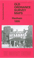
Hexham 1896
Hexham in 1896 in a fascinating series of reproductions of old Ordnance Survey plans in the Alan Godfrey Editions, ideal for anyone interested in the history of their neighbourhood or family. Selected towns in Great Britain and Ireland are covered by maps showing the extent of urban development in the last decades of the 19th and early 20th century.In this title: the map covers most of the historic town of Hexham. Features include St Andrew's church, Abbey remains, Gilesgate, Beaumont Street, Battle Hill, Cattle Market, Priestpopple, Hencotes, Market Street, Fore Street, part of station (at margin of map), St Wilfred's, Hexham Iron Works, Whetstone Bridge, The Seal, Cockshaw, Tynedale Hydropathic, Woodley Field, Causey Hill, reservoir, Leazes Nurseries, Hextol Terrace
and much more. On the reverse is an 1890 commercial directory for Hexham.About the Alan Godfrey Editions of the 25
and much more. On the reverse is an 1890 commercial directory for Hexham.About the Alan Godfrey Editions of the 25
Product Description
Reviews/Comments
Add New
Intelligent Comparison
Archived Product
Hexham 1896 Stanfords
£3.50
Vouchers
No voucher codes found.
Do you know a voucher code for this product or supplier? Add it to Insights for others to use.
Do you know a voucher code for this product or supplier? Add it to Insights for others to use.
 Denmark