
 United Kingdom
 France
 Germany
 Netherlands
 Sweden
 USA
USA
 Italy
Italy
 Spain
Spain
More From Contributor


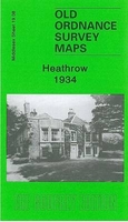
Heathrow 1934
Heathrow in 1934 in a fascinating series of reproductions of old Ordnance Survey plans in the Alan Godfrey Editions, ideal for anyone interested in the history of their neighbourhood or family. The map covers an area in which scarcely a single feature remains traceable today. Author of the notes accompanying the map, Tony Painter, comments that in 1934 the picture, with its farmsteads, had changed little since the Middle Ages. But by 1936 plans were afoot to develop a civil airfield on the Fairey site nearby. Heathrow Airport was duly opened in 1946 ”with limited and primitive facilities”. Features on the map include Heathrow Farm, Perrott`s Farm, Cain`s Farm, Heathrow Hall, Perry Oaks and some orchards. On the reverse is part of the adjacent sheet 19.07, covering Perry Oaks
Sludge Disposal Works, now replaced by Terminal 5. A directory of the hamlet of Heathrow is included, with just 9 entries.About the Alan Godfrey Editions of the 25” OS Series:Selected towns in Great Britain and Ireland are covered by maps showing the extent of urban development in the last decades of the 19th and early 20th century. The plans have been taken from the Ordnance Survey mapping and reprinted at about 15 inches to one mile (1:4, 340). On the reverse most maps have historical notes and many also include extracts from contemporary directories. Most maps cover about one mile (1.6kms) north/south, one and a half miles (2.4kms) across; adjoining sheets can be combined to provide wider coverage.FOR MORE INFORMATION AND A COMPLETE LIST OF ALL AVAILABLE TITLES PLEASE CLICK ON THE
SERIES LINK.

Product Description
Reviews/Comments
Add New
Vouchers
No voucher codes found.
Do you know a voucher code for this product or supplier? Add it to Insights for others to use.
Do you know a voucher code for this product or supplier? Add it to Insights for others to use.
 Denmark