
 United Kingdom
 France
 Germany
 Netherlands
 Sweden
 USA
USA
 Italy
Italy
 Spain
Spain
More From Contributor


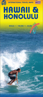
Hawaii & Honolulu ITMB
Hawaiian Islands on a double-sided map from ITMB, printed on light, waterproof and tear-resistant plastic paper. Altitude colouring shows the terrain and several street plans are included. The map presents the islands on separate panels and at scales appropriate to their size. On one side are the Big Island (1:300, 000) plus Oahu (1:120, 000) with a large street plan of Honolulu (1:35, 000) which extends out to the Waikiki Beach area and the Diamond Head Crater, and on the other side of the downtown districts to Pearl City to include Pearl Harbour with the WWII monuments.On the reverse Maui, Molokai, Lanai and Kahoolawe are shown together at 1:150, 000 with Kauai and Nihau on separate panels but at the same scale. Street plans at various scales present on Maui the areas of Wailuku -
Kahului, Kapalua - Lahaina and Kihei - Wailea; on Molokai the town of Kaunakakai: Lanai City; and on Kauai, Lihue and the Poipu - Koloa area.Maps of the islands have bright altitude colouring with contours at 500 feet. National parks and other protected areas are highlighted. The maps show the islands’ road network including selected 4WD tracks and paths. Symbols highlight various places of interest including campgrounds, beaches, diving/snorkelling/surfing sites, view points, hot springs, historic sites, etc. Latitude and longitude lines are drawn at 0.10° intervals. Each panel has a separate index. Street plans indicate selected hotels, notable buildings and various places of interest. None of the plans are indexed.To see other regional titles from ITMB covering USA please
click on the series link.

Product Description
Reviews/Comments
Add New
Vouchers
No voucher codes found.
Do you know a voucher code for this product or supplier? Add it to Insights for others to use.
Do you know a voucher code for this product or supplier? Add it to Insights for others to use.
 Denmark