More From Contributor
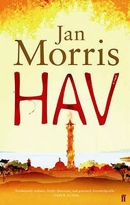
£12.99
Topographic survey of France at 1:25, 000 in IGN`s excellent TOP25 / Série Bleue series. All the maps are GPS compatible, with a 1km UTM grid plus latitude & longitude lines at 5’ intervals. Contours are at 5m intervals except for mountainous areas where the maps have contours at 10m intervals, vividly enhanced by hill shading & graphics for rocky terrain. Colouring with graphics indicates different types of vegetation or land use (deciduous or coniferous forests, moors, orchards, vineyards, etc). PLEASE NOTE: coverage of France at this scale is currently being revised – the format & the presentation of each title are indicated by the letters at the end of its Sheet Reference number (e.g. 0416ET, 3531ETR, 1923SB, etc.)MAPS WITH FULL TOURIST OVERPRINT & AN ENGLISH MAP LEGEND: all TOP25 maps & the SB editions of Série Bleue have an overprint highlighting waymarked walking trails including long-distance GR routes &, where appropriate, ski routes. Symbols indicate campsites, gîtes d’etape, refuges, equestrian centres & other recreational facilities or sites, tourist information centres, cultural heritage, etc. Towns & locations of particular interest are highlighted.- ET or OT = single-sided TOP25 map covering approx. 29x 21 km / 18x 13 miles.- ETR or OTR = waterproof & tear resistant TOP25 map covering the same area as the corresponding ET or OT number, but double-sided, printed on a smaller size sheet with a good overlap between the sides.- SB = Série Bleue map with full tourist overprint; these maps, first introduced in summer 2014, each cover approx. 29x 24km / 18x 15 miles.SÉRIE BLEUE maps with numbers ending in E (Est) or O (Ouest): most editions now indicate the GR routes, but do not show any other tourist information. Map legend is in French only. Each map covers approx. 14x 20km / 9x 12 miles. ...
Archived Product
£11.50
Topographic survey of France at 1:25, 000 in IGN`s excellent TOP25 / Série Bleue series. All the maps are GPS compatible, with a 1km UTM grid plus latitude & longitude lines at 5’ intervals. Contours are at 5m intervals except for mountainous areas where the maps have contours at 10m intervals, vividly enhanced by hill shading & graphics for rocky terrain. Colouring with graphics indicates different types of vegetation or land use (deciduous or coniferous forests, moors, orchards, vineyards, etc). PLEASE NOTE: coverage of France at this scale is currently being revised – the format & the presentation of each title are indicated by the letters at the end of its Sheet Reference number (e.g. 0416ET, 3531ETR, 1923SB, etc.)MAPS WITH FULL TOURIST OVERPRINT & AN ENGLISH MAP LEGEND: all TOP25 maps & the SB editions of Série Bleue have an overprint highlighting waymarked walking trails including long-distance GR routes &, where appropriate, ski routes. Symbols indicate campsites, gîtes d’etape, refuges, equestrian centres & other recreational facilities or sites, tourist information centres, cultural heritage, etc. Towns & locations of particular interest are highlighted.- ET or OT = single-sided TOP25 map covering approx. 29x 21 km / 18x 13 miles.- ETR or OTR = waterproof & tear resistant TOP25 map covering the same area as the corresponding ET or OT number, but double-sided, printed on a smaller size sheet with a good overlap between the sides.- SB = Série Bleue map with full tourist overprint; these maps, first introduced in summer 2014, each cover approx. 29x 24km / 18x 15 miles.SÉRIE BLEUE maps with numbers ending in E (Est) or O (Ouest): most editions now indicate the GR routes, but do not show any other tourist information. Map legend is in French only. Each map covers approx. 14x 20km / 9x 12 miles. ...
Archived Product
£5.99
Hautes-Pyrénées & Pyrénées Atlantiques départments of France at 1:150, 000 in Michelin’s Local Series, with highlighting for scenic routes, an index, a special panel with best sights & recommended driving tours, & street plans of Pau, Lourdes, Biarritz – Anglet
- Bayonne & Tarbes. Coverage extends from the Atlantic coast along the Pyrenees to Bagnères-de-Luchon to include the highest part of the mountains around Gavarnie & the Pyrenees National Park, & northwards to just short of Dax. PLEASE NOTE: our coverage image, provided by the publishers, does not take into account which areas along the edge of the map are blocked by the index & the additional features. Maps in Michelin’s Local Series of France have the same cartography (road network & place names shown on the maps) as the publishers’ Regional Series at 1;200, 000 but enlarged here to 1:150, 000 to provide greater clarity & larger, easier to read print size. Road network is presented in great detail, indicating width, motorway services & rest areas, dangerous or restricted entry roads, steep gradients, height & weight restrictions, etc. Scenic sections are highlighted. The maps also show selected cycle paths & nature trails. Railway lines are shown with stations & local airports are marked. Symbols indicate various places of interest, with additional star rating for best sights, based on the publishers’ Green Guides for French regions. Satellite-derived base with colouring for the forested areas & boundaries of national or regional parks shows the topography. In the mountainous regions the maps have bold, very effective relief shading, with a large number of names of peaks, passes, & other topographic features. The maps have latitude & longitude lines at 10’ intervals & are indexed. Map legend

Includes::
English. Each title in addition

Includes::
a panel showing the area’s principal roads & places of interest, plus recommendations for sightseeing tours. Also provided are town centre maps of main cities, indicating principal traffic arteries, one way streets & places of interest. Only selected streets are named & listed in the accompanying index. Please click on the series link to see all the titles in this series.


...
Archived Product
£9.95
Double-sided, contoured map with trails & locations for outdoor activities. Extensive overprint highlights local & long-distance hiking paths, mountain bike routes, numerous sport & recreational facilities from equestrian centres & ski areas to paragliding schools & climbing walls, tourist offices, places of interest, various types of accommodation, etc. Map legend

Includes::
English. This title is part of a series of maps for hiking, cycling & other outdoor pursuits published by the IGN in cooperation with local authorities, ramblers' associations, cycling clubs, etc. The maps are designed to provide information on places of interest, recreational facilities, various types of accommodation, local & long-distance footpaths, bridleways, cycling & mountain bike routes, etc.

...
Archived Product
£11.50
Hauzenberg in a series of GPS compatible recreational editions of the Bavarian topographic survey at 1:25, 000, with waymarked hiking trails & cycling routes, campsites & youth hostels, etc. Coverage

Includes::
Obernzell, Wegscheid, Untergriesbach. Contours used in this map vary between 5 to 20m according to the terrain, with 20m interval predominantly used for hilly areas. Varied colouring show different types of landscape: woods, vineyards, fields etc. Maps in this series feature extensive overprint highlighting local & long-distance footpaths & cycle routes, including King Ludwig Way or different variants of the Way of St James, indicating their waymarking. Symbols highlight different types of accommodation (campsites, youth hostels, refuges, etc), sport & recreational facilities, various places of interest, etc. The maps have a 1-km UTM grid. Map legend & all the text are in German only. To see other titles in this series please click on the series link.

...
Archived Product
£8.50
Large scale street plan of Havana, fully indexed. All roads are shown, with clear distinctions between dual carriageways, through roads, & secondary roads. Railway lines & stations are marked, as are public buildings, forests/parks, & industrial zones. Points of interest such as sporting facilities, historical sites, zoos, commercial centres are displayed, as well as post offices, hospitals, police stations & cemeteries. The map is grid-referenced & fully indexed. ...
Archived Product
£10.39
Havana in the Countries, Regions & Cities series from Rough Guides; comprehensively detailed guidebooks specifically designed for independent travellers & serving a range of worldwide destinations. Widely recognised for their free editorial style, Rough Guide authors are allowed to express their personal opinions on a range of subjects. Although sometimes controversial, this editorial stance allows readers to experience more detailed & personal takes on each destination, a feature often more limited in other guidebooks. Cultural & historical nuances are explored in significant depth throughout the text & descriptions on the ambience of individual settings alongside personal recommendations, particularly in cities, are notably prevalent. Each Rough Guide in the Countries, Regions & Cities series has a similar layout. A ...
Archived Product
£6.99
Havana in the Footprint Focus Guides, which are targeted at cities, regions & countries worldwide that have no, or very limited, coverage from other publishers. Widely recognised for their reliability & independent writing style, Footprint Focus guides all have the same layout. Smaller than their sister Handbooks, the Focus guides are intended to streamline the information contained so that you have more of what you need, without losing Footprint ...
Archived Product
£8.99
Of all the capital cities in the Caribbean, Havana has the reputation for being the most splendid & sumptuous. From strolling along the Malecon & exploring La Habana Vieja (Old Havana), to Museo Ernest Hemingway or the tropical beaches of Playas del Este, this guidebook will help you make the most of your visit to this intriguing city. * Essentials section with indispensable information on getting there & around. * Highlights maps of the region so you know what not to miss. * Comprehensive, up-to-date listings of where to eat, drink & sleep. * Detailed street maps for Havana & its key municipalities. * Slim enough to fit in your pocket Loaded with advice & information on how to get around, this concise Footprint Handbook will help you get the most out of Havana without weighing you down. ...
Archived Product
£9.99
An indexed street plan of the Havana at a scale of 1:12, 000 showing the UNESCO site Old Town & the surrounding districts, which also features an indexed overview map of Central Cuba at a scale of 1:420, 000. The Havana street plan portrays the city’s road & rail network, as well as petrol stations. Some places of accommodation & of visitor interest are shown, particularly in the Old Town & central Havana. A comparably large number of football stadia/fields are dominantly indicated. The map shows the regional road network from expressways main roads to secondary roads & tracks, as well as en-route petrol stations. Rail lines, ferry routes, harbours & airports are located. Also shown is a handful of visitor related sites & beach & water sport sites, as well as reefs & swamps. Some spot heights are given, with colour shading indicating land height. ...
Archived Product

Hav

Hav gives us Jan Morris at her most delightful and most suggestive. The city is a magical place - yet behind its arcane splendours are darker implications. The traditional Roof Race is peculiarly exciting, the waterfront is picturesque, the wistful call of a trumpeter from a distant rampart is wonderfully evocative, and every street corner is haunted by memories of illustrious visitors - Freud, Diaghilev, Marco Polo, Lawrence of Arabia and countless others. But Morris` visit ends in flight when an unidentified enemy arrives to seize control. When Jan Morris returns to Hav, some twenty years later, she finds that her account of her earlier visit is banned - and discovers a place that has rebuilt itself, transformed by a new energy and now dominated by a totemic tower 2000 feet
tall. But as the old Hav was in many ways an allegory of the last century, so the city in its new incarnation offers no less elusive hints, echoes and portents of our twenty-first century world. As a destination it remains as entertaining as ever.
RIP - This product is no longer available on our network. It was last seen on 25.09.2019

This page now acts as a permanent archive for this product. Add more information using the comments box below to ensure it can still be found by future generations.

Use our search facility to see if it is available from an alternative contributor.
  • External links may include paid for promotion
  • Availability: Out Of Stock
  • Supplier: Stanfords
  • SKU: 9780571229840
Availability: In Stock
£7.99

Product Description

Hav gives us Jan Morris at her most delightful & most suggestive. The city is a magical place
- yet behind its arcane splendours are darker implications. The traditional Roof Race is peculiarly exciting, the waterfront is picturesque, the wistful call of a trumpeter from a distant rampart is wonderfully evocative, & every street corner is haunted by memories of illustrious visitors
- Freud, Diaghilev, Marco Polo, Lawrence of Arabia & countless others. But Morris` visit ends in flight when an unidentified enemy arrives to seize control. When Jan Morris returns to Hav, some twenty years later, she finds that her account of her earlier visit is banned
- & discovers a place that has rebuilt itself, transformed by a new energy & now dominated by a totemic tower 2000 feet tall. But as the old Hav was in many ways an allegory of the last century, so the city in its new incarnation offers no less elusive hints, echoes & portents of our twenty-first century world. As a destination it remains as entertaining as ever.

Reviews/Comments

Add New

Price History

Vouchers

No voucher codes found.
Do you know a voucher code for this product or supplier? Add it to Insights for others to use.

Facebook

Jargon Buster

Flight - The process of of an object moving through the air
World - A physical grouping, commonly used to describe earth and everything associated with ti
Traditional - Something that has become the same through a period of time and thus repeated.
Traditional - Something that has been around for a while and is repeated regularly.

Supplier Information

Stanfords
Stanfords was established in 1853 and opened their iconic Covent Garden flagship store in 1901. They have become the top retailer of maps, travel books and accessories in the UK and arguably offer the largest selection of maps and travel books worldwide. Famous names such as Captain Robert Falcon Scott, Ranulph Fiennes and Michael Palin have purchased from Stanfords. They now have a shop in Bristol and both stores together with other venues operate a calendar of events including talks, book signings and exhibitions. As a specialist map retailer, the map selection is comprehensive and includes road maps, street maps and walking maps from worldwide destinations, as well as a selection of world atlases and wall maps. Books include travel guides and travel literature. Stanfords also stock globes, from miniatures made of blue marble to magnificent floor-standing globes. The website features a selection of interesting articles on travel topics.
Page Updated: 2023-11-12 20:15:36

Community Generated Product Tags

Oh No! The productWIKI community hasn't generated any tags for this product yet!
Menu