More From Contributor
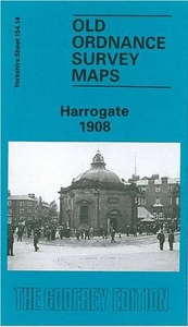
£9.99
Map No. 756, Harriman
- Bear Mountain
- Sterling Forest State Parks, NY at 1:30, 000 in an extensive series of GPS compatible,

...
Archived Product
£12.95
Walking on Harris & Lewis by Richard Barrett features 30 routes of between 4km & 22km on these Outer Hebrides islands, which are viewed by many as one of the last remaining refuges for walkers looking for spectacular yet non-tourist trail locations. There are few mapped footpaths on the islands, but Cicerone’s Walking on Harris & Lewis offers full route descriptions which, with a relevant map, should provide the walker with as much information as needed to undertake full days in the high hills & wilderness areas, as well as shorter, lower level walks visiting heritage sites & antiquities. Frequent notes are provided on local history, geology & wildlife & the routes are all illustrated on Ordnance Survey map extracts & accompanied by inspiring colour photography. The guidebook introduces the walker the tidal islands & deserted villages, & guides into areas of wilderness visited only by the Golden Eagle & the mountain hare. On the Isle of Harris routes include a high-level horseshoe around An Cliseam, the three summits of Stulabhal, Tèileasbhal & Uisgneabhal Mòr, & Tiorga Mòr. On the Isle of Lewis there are half-day circular walks around the famous stone circles of Calanais & the Butt of Lewis lighthouse, along with routes in the Uig Hills including Mealaisbhal, Cracabhal & Laibheal a Tuath. Walking on Harris & Lewis it is an ideal companion for an island adventure & the perfect escape. ...
Archived Product
£25.00
The unique, the unusual, the rare
- these are the features that form the criteria for selection in Brian Harris`s wonderful guide
...
Archived Product
£10.00
If you ever wondered what Jane Austen`s Mr Darcy & his fellows got up to on their numerous trips to London, here is the book they would certainly have carried around.. .HARRIS`S LIST OF COVENT GARDEN LADIES was a bestseller in the Eighteenth Century, shifting 250, 000 copoies in an age before mass consumerism. A `guide book` published annually at Christmas, it detailed the names, attributes & `specialities` of the capital`s prostitutes. During its heyday (1759 -95) HARRIS`S LIST was the essential accessory for any serious gentleman of pleasure. Hallie Rubenhold has collected the funniest, rudest & most bizarre entries penned by Jack Harris, Pimp-General-of-all-Engl&, into this fascinating & mischievous collection. ...
Archived Product
£5.99
Harrogate & Surrounding Area in the Landmark Visitor Guides series, exploring a range of places in Britain, Europe & the Caribbean, with a particular expertise in UK destinations. Each guide presents the reader with detailed, wide-ranging & accessible overview of the region or area, with a particular focus on history & culture, notable local attractions, the landscape, local events & family activities. A series of recommended walks & guided car tours exploring the region are also included in each title. The guides are arranged geographically by region & are ideal both for short & longer breaks, with practical guidance on recommended routes & tourist attractions, in addition to insightful inset boxes into local history, culture & traditions. Information on accommodation, restaurants & day-to-day information are more limited, though a compact Directory at the end of each guide provides basic listings of recommended accommodation & restaurants, as well as tourist information contacts & regional event calendars. International destinations also carry climate & country facts, basic phrases & other general travel practical guidance for travelling to the region. The British titles in the Landmark Visitor Guides series are highly recommended, covering titles that are rarely available from other publishers. ...
Archived Product
£4.95
Harrogate, Knaresborough, Ripon, Thirsk & Wetherby Street Atlas from the Geographers` A-Z Map Company in a paperback format slightly smaller than A5. Map scale is 1:15, 840 (4” to a mile), with an enlargement showing the town centre of Harrogate in greater detail at 1:7, 920 (8” to 1 mile). Coverage

Includes::
Boroughbridge, Kirby Hill & Spofforth. Current edition of this title was published in 2012. To see other titles in this series of A-Z street atlases of towns & cities please click on the series link. A-Z also publish a series of County Street Atlases
- for a list of titles in that series please search for SI00000917.A-Z street atlases present motorways plus A & B roads highlighted by colouring & shown with route numbers. One way or restricted access streets & car parks are marked, as are in more recently published titles locations of speed cameras. Also shown are selected cycleway routes. Where appropriate, A & B roads are annotated with selected house numbers for easier identification of addresses. Railway lines are shown with stations & level crossings. Colouring indicates different types of buildings: educational, hospitals & healthcare, industrial, leisure & recreational, shopping centres & markets, public buildings, & places of interest. Symbols mark locations of facilities usually indicated on street mapping: post offices, emergency services, public toilets, etc. Also marked are postcode & local authority boundaries. Each page has the lines & coordinates of the British National Grid. The indexes list streets, places & areas, hospitals, industrial estates, blocks of flats on housing estates, railway stations, & selected places o interest; the latter are printed in contrasting colouring to make them easier to find.


...
Archived Product
£4.95
Harrow & Wembley Street Atlas at 1:15, 840 (4 to 1 mile) in a series of A5, paperback street atlases from Geographers A-Z Map Company. Coverage

Includes::
Edgware, Neasden, Northolt, Northwood, Pinner, Ruislip, South Oxhey, Stanmore & Wealdstone. Current edition of this title was published in 2013.A-Z

...
Archived Product
£15.95
Harrow is famous for its public school, & St Mary`s church perched on the top of the Hill & at one time visible from the streets of London. The school`s dominance prevented development on the Hill itself, so that much of Harrow`s later history occurred in the hamlets around, such as Roxeth, Sudbury & Wealdstone. ...
Archived Product
£12.99
The London Borough of Harrow has seen dramatic changes over the decades, moving gradually away from its countrified roots to become a bustling & diverse urban centre. Local historian Don Walter`s view that ` Harrow is not the place it was` is evident in this selection of archive images of Harrow`s streets over the last century, but modern Harrow has changed both a huge amount & surprisingly little over the last 100 years, due both to population growth & the clever actions of far-sighted town administrators of decades past. Placing these archive images alongside beautiful modern photography of the same views today & fascinating informative captions, ” Harrow Then & Now” takes us on a tour of the changing face of this historic area, from the modern central streets to the beautifully preserved historic school in Harrow on the Hill. ...
Archived Product
£3.50
Harrow Weald & Hatch End in 1935 in a fascinating series of reproductions of old Ordnance Survey plans in the Alan Godfrey Editions, ideal for anyone interested in the history of their neighbourhood or family. The map covers an area from Hatch End, in the south-western corner, eastward to Clamp Hill & northward to Old Redding. Features include the area called The City, Hatch End station, Royston Park, Clonard, Harrow Weald Park, Belgrano, All Saints church, Harrow Weald Lodge, Grim`s Dyke house, Grimswood, etc. On the reverse are directories of Harrow Weald for 1890 & 1933. About the Alan Godfrey Editions of the 25” OS Series: Selected towns in Great Britain & Ireland are covered by maps showing the extent of urban development in the last decades of the 19th & early 20th century. The plans have been taken from the Ordnance Survey mapping & reprinted at about 15 inches to one mile (1:4, 340). On the reverse most maps have historical notes & many also include extracts from contemporary directories. Most maps cover about one mile (1.6kms) north/south, one & a half miles (2.4kms) across; adjoining sheets can be combined to provide wider coverage.FOR MORE INFORMATION & A COMPLETE LIST OF ALL AVAILABLE TITLES PLEASE CLICK ON THE SERIES LINK. ...
Archived Product

Harrogate 1908

Harrogate in 1908 in a fascinating series of reproductions of old Ordnance Survey plans in the Alan Godfrey Editions, ideal for anyone interested in the history of their neighbourhood or family. SCoverage stretches from Valley Gardens eastward to Silker Fields and Hurstleigh Terrace, and from Mayfield Terrace southward to Trinity church. Features include the town centre with railway station, Cheltenham Crescent, Parliament Street, The Stray or Two Hundred Acre, Harlow Manor Hydro (bottom left corner), Grand Hotel, Bogs Field, Low Harrogate, White Hart Hotel, Royal Baths, Harrogate Hydro, Cairn Hydro, Ladies College, Kursaal, Hotel Majestic, Crescent Gardens, Victoria Avenue, High Harrogate, Oatlands, Christ Church, Church Square, South Park, etc. Extracts from a
contemporary street directory are on the reverse, including Cambridge Street, Cheltenham Road, Montpelier Parade and Station Parade.About the Alan Godfrey Editions of the 25” OS Series:Selected towns in Great Britain and Ireland are covered by maps showing the extent of urban development in the last decades of the 19th and early 20th century. The plans have been taken from the Ordnance Survey mapping and reprinted at about 15 inches to one mile (1:4, 340). On the reverse most maps have historical notes and many also include extracts from contemporary directories. Most maps cover about one mile (1.6kms) north/south, one and a half miles (2.4kms) across; adjoining sheets can be combined to provide wider coverage.FOR MORE INFORMATION AND A COMPLETE LIST OF ALL AVAILABLE TITLES PLEASE
CLICK ON THE SERIES LINK.
RIP - This product is no longer available on our network. It was last seen on 25.09.2019

This page now acts as a permanent archive for this product. Add more information using the comments box below to ensure it can still be found by future generations.

Use our search facility to see if it is available from an alternative contributor.
  • External links may include paid for promotion
  • Availability: Out Of Stock
  • Supplier: Stanfords
  • SKU: 9780850543162
Availability: In Stock
£3.50

Product Description

Harrogate in 1908 in a fascinating series of reproductions of old Ordnance Survey plans in the Alan Godfrey Editions, ideal for anyone interested in the history of their neighbourhood or family. SCoverage stretches from Valley Gardens eastward to Silker Fields & Hurstleigh Terrace, & from Mayfield Terrace southward to Trinity church. Features include the town centre with railway station, Cheltenham Crescent, Parliament Street, The Stray or Two Hundred Acre, Harlow Manor Hydro (bottom left corner), Grand Hotel, Bogs Field, Low Harrogate, White Hart Hotel, Royal Baths, Harrogate Hydro, Cairn Hydro, Ladies College, Kursaal, Hotel Majestic, Crescent Gardens, Victoria Avenue, High Harrogate, Oatlands, Christ Church, Church Square, South Park, etc. Extracts from a contemporary street directory are on the reverse, including Cambridge Street, Cheltenham Road, Montpelier Parade & Station Parade. About the Alan Godfrey Editions of the 25” OS Series: Selected towns in Great Britain & Ireland are covered by maps showing the extent of urban development in the last decades of the 19th & early 20th century. The plans have been taken from the Ordnance Survey mapping & reprinted at about 15 inches to one mile (1:4, 340). On the reverse most maps have historical notes & many also include extracts from contemporary directories. Most maps cover about one mile (1.6kms) north/south, one & a half miles (2.4kms) across; adjoining sheets can be combined to provide wider coverage.FOR MORE INFORMATION & A COMPLETE LIST OF ALL AVAILABLE TITLES PLEASE CLICK ON THE SERIES LINK.

Reviews/Comments

Add New

Intelligent Comparison

Oooops!
We couldn't find anything!
Perhaps this product's unique.... Or perhaps we are still looking for comparisons!
Click to bump this page and we'll hurry up.

Price History

Vouchers

No voucher codes found.
Do you know a voucher code for this product or supplier? Add it to Insights for others to use.

Facebook

Jargon Buster

Contemporary - Modern era design
Contemporary - A design reference to indicate post war modern design
White - A colour combining all colours
Hotel - An establishment which provides lodging for a fee
History - Anything that happens in the past. An acedemic subject.
Road - a manmade lane or a path that is used to speed up travel.
Contemporary - An object that is living in the same time.
Ideal - Something that satisfies a perfect criteria.
Family - A group of people that live together made up from parents and children.

Supplier Information

Stanfords
Stanfords was established in 1853 and opened their iconic Covent Garden flagship store in 1901. They have become the top retailer of maps, travel books and accessories in the UK and arguably offer the largest selection of maps and travel books worldwide. Famous names such as Captain Robert Falcon Scott, Ranulph Fiennes and Michael Palin have purchased from Stanfords. They now have a shop in Bristol and both stores together with other venues operate a calendar of events including talks, book signings and exhibitions. As a specialist map retailer, the map selection is comprehensive and includes road maps, street maps and walking maps from worldwide destinations, as well as a selection of world atlases and wall maps. Books include travel guides and travel literature. Stanfords also stock globes, from miniatures made of blue marble to magnificent floor-standing globes. The website features a selection of interesting articles on travel topics.
Page Updated: 2023-11-12 20:15:36

Community Generated Product Tags

Oh No! The productWIKI community hasn't generated any tags for this product yet!
Menu