
 United Kingdom
 France
 Germany
 Netherlands
 Sweden
 USA
USA
 Italy
Italy
 Spain
Spain
More From Contributor
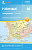


Haltwhistle And Brampton
Map No. 86, Haltwhistle and Brampton, in the Ordnance Survey Landranger series at 1:50, 000, including Bewcastle, Hethersgill, Kirkcambeck, Gilsland, Stonehaugh, Greenhead, Henshaw, Low Row, Haydon Bridge, Catton, Lambley, Castle Carrock, Warwick Bridge, Wetheral, Cotehill, Newbiggin, Armathwaite, High Hesket, Kirkoswald, Croglin, Renwick, Garrigill, Nenthead, Alston, Carrshield, Allendale Town and Slaggyford, with the Northumberland National Park, Wark Forest, Haughton Common, Chamot Hill, plus the Pennine Way and Hadrian
Product Description
Reviews/Comments
Add New
Intelligent Comparison
Archived Product

Haltwhistle And Brampton 1925 Stanfords
£9.99
Archived Product
Haltwhistle And Brampton 1866-1869 Stanfords
£9.99
Archived Product

Haltwhistle And Brampton 1901-1904 Stanfords
£9.99
Archived Product
Haltwhistle And Brampton WATERPROOF Stanfords
£10.39
Archived Product
Haltwhistle And Brampton OS ACTIVE Map Stanfords
£9.09
Vouchers
No voucher codes found.
Do you know a voucher code for this product or supplier? Add it to Insights for others to use.
Do you know a voucher code for this product or supplier? Add it to Insights for others to use.
 Denmark