
 United Kingdom
 France
 Germany
 Netherlands
 Sweden
 USA
USA
 Italy
Italy
 Spain
Spain
More From Contributor


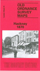
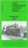

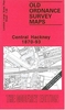

Hackney 1870
Hackney in 1870 in a fascinating series of reproductions of old Ordnance Survey plans in the Alan Godfrey Editions, ideal for anyone interested in the history of their neighbourhood or family. Selected towns in Great Britain and Ireland are covered by maps showing the extent of urban development in the last decades of the 19th and early 20th century.In this title: three versions of this map have been published to show how the area developed across the years. The maps each cover the same area, stretching from Mare Street eastward to White Post Lane, and from Tresham Avenue and Ashenden Road southward to Victoria Park Road. Features include much of Victoria Park, Hackney Cut Navigation, Hertford Union Canal, Hackney Common, Well Street, Wick Road, Hackney Wick, South Hackney,
Homerton; Victoria Park, Homerton and Hackney stations; City of London Union Workhouse (later Institution), Hackney Workhouse, Eastern Fever Hospital, chemical works and factories at the east edge of map, St Thomas's Square, St John of Jerusalem church, St John's church, French Hospital, site of Rowe Chapel, Town Hall, Old Town Hall. The 1870 map is especially attractive, notably portraying South Hackney with its leafy gardens.About the Alan Godfrey Editions of the 25
Homerton; Victoria Park, Homerton and Hackney stations; City of London Union Workhouse (later Institution), Hackney Workhouse, Eastern Fever Hospital, chemical works and factories at the east edge of map, St Thomas's Square, St John of Jerusalem church, St John's church, French Hospital, site of Rowe Chapel, Town Hall, Old Town Hall. The 1870 map is especially attractive, notably portraying South Hackney with its leafy gardens.About the Alan Godfrey Editions of the 25
Product Description
Reviews/Comments
Add New
Vouchers
No voucher codes found.
Do you know a voucher code for this product or supplier? Add it to Insights for others to use.
Do you know a voucher code for this product or supplier? Add it to Insights for others to use.
 Denmark