
 United Kingdom
 France
 Germany
 Netherlands
 Sweden
 USA
USA
 Italy
Italy
 Spain
Spain
More From Contributor


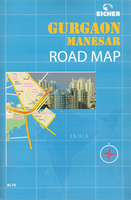
Gurgaon And Manesar
Index street plan of Gurgaon, a rapidly expanding satellite town of Delhi and regarded as the country’s call centre capital, with coverage extending to include Masenar, plus a road map of the city’s environs including the National Capital Territory of Delhi.On one side is a street plan of Gurgaon with Masenar, highlighting main traffic arteries and naming sectors and colonies. Symbols highlight various services and facilities including hotels, restaurants, petrol stations, etc, as well as indicate locations many businesses. The city centre is shown on an enlargement in greater detail. The index on the reverse side lists streets, sectors, gardens and parks, hotels, restaurants, railway stations, shopping and commercial centres, etc. Also provided is a road map of the
surrounding area showing road and rail access to Delhi and the capital’s international airport.The accompanied booklet provides descriptions of the city and its history. Map legend and all the text are in English.
surrounding area showing road and rail access to Delhi and the capital’s international airport.The accompanied booklet provides descriptions of the city and its history. Map legend and all the text are in English.

Product Description
Reviews/Comments
Add New
Vouchers
No voucher codes found.
Do you know a voucher code for this product or supplier? Add it to Insights for others to use.
Do you know a voucher code for this product or supplier? Add it to Insights for others to use.
 Denmark