More From Contributor
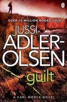
£8.99
Guildford & Godalming in the Cassini Past & Present map series which covers town & cities of England & Wales & offers a unique way of tracing their history & expansion by showing four different periods of their development using Ordnance Survey mapping from the mid-19th century, the late 19th century, the 1920s & the present day. Coverage

Includes::
Bramley, Cranleigh, East Clandon, Hascombe, Milford Puttenham, Shalford, Shamley Green, Wonersh & Worplesdon. Each Past & Present map consists of four panels, all centred on a city or a town & covering exactly the same 15km x 15km area. Three of the panels reproduce Ordnance Survey

...
Archived Product
£7.99
Guildford, Farnham & The North Downs area at 1:25, 000 in a series of Walker’s Maps published by the AA with the cartography from the Ordnance Survey’s Explorer series. The map is double-sided & coverage

Includes::
Leatherhead, Effingham, Farnborough, Fleet, Pirbright, Dorking, Horsham, Rudgwick, Ockley, Alfold, Haslemere, Fernhurst, Liphook, Frensham, etc. Maps in the AA Walker’s series are identical to the OS Explorer maps & provide plenty of recreational & tourist information, indicating in England & Wales the traditional public rights of way paths, including bridleways & byways restricted or open to motorized traffic. Also shown are other routes with public access, including permissive footpaths & bridleways. For Scotl&, where different access rights apply, the maps provide an additional note explaining the regulations. Special marking indicates National Trails & Recreational Routes & for cyclists the maps show traffic-free routes & the National Cycle Network. A wide range of symbols highlights locations of special tourist interest: camping & caravanning sites, youth hostels, information offices & visitors’ centres, parking & picnicking places, historic buildings (indicating where appropriate National Trust, English Heritage, Historic Scotland or Cadw), sites for various recreational pursuits, country pubs, public toilets, etc. The maps provide detailed presentation of the topography with contours at 5 or 10m intervals, numerous spot heights & colouring and/or graphics for different types of vegetation. Additional colouring shows access l&, including areas managed by the National Trust, Forestry Commission & Woodland Trust. All the standard information expected of high quality survey mapping at this scale is included: finely graded road network, railway lines with stations, cuttings or embankments, individual isolated buildings, etc. For GPS users the British National Grid is drawn at 1km intervals.

...
Archived Product
£4.50
A new edition in the AA's ground breaking series of street atlases, covering Guildford in a handy glovebox size. With an enlarged scale for city / town centres, this really is Britain's clearest street mapping. The atlas uses the latest digital data for Britain from Ordnance Survey & the AA & also

Includes::
National Grid Referencing as used by the emergency services. All of the maps clearly show recommended restaurants, hotels, one-way streets & car parks with 24-hour petrol stations now highlighted. Featuring a clever use of colour to ensure they can be read under street lighting, these maps are all you need to keep you on the move.

...
Archived Product
£12.99
Topographic survey of France at 1:25, 000 in IGN`s excellent TOP25 / Série Bleue series. All the maps are GPS compatible, with a 1km UTM grid plus latitude & longitude lines at 5’ intervals. Contours are at 5m intervals except for mountainous areas where the maps have contours at 10m intervals, vividly enhanced by hill shading & graphics for rocky terrain. Colouring with graphics indicates different types of vegetation or land use (deciduous or coniferous forests, moors, orchards, vineyards, etc). PLEASE NOTE: coverage of France at this scale is currently being revised – the format & the presentation of each title are indicated by the letters at the end of its Sheet Reference number (e.g. 0416ET, 3531ETR, 1923SB, etc.)MAPS WITH FULL TOURIST OVERPRINT & AN ENGLISH MAP LEGEND: all TOP25 maps & the SB editions of Série Bleue have an overprint highlighting waymarked walking trails including long-distance GR routes &, where appropriate, ski routes. Symbols indicate campsites, gîtes d’etape, refuges, equestrian centres & other recreational facilities or sites, tourist information centres, cultural heritage, etc. Towns & locations of particular interest are highlighted.- ET or OT = single-sided TOP25 map covering approx. 29x 21 km / 18x 13 miles.- ETR or OTR = waterproof & tear resistant TOP25 map covering the same area as the corresponding ET or OT number, but double-sided, printed on a smaller size sheet with a good overlap between the sides.- SB = Série Bleue map with full tourist overprint; these maps, first introduced in summer 2014, each cover approx. 29x 24km / 18x 15 miles.SÉRIE BLEUE maps with numbers ending in E (Est) or O (Ouest): most editions now indicate the GR routes, but do not show any other tourist information. Map legend is in French only. Each map covers approx. 14x 20km / 9x 12 miles. ...
Archived Product
£18.99
Topographic survey of France at 1:25, 000 in IGN`s excellent TOP25 / Série Bleue series. All the maps are GPS compatible, with a 1km UTM grid plus latitude & longitude lines at 5’ intervals. Contours are at 5m intervals except for mountainous areas where the maps have contours at 10m intervals, vividly enhanced by hill shading & graphics for rocky terrain. Colouring with graphics indicates different types of vegetation or land use (deciduous or coniferous forests, moors, orchards, vineyards, etc). PLEASE NOTE: coverage of France at this scale is currently being revised – the format & the presentation of each title are indicated by the letters at the end of its Sheet Reference number (e.g. 0416ET, 3531ETR, 1923SB, etc.)MAPS WITH FULL TOURIST OVERPRINT & AN ENGLISH MAP LEGEND: all TOP25 maps & the SB editions of Série Bleue have an overprint highlighting waymarked walking trails including long-distance GR routes &, where appropriate, ski routes. Symbols indicate campsites, gîtes d’etape, refuges, equestrian centres & other recreational facilities or sites, tourist information centres, cultural heritage, etc. Towns & locations of particular interest are highlighted.- ET or OT = single-sided TOP25 map covering approx. 29x 21 km / 18x 13 miles.- ETR or OTR = waterproof & tear resistant TOP25 map covering the same area as the corresponding ET or OT number, but double-sided, printed on a smaller size sheet with a good overlap between the sides.- SB = Série Bleue map with full tourist overprint; these maps, first introduced in summer 2014, each cover approx. 29x 24km / 18x 15 miles.SÉRIE BLEUE maps with numbers ending in E (Est) or O (Ouest): most editions now indicate the GR routes, but do not show any other tourist information. Map legend is in French only. Each map covers approx. 14x 20km / 9x 12 miles. ...
Archived Product
£10.99
` Life for De Quincey was either angels ascending on vaults of cloud or vagrants shivering on the city streets.` Thomas De Quincey
-
...
Archived Product
£6.50
Topographic coverage of the Canary Islands at 1:25, 000 published by the Instituto Geográfico Nacional – Centro Nacional de Información Geografica, the country’s civilian survey organization. The maps have contours at 10m intervals & colouring and/or graphics to show different types of vegetation or land use. Boundaries of national parks & other protected areas are marked. In addition to all the usual information shown on topographic mapping at this scale: detailed presentation of the road network with rural tracks & paths, etc, the maps also show campsites. The maps have a 1-km UTM grid, plus margin ticks for latitude & longitude at 1` intervals. The majority of the titles have been published since late 1990s. Map legend is in Spanish only.COVERAGE: each 25K map covers one quarter of the corresponding 1:50, 000 map, with the numbering system: I = NW quarter, II = NE quarter, III = SW quarter, & IV = SE quarter. To see other titles in this series please click on the series link. ...
Archived Product
£15.95
A detailed, colour survey map from the Portuguese Military Survey's M782 series. Each map in this series has contours at 20m intervals with supplementary contours at 10m intervals. One major advantage the military mapping has over the civilian equivalent is that the legend is in English as well as Portuguese. This legend

Includes::
roads, railways, buildings, spot heights, vegetation type, fluvial information, scree, dunes, churches, ruins, etc. Latitude & longitude ticks are show at 10' intervals. Recently revised sheets also have a UTM grid at 100m intervals. Vertical Datum: Mean Sea Level at Cascais Harbour Projection: Transverse Mercator

...
Archived Product
£17.99
Topographic survey of Portugal at 1:50, 000 from the Instituto Geográfico do Exército, the country’s military survey organisation. The maps have contours at 20m intervals & in addition to the standard features shown on topographic mapping at this scale also indicate various types of terrain or vegetation (s&, terraces, rocks, woodlands, vineyards, etc). Each sheet covers an area of 32 x 20km (20 x 12.5 miles approx). The maps have a 1-km UTM grid plus latitude & longitude coordinates for the map corners. Map legend & a glossary of terms used on the maps include English.EDITION DATES: most titles in this series date from 1990s or later. To see all the titles in this series please click on the series link. ...
Archived Product
£17.99
Topographic survey of Portugal at 1:50, 000 from the Instituto Geográfico Português, the country’s civilian survey organisation. The maps have contours at 25m intervals & in addition to the standard features shown on topographic mapping at this scale also indicate various types of vegetation (vineyards, olive groves, etc). Each sheet covers an area of 32 x 20km (20 x 12.5miles approx). The maps have latitude & longitude margin ticks at 1’ intervals & UTM coordinates for the map corners – each sheet also shows conversion details from BBLx (Bessel-Bonnie system, Datum Lisbon) to UTM. Map legend is in Portuguese only.EDITION DATES: most titles in this series have now been updated in the 1990s or later. To see all the titles in this series please click on the series link. ...
Archived Product

Guilt

Guilt is the fourth novel in Jussi Adler-Olsen`s 10 million copy global bestselling Department Q series. 1987: Nete Hermansen, a young woman brutally assaulted in her youth, sterilised without her consent by a fanatical surgeon, and banished to Sprogo, the island for outcast women is planning her escape and her vengeance. And soon people begin to go missing and no one - certainly not the police - knows why, nor that individual cases are connected. Today: Carl Morck and his assistants Assad and Rose in Department Q are examining old missing persons cases and spot a disturbing pattern from 1987...Following the international No 1 bestsellers Mercy and Disgrace, Guilt is the fourth heart-stopping Department Q novel from Jussi Adler-Olsen, and a gripping treat for all fans of the
Scandinavian crime thriller. Praise for Adler-Olsen: ”The new ”it” boy of Nordic Noir”. (The Times). ”Engrossing”. (Sunday Express). ”Adler-Olsen`s fascination with abnormal psychology once again pays off”. (Sunday Times). Jussi Adler-Olsen was born in Copenhagen and worked as a magazine editor and publisher before starting to write fiction.Mercy and Disgrace are the first two in currently four novels in the Department Q series. He holds the prestigious Glass Key Award, given annually for a crime novel by a Scandinavian author, and is also winner of the Golden Laurels, Denmark`s highest literary accolade.
RIP - This product is no longer available on our network. It was last seen on 25.09.2019

This page now acts as a permanent archive for this product. Add more information using the comments box below to ensure it can still be found by future generations.

Use our search facility to see if it is available from an alternative contributor.
  • External links may include paid for promotion
  • Availability: Out Of Stock
  • Supplier: Stanfords
  • SKU: 9781405909785
Availability: In Stock
£7.99

Product Description

Guilt is the fourth novel in Jussi Adler-Olsen`s 10 million copy global bestselling Department Q series. 1987: Nete Hermansen, a young woman brutally assaulted in her youth, sterilised without her consent by a fanatical surgeon, & banished to Sprogo, the island for outcast women is planning her escape & her vengeance. & soon people begin to go missing & no one
- certainly not the police
- knows why, nor that individual cases are connected. Today: Carl Morck & his assistants Assad & Rose in Department Q are examining old missing persons cases & spot a disturbing pattern from 1987... Following the international No 1 bestsellers Mercy & Disgrace, Guilt is the fourth heart-stopping Department Q novel from Jussi Adler-Olsen, & a gripping treat for all fans of the Scandinavian crime thriller. Praise for Adler-Olsen: ” The new ”it” boy of Nordic Noir”. (The Times). ” Engrossing”. (Sunday Express). ” Adler-Olsen`s fascination with abnormal psychology once again pays off”. (Sunday Times). Jussi Adler-Olsen was born in Copenhagen & worked as a magazine editor & publisher before starting to write fiction. Mercy & Disgrace are the first two in currently four novels in the Department Q series. He holds the prestigious Glass Key Award, given annually for a crime novel by a Scandinavian author, & is also winner of the Golden Laurels, Denmark`s highest literary accolade.

Reviews/Comments

Add New

Intelligent Comparison

Oooops!
We couldn't find anything!
Perhaps this product's unique.... Or perhaps we are still looking for comparisons!
Click to bump this page and we'll hurry up.

Price History

Vouchers

No voucher codes found.
Do you know a voucher code for this product or supplier? Add it to Insights for others to use.

Facebook

Jargon Buster

Rose - Commonly associated with a light pink colour
Rose - A fragrant garden plant
Glass - A solid, typically transparent. Brittle and used in windows. The first patent granted in the UK was for Glass.
police - Persons empowered to reduce civil disorder and enforce the law.
Denmark - A country in Scandinavia, Northern Europe.
Key - A physical or virtual device or code used for opening something
Heart - An organ that pumps blood around the body. Usually related to love.
Treat - A reward, also can be away which someone is dealt with to change behaviour.
Individual - A single separate item or person.

Supplier Information

Stanfords
Stanfords was established in 1853 and opened their iconic Covent Garden flagship store in 1901. They have become the top retailer of maps, travel books and accessories in the UK and arguably offer the largest selection of maps and travel books worldwide. Famous names such as Captain Robert Falcon Scott, Ranulph Fiennes and Michael Palin have purchased from Stanfords. They now have a shop in Bristol and both stores together with other venues operate a calendar of events including talks, book signings and exhibitions. As a specialist map retailer, the map selection is comprehensive and includes road maps, street maps and walking maps from worldwide destinations, as well as a selection of world atlases and wall maps. Books include travel guides and travel literature. Stanfords also stock globes, from miniatures made of blue marble to magnificent floor-standing globes. The website features a selection of interesting articles on travel topics.
Page Updated: 2023-11-12 20:15:36

Community Generated Product Tags

Oh No! The productWIKI community hasn't generated any tags for this product yet!
Menu