More From Contributor

£12.99
Gressoney, map No. 294, in the standard topographic survey of Switzerland at 1:50, 000 from Swisstopo, i.e. without the special overprint highlighting walking trails, local bus stops, etc, presented in Swisstopo’s hiking editions of the 50K survey. The map covers mainly the Italian side of the border, with only a small part of Switzerland shown on it. Highly regarded for their superb use of graphic relief & hill shading, the maps give an almost 3-D picture of Switzerland`s mountainous terrain. Contours are at 20m intervals. All the maps have a 1-km grid with the Swiss national coordinates. This standard version of the 50K survey covers the whole country on 78 small format sheets, with special larger format maps published for several popular tourist destinations. Small format sheets cover an area of 35 x 24 km (21 x 15 miles approx) & have map legend in the language of the area covered by the map. The special larger sheets cover 50 x 35 km (31 x 22 miles approx) & have no map legend, but a separate leaflet can be provided instead.PLEASE NOTE: the hiking editions of the 1:50, 000 Swisstopo survey are listed on our website in a separate series. ...
Archived Product
£8.99
Gretel & the Dark is Eliza Granville`s dazzling novel of darkness, evil
- & hope. It is suitable for fans of Markus Zusak`s The
...
Archived Product
£7.99
Grey Area, like all of Will Self's fiction, is funny, bizarre & disturbing. From a London where every waiter is an aspiring writer to a supply teacher killed by the colossal philistinism of his pupils, this is a truly inimitable showcase of short stories. ...
Archived Product
£6.99
Everything on the Island of Ashes is grey, from the weather to the castle, the grass & the flowers. But then the red boat arrives, & with it a young man who believes he is cursed
- everything he touches turns to colour. Princess Opal & the people of the island are enchanted, but the King is suspicious & imprisons Wendell. Opal must find a way to escape to a life filled with love & colour. High quality cream paper & a special easy to read font ensure a smooth read for all.
...
Archived Product
£6.99
12 year old Mary`s beloved grandmother is near the end of her life. Letting go is hard
- until Granny`s long-dead mammy appears.
...
Archived Product
£12.99
Featuring eight visually-stunning, imminently use-able graph paper designs repeating throughout the book & interspersed with ...
Archived Product
£7.99
In a London flat, two young boys face the unbearable sadness of their mother`s sudden death. Their father, a Ted Hughes scholar & scruffy romantic, imagines a future of well-meaning visitors & emptiness. In this moment of despair they are visited by Crow
- antagonist, trickster, healer, babysitter. This sentimental bird is drawn to the grieving family & threatens to stay until they no longer need him. This extraordinary debut, full of unexpected humour & emotional truth, marks the arrival of a thrilling & significant new talent.
...
Archived Product
£14.99
In this informal guide to Wales, Griff Rhys Jones rediscovers the land of his aunties. Born in Cardiff but raised in Essex, Griff is returning home on a mission to explore the real Wales: the one beyond the tourist trail that exists in the deep beautiful countryside, full of hidden treasures & eccentric characters that makes this country so unique. With help from a hidden h&, Griff is set a number of quests in eight distinct regions that not only test his knowledge of his homeland but his body too, as he climbs, abseils, rides & canoes his way through some truly breathtaking scenery. Join Griff on his journey through Snowdonia, Anglesey, the Gower, mid Wales, Brecon, Pembrokeshire, north Wales & Monmouthshire. Packed with all manners of weird, wonderful & enlightening facts, you'll learn as much about Wales as you do Griff. Is Griff insufficiently welsh? Published to coincide with Griff 's Guide to Wales on ITV1 (national) beginning at 8pm, Monday 6th January. Full colour hardback edition featuring photography from the series. Estimated viewing figure is 5 million. The series will run for eight weeks (30min per episode) & is backed by Visit Wales. ...
Archived Product
£3.50
Griffin`s Hill in 1902 in a fascinating series of reproductions of old Ordnance Survey plans in the Alan Godfrey Editions, ideal for anyone interested in the history of their neighbourhood or family. The map covers the part of Northfield which

Includes::
Griffin`s Hill, largely rural in 1902 but with St Mary`s church, Griffin`s Hill, Woodbrooke Farm, Woodbrooke, Lodge Hill Cemetery, Sellypark Farm, Manor House, Cottage Homes (for King`s Norton Poor Law), Shendley Court Farm, etc. About the Alan Godfrey Editions of the 25” OS Series: Selected towns in Great Britain & Ireland are covered by maps showing the extent of urban development in the last decades of the 19th & early 20th century. The plans have been taken from the Ordnance Survey mapping & reprinted at about 15 inches to one mile (1:4, 340). On the reverse most maps have historical notes & many also include extracts from contemporary directories. Most maps cover about one mile (1.6kms) north/south, one & a half miles (2.4kms) across; adjoining sheets can be combined to provide wider coverage.FOR MORE INFORMATION & A COMPLETE LIST OF ALL AVAILABLE TITLES PLEASE CLICK ON THE SERIES LINK.

...
Archived Product
£3.50
Griffithstown South & Sebastopol in 1917 in a fascinating series of reproductions of old Ordnance Survey plans in the Alan Godfrey Editions, ideal for anyone interested in the history of their neighbourhood or family. The map covers the southern part of Griffithstown, near Pontypool, & is split between Panteg & Llanfrechfa Upper parishes. Coverage stretches from Mary Street, Griffithstown, southward a mile. Pontrhydrun station is just off the map at the south. The main feature is the complex of steelworks, including Panteg Steel Works, Panteg Sheet & Galvanizing Works & Panteg Foundry, including their railway lines & stretches of the GWR Hereford & Newport & Monmouthshire Eastern Valleys Line either side. Other features include station, Sebastopol, Panteg House, Cwrdy Farm, St Oswald`s Mission Church, Monmouthshire & Brecon Canal, Panteg Junction, Penyrheol., etc. On the reverse are directories of Griffithstown & Sebastopol in 1905. About the Alan Godfrey Editions of the 25” OS Series: Selected towns in Great Britain & Ireland are covered by maps showing the extent of urban development in the last decades of the 19th & early 20th century. The plans have been taken from the Ordnance Survey mapping & reprinted at about 15 inches to one mile (1:4, 340). On the reverse most maps have historical notes & many also include extracts from contemporary directories. Most maps cover about one mile (1.6kms) north/south, one & a half miles (2.4kms) across; adjoining sheets can be combined to provide wider coverage.FOR MORE INFORMATION & A COMPLETE LIST OF ALL AVAILABLE TITLES PLEASE CLICK ON THE SERIES LINK. ...
Archived Product

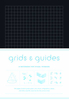
Grids & Guides: A Notebook For Visual Thinkers

A new Grids & Guides ”notebook for visual thinkers.” Like the original, this deluxe, cloth-covered Grids & Guides offers 144 pages of graph paper in eight designs (including two new designs!). Interspersed throughout are eight pages of informational diagrams. Encased in the same cloth-wrapped cover, this time in red.
RIP - This product is no longer available on our network. It was last seen on 25.09.2019

This page now acts as a permanent archive for this product. Add more information using the comments box below to ensure it can still be found by future generations.

Use our search facility to see if it is available from an alternative contributor.
  • External links may include paid for promotion
  • Availability: Out Of Stock
  • Supplier: Stanfords
  • SKU: 9781616894221
Availability: In Stock
£12.99

Product Description

A new Grids & Guides ”notebook for visual thinkers.” Like the original, this deluxe, cloth-covered Grids & Guides offers 144 pages of graph paper in eight designs (including two new designs!). Interspersed throughout are eight pages of informational diagrams. Encased in the same cloth-wrapped cover, this time in red.

Reviews/Comments

Add New

Intelligent Comparison

Oooops!
We couldn't find anything!
Perhaps this product's unique.... Or perhaps we are still looking for comparisons!
Click to bump this page and we'll hurry up.

Price History

Vouchers

No voucher codes found.
Do you know a voucher code for this product or supplier? Add it to Insights for others to use.

Facebook

Jargon Buster

Paper - A thin sheet mainly used for writing. Available in a variety of colours. Made mainly from wood pulp.
Red - One of the three primary colours

Supplier Information

Stanfords
Stanfords was established in 1853 and opened their iconic Covent Garden flagship store in 1901. They have become the top retailer of maps, travel books and accessories in the UK and arguably offer the largest selection of maps and travel books worldwide. Famous names such as Captain Robert Falcon Scott, Ranulph Fiennes and Michael Palin have purchased from Stanfords. They now have a shop in Bristol and both stores together with other venues operate a calendar of events including talks, book signings and exhibitions. As a specialist map retailer, the map selection is comprehensive and includes road maps, street maps and walking maps from worldwide destinations, as well as a selection of world atlases and wall maps. Books include travel guides and travel literature. Stanfords also stock globes, from miniatures made of blue marble to magnificent floor-standing globes. The website features a selection of interesting articles on travel topics.
Page Updated: 2023-11-12 20:15:36

Community Generated Product Tags

Oh No! The productWIKI community hasn't generated any tags for this product yet!
Menu