More From Contributor

£8.99
Greenwich, Gravesend, London’s East End & Docklands area on a detailed topographic & GPS compatible map No. 162, paper version, from the Ordnance Survey’s 1:25, 000 Explorer series. MOBILE DOWNLOADS: this title & all the other OS Explorer maps include a code for downloading after purchase the digital version onto your smartphone or tablet for viewing on the OS smartphone app.OS EXPLORER SERIES: to see the list of all the titles in the OS Explorer series, both paper & waterproof versions, please click on the series link. The Explorer series, Ordnance Survey’s most detailed maps recommended for anyone enjoying outdoor activities, provides topographic coverage of Great Britain at 1:25, 000 on GPS compatible maps with hiking trails, cycling routes & extensive tourist information. Each printed map is available either on paper or as a waterproof & tear-resistant OS Active Map, as indicated in its title. Britain’s National Parks & other areas of particular tourist interest are presented on often double-sided OL (Outdoor Leisure) maps, whilst most standard format Explorers cover an area of 30 x 20km (approx. 19 x 12 miles). All three versions (paper, waterproof & digital) are the same & provide plenty of recreational & tourist information, indicating the traditional public right of way paths (except in Scotland where different laws apply), including bridleways & byways. National Trails & other long-distance paths are marked, as well as permissive footpaths or bridleways & on-road or traffic-free cycle routes with, where appropriate, their National/ Regional Cycle Network numbers. Boundaries of access land are clearly marked. A wide range of symbols provides additional tourist information, highlighting camping & caravanning sites, information offices & visitors’ centres, parking & picnicking places, country pubs, sport & recreational facilities including cycle hire locations & mountain biking trails, historic buildings & museums, etc. Exceptionally clear presentation of the landscape is provided by contours at 5m or in the uplands at 10m intervals, with additional spot heights plus colouring and/or graphics for different types of woodlands, orchards, heath, marshl&, scree or boulders, & other topographic features. For GPS users the maps have British National Grid lines at 1km intervals, with latitude & longitude given by margin ticks at 1`. Clearly laid out map legend

Includes::
French & German translations for the tourist information symbols.

...
Archived Product
£3.50
Greenwich & the Isle of Dogs in 1867 in a fascinating series of reproductions of old Ordnance Survey plans in the Alan Godfrey Editions, ideal for anyone interested in the history of their neighbourhood or family. Three versions have been published for this area, stretching from Deptford Creek eastward to Annandale Road & Selcroft Road, & southward to Vanbrugh House. A portion of Millwall on the Isle of Dogs is also included. Features on the Greenwich side include the Royal Hospital & Royal Naval College, St Alfege`s church, Bridge Street, LCDR railway terminus, Maze Hill station, Greenwich Pier, South Metropolitan Gas Works, Bridge Street, Deptford Dry Dock, Thames Street, workhouse & infirmary, Trinity Hospital almshouses, Trafalgar Road with tramways, Christ Church; & coverage extends north to Enderbys Wharf, Chester Street, Telegraph Works, Thames Soap & Candle Works. On the Isle of Dogs coverage

Includes::
Napier Shipbuilding Yard, southern part of Millwall Dock, Globe Roap Works, Manchester Road, Wharf Road, Greenwich Vehicular Ferry, Dudgeons Wharf, Plymouth Wharf, Millwall Wharf, & much of Cubitt Town. About the Alan Godfrey Editions of the 25” OS Series: Selected towns in Great Britain & Ireland are covered by maps showing the extent of urban development in the last decades of the 19th & early 20th century. The plans have been taken from the Ordnance Survey mapping & reprinted at about 15 inches to one mile (1:4, 340). On the reverse most maps have historical notes & many also include extracts from contemporary directories. Most maps cover about one mile (1.6kms) north/south, one & a half miles (2.4kms) across; adjoining sheets can be combined to provide wider coverage.FOR MORE INFORMATION & A COMPLETE LIST OF ALL AVAILABLE TITLES PLEASE CLICK ON THE SERIES LINK.

...
Archived Product
£3.50
Greenwich & the Isle of Dogs in 1894 in a fascinating series of reproductions of old Ordnance Survey plans in the Alan Godfrey Editions, ideal for anyone interested in the history of their neighbourhood or family. Three versions have been published for this area, stretching from Deptford Creek eastward to Annandale Road & Selcroft Road, & southward to Vanbrugh House. A portion of Millwall on the Isle of Dogs is also included. Features on the Greenwich side include the Royal Hospital & Royal Naval College, St Alfege`s church, Bridge Street, LCDR railway terminus, Maze Hill station, Greenwich Pier, South Metropolitan Gas Works, Bridge Street, Deptford Dry Dock, Thames Street, workhouse & infirmary, Trinity Hospital almshouses, Trafalgar Road with tramways, Christ Church; & coverage extends north to Enderbys Wharf, Chester Street, Telegraph Works, Thames Soap & Candle Works. On the Isle of Dogs coverage

Includes::
Napier Shipbuilding Yard, southern part of Millwall Dock, Globe Roap Works, Manchester Road, Wharf Road, Greenwich Vehicular Ferry, Dudgeons Wharf, Plymouth Wharf, Millwall Wharf, & much of Cubitt Town. About the Alan Godfrey Editions of the 25” OS Series: Selected towns in Great Britain & Ireland are covered by maps showing the extent of urban development in the last decades of the 19th & early 20th century. The plans have been taken from the Ordnance Survey mapping & reprinted at about 15 inches to one mile (1:4, 340). On the reverse most maps have historical notes & many also include extracts from contemporary directories. Most maps cover about one mile (1.6kms) north/south, one & a half miles (2.4kms) across; adjoining sheets can be combined to provide wider coverage.FOR MORE INFORMATION & A COMPLETE LIST OF ALL AVAILABLE TITLES PLEASE CLICK ON THE SERIES LINK.

...
Archived Product
£3.50
Greenwich & the Isle of Dogs in 1913 in a fascinating series of reproductions of old Ordnance Survey plans in the Alan Godfrey Editions, ideal for anyone interested in the history of their neighbourhood or family. Three versions have been published for this area, stretching from Deptford Creek eastward to Annandale Road & Selcroft Road, & southward to Vanbrugh House. A portion of Millwall on the Isle of Dogs is also included. Features on the Greenwich side include the Royal Hospital & Royal Naval College, St Alfege`s church, Bridge Street, LCDR railway terminus, Maze Hill station, Greenwich Pier, South Metropolitan Gas Works, Bridge Street, Deptford Dry Dock, Thames Street, workhouse & infirmary, Trinity Hospital almshouses, Trafalgar Road with tramways, Christ Church; & coverage extends north to Enderbys Wharf, Chester Street, Telegraph Works, Thames Soap & Candle Works. On the Isle of Dogs coverage

Includes::
Napier Shipbuilding Yard, southern part of Millwall Dock, Globe Roap Works, Manchester Road, Wharf Road, Greenwich Vehicular Ferry, Dudgeons Wharf, Plymouth Wharf, Millwall Wharf, & much of Cubitt Town. About the Alan Godfrey Editions of the 25” OS Series: Selected towns in Great Britain & Ireland are covered by maps showing the extent of urban development in the last decades of the 19th & early 20th century. The plans have been taken from the Ordnance Survey mapping & reprinted at about 15 inches to one mile (1:4, 340). On the reverse most maps have historical notes & many also include extracts from contemporary directories. Most maps cover about one mile (1.6kms) north/south, one & a half miles (2.4kms) across; adjoining sheets can be combined to provide wider coverage.FOR MORE INFORMATION & A COMPLETE LIST OF ALL AVAILABLE TITLES PLEASE CLICK ON THE SERIES LINK.

...
Archived Product
£9.99
The Greenwich Meridian Trail is a new long-distance walk from Peacehaven in East Sussex to Sand le Mere in East Yorkshire, following the line of the Prime Meridian. The total length of the trail is 273 miles (439 km). It is divided into four parts, this guidebook covers the first part which takes you through the lovely & varied countryside of southern England & a surprisingly quiet & `green` way through the outskirts of London to Greenwich & the Royal Observatory. The guide uses ordnance survey maps for easy route finding & is full of information about the places you will visit & stay at along the way. Good access by public transport makes it easy to do the walk in sections. ...
Archived Product
£8.99
There is probably not a London suburb with more intense historical connections, more diversity & more astonishing buildings & artefacts than Greenwich. There are sections on MARITIME GREENWICH
- home of the Maritime museum & the CUTTY SARK; ROYAL GREENWICH
- Greenwich Park was Henry VIII`s favourite residence & where he met Anne Boelyn; SCIENTIFIC GREENWICH
- home of the Royal Observatory & GMT & of course The Dome itself... What`s it going to be like compared to similar vast jamborees
- the Great Exhibition of 1851 & the Festival Britain of 1951, what is that strange fabric stretched over those yellow spikes & WHO is going to settle in the 1400-home Millennium Village, to be opened in 2000, with the remains of the old gasworks lying a couple of feet below?


...
Archived Product
£9.99
“ Greenwood Dark” is an inspiring collection of 100 poems, all written between 1999 & 2008; Christopher Somerville has been walking, exploring & writing all over the world for 30 years, & these poems are the fruits of that long experience. Read individually, they are a true traveller`s observations of people, places, moods & reflections as they strike him. As a collection, they take the reader on a vivid, moving & unforgettable adventure through Britain & Irel&, & on out across the wider world. The poet sets his work in context with short prose descriptions of the circumstances in which each poem came to be written. ...
Archived Product
£14.95
This latest edition is aimed specifically at those travellers who not only want independence of movement, but also a measure of reassurance that they will get the best out of their holiday & be well looked after wherever they choose to go from B& Bs, game lodges, farms & guest houses to self catering cottages & uncategorisable others. There is also the useful resource of several maps & directions to the accommodation included within the guide. The Greenwood Guides team spend five months each year researching the best available accommodation & select only those places which excel in character, friendliness & hostly arts. The accommodation recommendations are described by Greenwood Guides, & not by the owners. ...
Archived Product
£9.99
` Don`t judge Australia just by the Australians.` Dame Edna Everadge Welcome to Australia. One of the most far-flung & beautiful destinations in the world. Home to the dreamiest coastlines & cityscapes human beings have ever clapped their eyes on. Home of dags, bingles, snags & sangers, Australia boasts some of the planet`s most exotic, dangerous & unique species of animal & insect &, irrefutably, the most inspiring outback terrain & ocean vistas known to man. It is the country referred to as the land of the plenty, God`s Own Country. & it`s true. It is. But God`s been a bit absent lately. Which is why, now, after all these years, Australia has started to look a little shitty. A little overgrown. A little bit long in the tooth. It is, in short, a country in need of a good hose down.. .and a hug. This is a hilarious collection of photographs of one of the world`s most ridiculous countries at its worst. The photos reveal the eccentricities, bleakness & humour of every nook & cranny of the entire country
- the dry bleak deserts & the over-the-top natives. Shit Australia is a warts-&-all walk around the world`s most crazy country, seen through the eyes of its own locals & Patrick Dalton
- the quintessential Englishman down under. Word count: 3, 000

...
Archived Product
£20.00
John Steinbeck famously christened Route 66 America`s ” Mother Road” in The Grapes of Wrath, & that chapter about Tom Joad`s exodus is just one of the classic pieces collected in this ultimate anthology. Here`s history, roadside attractions, pop culture, ghost stories-even recipes from famous greasy spoons. & it`s all illustrated with the largest collection of vintage art, postcards, travel decals, collectibles, & other memorabilia every amassed. This is a truly a worthy tribute to the Main Street of America. ...
Archived Product

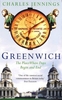
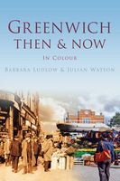
Greenwich Then And Now

The South London district of Greenwich is perhaps most famous for giving its name to Greenwich Mean Time and the Greenwich Meridian, but the area is also a World Heritage Site with many famous landmarks including the National Maritime Museum, the Royal Observatory and the Cutty Sark. This fascinating collection of old photographs, shown alongside today`s equivalent views, show the many fascinating changes which Greenwich has undergone. From the amalgamation of separate communities into the metropolis to the heavy bombing of the Second World War and subsequent redevelopment, Greenwich Then & Now illustrates what Greenwich has lost and what it has gained along the way.
RIP - This product is no longer available on our network. It was last seen on 25.09.2019

This page now acts as a permanent archive for this product. Add more information using the comments box below to ensure it can still be found by future generations.

Use our search facility to see if it is available from an alternative contributor.
  • Availability: Out Of Stock
  • Supplier: Stanfords
  • SKU: 9780752468754
Availability: In Stock
£12.99

Product Description

The South London district of Greenwich is perhaps most famous for giving its name to Greenwich Mean Time & the Greenwich Meridian, but the area is also a World Heritage Site with many famous landmarks including the National Maritime Museum, the Royal Observatory & the Cutty Sark. This fascinating collection of old photographs, shown alongside today`s equivalent views, show the many fascinating changes which Greenwich has undergone. From the amalgamation of separate communities into the metropolis to the heavy bombing of the Second World War & subsequent redevelopment, Greenwich Then & Now illustrates what Greenwich has lost & what it has gained along the way.

Reviews/Comments

Add New

Intelligent Comparison

Oooops!
We couldn't find anything!
Perhaps this product's unique.... Or perhaps we are still looking for comparisons!
Click to bump this page and we'll hurry up.

Price History

Vouchers

No voucher codes found.
Do you know a voucher code for this product or supplier? Add it to Insights for others to use.

Facebook

Jargon Buster

World - A physical grouping, commonly used to describe earth and everything associated with ti
heavy - A concept of weight indicating an item may require some effort to lift or move
Greenwich - A southern borough in London.
Museum - A building which exhibits old artefacts for viewing of people who show interest.

Supplier Information

Stanfords
Stanfords was established in 1853 and opened their iconic Covent Garden flagship store in 1901. They have become the top retailer of maps, travel books and accessories in the UK and arguably offer the largest selection of maps and travel books worldwide. Famous names such as Captain Robert Falcon Scott, Ranulph Fiennes and Michael Palin have purchased from Stanfords. They now have a shop in Bristol and both stores together with other venues operate a calendar of events including talks, book signings and exhibitions. As a specialist map retailer, the map selection is comprehensive and includes road maps, street maps and walking maps from worldwide destinations, as well as a selection of world atlases and wall maps. Books include travel guides and travel literature. Stanfords also stock globes, from miniatures made of blue marble to magnificent floor-standing globes. The website features a selection of interesting articles on travel topics.
Page Updated: 2023-11-12 20:15:36

Community Generated Product Tags

Oh No! The productWIKI community hasn't generated any tags for this product yet!
Menu