
 United Kingdom
 France
 Germany
 Netherlands
 Sweden
 USA
USA
 Italy
Italy
 Spain
Spain
More From Contributor


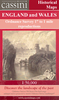
Grantham
Map No. 130, Grantham, in the Ordnance Survey Landranger series at 1:50, 000, including Sleaford, Bourne, Market Deeping, Ryhall, Exton, Market Overton, Langham, Stretton, Little Bytham, Baston, Thurlby, Grimsthorpe, Northgate, Rippingale, Corby Glen, South Witham, Stapleford, Wymondham, Waltham on the Wolds, Colsterworth, Croxton Kerrial, Denton, Great Ponton, Ingoldsby, Folkingham, Billingborough, Culverthorpe, Helpringham, Heckington, South Kyme, Belvoir, Barrowby, Bottesford, Belton, Ancaster, Marston, Caythorpe, Long Bennington and Claypole, with the E2 European Long Distance Path crossing the entire area. Edition C2; Revised for selected changes 2006; Reprinted with minor change 2007; Copyright date 2007 This title is also available on our
website in a waterproof and tear-resistant version.Maps in this series are only published folded. Stanfords can also print flat versions of Ordnance Survey maps through the OS Select system, centring the map on a location of your choice and with a picture provided by you on the cover. For more information please click on the link at the bottom of this description.About Ordnance Survey
website in a waterproof and tear-resistant version.Maps in this series are only published folded. Stanfords can also print flat versions of Ordnance Survey maps through the OS Select system, centring the map on a location of your choice and with a picture provided by you on the cover. For more information please click on the link at the bottom of this description.About Ordnance Survey
Product Description
Reviews/Comments
Add New
Intelligent Comparison
Archived Product
Grantham Stanfords
£6.39
Archived Product

Grant Stanfords
£30.00
Archived Product

Grantham 1824 Stanfords
£9.99
Archived Product
Grantham 1903 Stanfords
£2.95
Archived Product

Grantham 1903 Stanfords
£3.50
Vouchers
No voucher codes found.
Do you know a voucher code for this product or supplier? Add it to Insights for others to use.
Do you know a voucher code for this product or supplier? Add it to Insights for others to use.
 Denmark