
 United Kingdom
 France
 Germany
 Netherlands
 Sweden
 USA
USA
 Italy
Italy
 Spain
Spain
More From Contributor


Grangemouth 1896
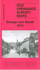
Grangemouth in 1896 in a fascinating series of reproductions of old Ordnance Survey plans in the Alan Godfrey Editions, ideal for anyone interested in the history of their neighbourhood or family. Selected towns in Great Britain and Ireland are covered by maps showing the extent of urban development in the last decades of the 19th and early 20th century.In this title: the map is double-sided. The main map covers the centre and south of the town, stretching from the Old Dock southward to Abbotsgrange, and from Carron Old Wharf eastward to Oxgang. Features include much of Grangemouth Docks, Old Dock, Upper Dock, Caledonian Saw Mills, Town Hall, Caledonian Railway Grangemouth Branch with station, sidings, timber basin, much of Old Harbour, Eastend, Newhouse, Granbge Burn,
Carronflats, site of Abbots Grange, Avon Hall, etc. On the reverse is a section of the adjacent sheet 25.09 extending coverage north to include New Dock, Forth & Clyde Canal, locks, River Carron, Heuck, Grangemouth Colliery Barony No.3 Pit, quay, etc. About the Alan Godfrey Editions of the 25
Carronflats, site of Abbots Grange, Avon Hall, etc. On the reverse is a section of the adjacent sheet 25.09 extending coverage north to include New Dock, Forth & Clyde Canal, locks, River Carron, Heuck, Grangemouth Colliery Barony No.3 Pit, quay, etc. About the Alan Godfrey Editions of the 25
Product Description
Reviews/Comments
Add New
Vouchers
No voucher codes found.
Do you know a voucher code for this product or supplier? Add it to Insights for others to use.
Do you know a voucher code for this product or supplier? Add it to Insights for others to use.
 Denmark