More From Contributor

£12.95
This guidebook presents 30 circular day walks in the Gower Area of Outstanding Natural Beauty, taking in the rich variety of landscapes across this beautiful area of South Wales. Ranging from 21/2 to 14 miles long, there are walks to suit all abilities. The peninsula is famous for its spectacularly steep, rugged coastline & perfect golden sand beaches but this guide also takes walkers to the inland valleys, hills & ridges little explored by most holidaymakers. Route descriptions are illustrated with OS mapping extracts & inspiring photography & accompanied by a route summary table to help you choose walks to suit your location & ability. Along the way, the author provides a wealth of information on the plants, animals, geology, history & archaeology of a region with something for everyone, all within a compact area easily accessible from Swansea & Mumbles. Coastal areas such as those around Langl&, Oxwich & Port Eynon are well frequented, but this guidebook concentrates on places where walkers can escape the crowds to find peace & solitude in this exceptionally beautiful & unspoilt area. ...
Archived Product
£12.99
Wales` capital city Cardiff has a thriving heritage & cultural scene, & is surrounded by the beautiful vale of Glamorgan, with its coastal fringes, pleasant villages & industrial tradition. Gower, lying to the west of Swansea, offers superb scenery, glorious sandy beaches, wooded valleys, open moorland & pretty villages. It is a fascinating & uniquely interesting area with superb & varied walking country that comprises a mixture of open moorl&, steep hillsides, wooded valleys, fertile lowlands & a magnificent coastline. Added to this are medieval castles, picturesque churches & attractive villages & towns. The tremendous variety offered by the area is reflected in the interesting routes included within this guide. ...
Archived Product
£11.99
Gower, Swansea & Cardiff in the Pathfinder Guides series, produced in association with Ordnance Survey & published by Crimson; comprising a range of walking guides to popular British destinations. Each Pathfinder guide

Includes::
28 varied walks ranging from easy strolls to exhilarating hikes & is accompanied by 1:25, 000 Ordnance Survey mapping with marked, colour-coded routes. Introductory sections profile the county or region covered, with recommendations on the best time to visit & a brief explanation of GPS. An ‘at-a-glance’ table gives an overview of the walks covered in the guide, with information on the starting point, National Grid reference, distance, time, highest point & general brief comments. Each walk described in the guide has a dedicated information box profiling the walk, with useful information such as the starting point, distance, approximate time, parking, refreshments & the relevant Ordnance Survey map for navigation. Clear & easy to follow directions are provided & are accompanied by practical information about the route, including the location of toilets, refreshment areas & picnic sites, as well as colour photography illustrating some of the highlights of the walk. A Further Information section contains information on walking safety & responsible walking, as well as a list of useful contacts.

...
Archived Product
£9.50
Topographical survey of Belgium at 1:20, 000 from Nationaal Geografisch Instituut / Institut Géographique National, the country’s national survey organization. Each 20K map covers one quarter of the corresponding 1:50, 000 map (with adjustments in the border & coastal areas). The maps provide all the information expected of topographic mapping at this scale & in addition have an unusually large amount of vegetation and/or land use information (different types of woodlands, gardens, orchards, heath, etc). The maps have a 1-km UTM grid, with margin ticks for latitude & longitude at intervals of 1`. Map legend & a glossary of terms used on the maps include English. Stanfords keeps as regular stock 20K maps for the World War I battlefields around the Ypres, Messines & Passchendaele, & for the area of the Battle of Waterloo. The 1:20, 000 survey covers the whole of Belgium & maps for other regions can be supplied as special orders. To see the list of titles in this series please click on the series link.PLEASE NOTE: the Long-Distance Footpaths Map of Belgium at 1:300, 000 which shows the division of Belgium into the 50K survey sheets can also be used to see in more detail coverage by the 20K maps. ...
Archived Product
£62.30
A worldwide resource for fundamental astronomical data, the Astronomical Almanac

Includes::
contributions

...
Archived Product
£16.50
This publication provides a summary of astronomical events. It is published several years in advance & contains much of Section A of the corresponding Astronomical Almanac (GP100). This publication
Includes:: Phases of the Moon, eclipses of the Sun & Moon Principal occultations, planetary phenomena, elongations & magnitudes of the planets Times of sunrise/set, moonrise/set Tabulated equations of time, the declination of the Sun & the Greenwich hour angles of the pole stars Polaris & Sigma Octantis
...
Archived Product
£14.95
The Global Positioning System (GPS) will pinpoint a boat`s position to within a few yards, & give a course to steer to its destination (the waypoint). This book explains how the system works & how to navigate safely & efficiently -- in daylight, darkness or in fog. ...
Archived Product
£11.99
This Pathfinder guide introduces to the use of GPS & digital mapping for walkers in an easy-to-use, step-by-step manner. “GPS for Walkers” uses non-technical language to introduce walkers to choosing & using a GPS receiver to enhance walking skills & make walking safer. The book uses the basic entry-level Garmin e Trex as an example to illustrate, how a GPS functions, how to navigate using a GPS & how to use one with “ Pathfinder” walks, how a GPS can be used with a PC, map reading, the use of digital mapping products, & the practical uses of a GPS when walking. Also included are details of useful websites & FAQ fact boxes, plus over 40 detail diagrams, maps & colourful pictures. ...
Archived Product
£11.99
GPS for Walkers in Western Europe in the Pathfinder Guides series, produced in association with Ordnance Survey & published by Crimson; comprising a range of walking guides to popular British destinations. Each Pathfinder guide

Includes::
28 varied walks ranging from easy strolls to exhilarating hikes & is accompanied by 1:25, 000 Ordnance Survey mapping with marked, colour-coded routes. Introductory sections profile the county or region covered, with recommendations on the best time to visit & a brief explanation of GPS. An ‘at-a-glance’ table gives an overview of the walks covered in the guide, with information on the starting point, National Grid reference, distance, time, highest point & general brief comments. Each walk described in the guide has a dedicated information box profiling the walk, with useful information such as the starting point, distance, approximate time, parking, refreshments & the relevant Ordnance Survey map for navigation. Clear & easy to follow directions are provided & are accompanied by practical information about the route, including the location of toilets, refreshment areas & picnic sites, as well as colour photography illustrating some of the highlights of the walk. A Further Information section contains information on walking safety & responsible walking, as well as a list of useful contacts.

...
Archived Product
£339.99
GPS SATMAP Active 10
- Bike by Garmin has been designed with the cyclist in mind, coming with an attachable bike mount & bike
...
Archived Product

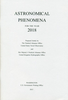
GP200 Astronomical Phenomena 2018

This publication provides a summary of astronomical events. It is published several years in advance and contains much of Section A of the corresponding Astronomical Almanac (GP100). This publication includes:Phases of the Moon, eclipses of the Sun and MoonPrincipal occultations, planetary phenomena, elongations and magnitudes of the planetsTimes of sunrise/set, moonrise/setTabulated equations of time, the declination of the Sun and the Greenwich hour angles of the pole stars Polaris and Sigma Octantis
RIP - This product is no longer available on our network. It was last seen on 25.09.2019

This page now acts as a permanent archive for this product. Add more information using the comments box below to ensure it can still be found by future generations.

Use our search facility to see if it is available from an alternative contributor.
  • Availability: Out Of Stock
  • Supplier: Stanfords
  • SKU: 9780707741796
Availability: In Stock
£16.50

Product Description

This publication provides a summary of astronomical events. It is published several years in advance & contains much of Section A of the corresponding Astronomical Almanac (GP100). This publication
Includes:: Phases of the Moon, eclipses of the Sun & Moon Principal occultations, planetary phenomena, elongations & magnitudes of the planets Times of sunrise/set, moonrise/set Tabulated equations of time, the declination of the Sun & the Greenwich hour angles of the pole stars Polaris & Sigma Octantis

Reviews/Comments

Add New

Intelligent Comparison

Oooops!
We couldn't find anything!
Perhaps this product's unique.... Or perhaps we are still looking for comparisons!
Click to bump this page and we'll hurry up.

Price History

Vouchers

No voucher codes found.
Do you know a voucher code for this product or supplier? Add it to Insights for others to use.

Facebook

Jargon Buster

Hour - A measurement of time, 60 minutes is equal to one hour
sun - A star at the centre of the solar system.
Set - a group of items usually related to one another. Some objects cannot function without the complete set of items.
Greenwich - A southern borough in London.

Supplier Information

Stanfords
Stanfords was established in 1853 and opened their iconic Covent Garden flagship store in 1901. They have become the top retailer of maps, travel books and accessories in the UK and arguably offer the largest selection of maps and travel books worldwide. Famous names such as Captain Robert Falcon Scott, Ranulph Fiennes and Michael Palin have purchased from Stanfords. They now have a shop in Bristol and both stores together with other venues operate a calendar of events including talks, book signings and exhibitions. As a specialist map retailer, the map selection is comprehensive and includes road maps, street maps and walking maps from worldwide destinations, as well as a selection of world atlases and wall maps. Books include travel guides and travel literature. Stanfords also stock globes, from miniatures made of blue marble to magnificent floor-standing globes. The website features a selection of interesting articles on travel topics.
Page Updated: 2023-11-12 20:15:36

Community Generated Product Tags

Oh No! The productWIKI community hasn't generated any tags for this product yet!
Menu