-
Home
-
Contributors
-
International
-
Account
-
Information
More From Contributor
- with a fun-seeking ...
Includes:: a list of useful phone numbers. Also provided are diagrams of tram lines plus regional bus & train networks, a road map of the city’s environs at 1:488, 000 & a map of ferry routes connecting the nearby islands. ...
Includes:: brief descriptions of 48 main places of interest, ranging from museums & historical remains to best examples of local architecture, nature reserves, etc. Map legend & the descriptions include English. The publishers, Norstedts Kartförlaget, is the now privatized section of Sweden’s national survey organization, Lantmäteriet. ...
- 469T), with special larger maps now published for some areas. Cartography is the same as in the country ...
Includes:: English.* On the reverse, an index of towns & villages
Includes:: names of geographical features such as mountains, alpine passes, glaciers, lakes, rivers, as well as places of interest. Also provided is an overview road map of surrounding region. ...
Includes:: English.* On the reverse, an index of towns & villages
Includes:: names of geographical features such as mountains, alpine passes, glaciers, lakes, rivers, as well as places of interest. Also provided is an overview road map of surrounding region. ...
Includes:: English. To see other maps in this series please click on the series link. ...

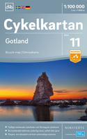
Gotland Cycling Map
network, including privately maintained roads open to the general public. Railway lines are shown with stations and ferry connections are marked. Topography is indicated by light relief shading with spot heights, plus colouring and/or graphics for forests and marshland. The maps have a UTM grid, plus latitude and longitude lines at intervals of 10’. Map legend includes English. Each map also provides phone numbers and web addresses of local tourist offices.
This page now acts as a permanent archive for this product. Add more information using the comments box below to ensure it can still be found by future generations.
Use our search facility to see if it is available from an alternative contributor.
- External links may include paid for promotion
- Availability: Out Of Stock
- Supplier: Stanfords
- SKU: 9789113083957
Product Description
The southern part of Sweden in a series of 30 double-sided cycling maps from Norstedts printed on light, waterproof & tear-resistant synthetic paper. Mainland is covered at 1:90, 000 with Gotland at 1:100, 000. The maps, prepared in association with Cykelfrämjandet
- Sweden’s largest national cycling organization, highlight all the national & other major cycle routes, plus a selection of local routes. The overprint indicates sections which are on gravel roads and/or not singposted. Also marked are selected hiking trails. A range of symbols indicate various facilities & places of interest, including campsites & youth hostels, wind shelters, cultural & historical sites, interesting nature & geological spots, etc. The maps provide a very detailed picture of the road network, including privately maintained roads open to the general public. Railway lines are shown with stations & ferry connections are marked. Topography is indicated by light relief shading with spot heights, plus colouring and/or graphics for forests & marshl&. The maps have a UTM grid, plus latitude & longitude lines at intervals of 10’. Map legend
Includes:: English. Each map also provides phone numbers & web addresses of local tourist offices.
Reviews/Comments
Add New
Intelligent Comparison
We couldn't find anything!
Perhaps this product's unique.... Or perhaps we are still looking for comparisons!
Click to bump this page and we'll hurry up.
Price History
Vouchers
Do you know a voucher code for this product or supplier? Add it to Insights for others to use.


 United Kingdom
 France
 Germany
 Netherlands
 Sweden
 USA
USA
 Italy
Italy
 Spain
Spain


 Denmark