More From Contributor
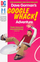
£6.99
Goodnight Mister Tom by Michelle Magorian won the Guardian Children's Fiction Award. Mum said war was a punishment from God for people's sins, so he'd better watch out. She didn't tell him what to watch out for, though. When the Second World War breaks out, young Willie Beech is evacuated to the countryside. A sad, deprived child, he slowly begins to flourish under the care of kind old Tom Oakley. But then his cruel mother summons him back to war-torn London... Will he ever see Mister Tom again? Everyone's idea of a smash-hit first novel: full-blown characters to love & hate, moments of grief & joy, & a marvellous story that knows just how to grab the emotions. (Guardian). Michelle Magorian was born in Portsmouth & on leaving school studied at the Rose Bruford College of speech & Drama & Marcel Marceau's International School of Mime in Paris. Over the years she became interested in children's books & decided to write one herself. The result was Goodnight Mister Tom, which won the Guardian Children's Fiction Award, an International Reading Association Award & was also made into a much-loved film, starring the late John Thaw. ...
Archived Product
£6.99
Inspired by ESA astronaut Tim Peake & his sons, & featuring an introduction from Tim, this is the perfect bedtime book! Two space-mad little boys get ready for bed & say goodnight to their toy rockets, launch pads & planet mobiles, before being whisked away into space on an adventure beyond their wildest dreams.. . Tim Peake is the first official British ESA astronaut. He left Earth on 15th December 2015 to begin a six month long mission aboard the International Space Station. His time in space has been watched by millions & he is inspiring a new generation of explorers, adventurers & questioners. Goodnight Spaceman is the sixth book in Michelle Robinson & Nick East`s beloved series. Look out for Goodnight Digger, Goodnight Tractor, Goodnight Princess, Goodnight Pirate & Goodnight Santa too! ...
Archived Product
£6.99
Goodnight Tiger is a quirky, funny bedtime story book, full of jungle animals & surprises. With vibrant, characterful illustrations by Laura Hughes (Daddy Sandwich), this charming picture book by best-selling author Timothy Knapman (Mungo & the Picture Book Pirates & Dinosaurs in the Supermarket) is sure to delight children at bedtime
- & it`s great for reinforcing bath & bedtime routines too. The animals in Emily`s jungle wallpaper can`t sleep, & they are bellowing & stomping & growling & keeping her awake! ” Go to sleep!” shouts Emily. ” We`ve tried & tried, but can`t!” says the tiger. So Emily climbs into the wallpaper & shows the animals how to get ready for bed. Only baths & lullabies aren`t quite the same in the jungle...! Perfect for fans of The Tiger Who Came to Tea!
...
Archived Product
£8.99
A beautiful new cloth book from the family-run Wee Gallery creators who know that newborn babies love high-contrast images & respond well to them. Get ready for sleeptime with familiar objects & animals such as a star, a car, a bunny a bee
- before finally saying good night to you & to me. Gorgeous colours, tactile pages & a mirror will ensure this book becomes a firm favourite to return to night after night.
...
Archived Product
£3.50
Goodwick & Fishguard Harbour in 1937 in a fascinating series of reproductions of old Ordnance Survey plans in the Alan Godfrey Editions, ideal for anyone interested in the history of their neighbourhood or family. The map covers the village of Goodwick & most of Fishguard Harbour. Coverage stretches from Goodwick Moor & Saddle Point northward to Garn Wen & Fishguard Harbour station. Features include Goodwick station with shed & sidings, East Breakwater, Harbour Village, St Peter`s church, Pant-yr-ychain, Stop-&-Call, Waun Pen-rhiw, etc. On the reverse are a directory of Llanwnda parish & a timetable for the Clynderwen-Fishguard line. About the Alan Godfrey Editions of the 25” OS Series: Selected towns in Great Britain & Ireland are covered by maps showing the extent of urban development in the last decades of the 19th & early 20th century. The plans have been taken from the Ordnance Survey mapping & reprinted at about 15 inches to one mile (1:4, 340). On the reverse most maps have historical notes & many also include extracts from contemporary directories. Most maps cover about one mile (1.6kms) north/south, one & a half miles (2.4kms) across; adjoining sheets can be combined to provide wider coverage.FOR MORE INFORMATION & A COMPLETE LIST OF ALL AVAILABLE TITLES PLEASE CLICK ON THE SERIES LINK. ...
Archived Product
£6.39
A detailed topographic map of Goole & Gilberdyke from the Ordnance Survey Explorer series, covering Holme-on-Spalding-Moor, Hemingbrough & Howden. Edition A1; Publication date April 2006 About this series: These highly detailed maps show all the administrative boundaries, settlements as small as isolated farms, the road network down to unfenced roads & country tracks, & field boundaries (hedges & drystone walls) which make navigation across the countryside much easier. Steep gradients on roads are indicated. Various landmarks, e.g. powerlines, archaeological sites, windmills, churches & lighthouses are shown & additional graphics indicate natural terrain features such as cliffs, scree, mud & vegetation variations. The contour interval is 5 metres in the lower parts of the country & 10 metres in the uplands, & spot heights are marked. Each map covers an area of 30 x 20km (i.e. approx. 19 x 12 miles), with some double-sided maps covering more, as indicated in the individual descriptions. The maps are fully GPS compatible, with the National Grid shown at 1km intervals & latitude & longitude indicated by margin ticks at 1'. The Explorer series has replaced the earlier, green-cover Pathfinder maps. The Explorer series is now complete & covers all of Engl&, Wales & Scotl&. Some sheets for popular areas like the National Parks are still branded as Outdoor Leisure (OL) maps, but are now included in this series as the cartography is the same as that in the Explorer Maps. The Explorer maps offer a substantial improvement on the Pathfinder series, with greater use of colour, larger area per map, & stronger emphasis on information for ramblers & tourists. This series is ideal for walking & other outdoor pursuits & each map shows a large amount of information for ramblers & tourists. Public rights of way are shown (except in Scotland), together with other routes with public access: National Trails & Recreational Paths, permitted paths & bridleways, & selected cycle routes. Open access land created under the Countryside & Rights of Way Act 2000 is marked. Tourist information

Includes::
caravan & camp sites, Park & Ride locations, recreation/leisure/sport centres, museums, historic buildings, English Heritage & National Trust sites, rural pubs, etc. The map legend is in English only, except for the tourist information content which is also in French & German.

...
Archived Product
£14.99
Goole, Gilberdyke, Holme-on-Spalding-Moor, Hemingbrough & Howden area on a detailed topographic & GPS compatible map No. 291, waterproof version, from the Ordnance Survey’s 1:25, 000 Explorer series. MOBILE DOWNLOADS: this title & all the other OS Explorer maps include a code for downloading after purchase the digital version onto your smartphone or tablet for viewing on the OS smartphone app.OS EXPLORER SERIES: to see the list of all the titles in the OS Explorer series, both paper & waterproof versions, please click on the series link. The Explorer series, Ordnance Survey’s most detailed maps recommended for anyone enjoying outdoor activities, provides topographic coverage of Great Britain at 1:25, 000 on GPS compatible maps with hiking trails, cycling routes & extensive tourist information. Each printed map is available either on paper or as a waterproof & tear-resistant OS Active Map, as indicated in its title. Britain’s National Parks & other areas of particular tourist interest are presented on often double-sided OL (Outdoor Leisure) maps, whilst most standard format Explorers cover an area of 30 x 20km (approx. 19 x 12 miles). All three versions (paper, waterproof & digital) are the same & provide plenty of recreational & tourist information, indicating the traditional public right of way paths (except in Scotland where different laws apply), including bridleways & byways. National Trails & other long-distance paths are marked, as well as permissive footpaths or bridleways & on-road or traffic-free cycle routes with, where appropriate, their National/ Regional Cycle Network numbers. Boundaries of access land are clearly marked. A wide range of symbols provides additional tourist information, highlighting camping & caravanning sites, information offices & visitors’ centres, parking & picnicking places, country pubs, sport & recreational facilities including cycle hire locations & mountain biking trails, historic buildings & museums, etc. Exceptionally clear presentation of the landscape is provided by contours at 5m or in the uplands at 10m intervals, with additional spot heights plus colouring and/or graphics for different types of woodlands, orchards, heath, marshl&, scree or boulders, & other topographic features. For GPS users the maps have British National Grid lines at 1km intervals, with latitude & longitude given by margin ticks at 1`. Clearly laid out map legend

Includes::
French & German translations for the tourist information symbols.

...
Archived Product
£8.99
Goole, Gilberdyke, Holme-on-Spalding-Moor, Hemingbrough & Howden area on a detailed topographic & GPS compatible map No. 291, paper version, from the Ordnance Survey’s 1:25, 000 Explorer series. MOBILE DOWNLOADS: this title & all the other OS Explorer maps include a code for downloading after purchase the digital version onto your smartphone or tablet for viewing on the OS smartphone app.OS EXPLORER SERIES: to see the list of all the titles in the OS Explorer series, both paper & waterproof versions, please click on the series link. The Explorer series, Ordnance Survey’s most detailed maps recommended for anyone enjoying outdoor activities, provides topographic coverage of Great Britain at 1:25, 000 on GPS compatible maps with hiking trails, cycling routes & extensive tourist information. Each printed map is available either on paper or as a waterproof & tear-resistant OS Active Map, as indicated in its title. Britain’s National Parks & other areas of particular tourist interest are presented on often double-sided OL (Outdoor Leisure) maps, whilst most standard format Explorers cover an area of 30 x 20km (approx. 19 x 12 miles). All three versions (paper, waterproof & digital) are the same & provide plenty of recreational & tourist information, indicating the traditional public right of way paths (except in Scotland where different laws apply), including bridleways & byways. National Trails & other long-distance paths are marked, as well as permissive footpaths or bridleways & on-road or traffic-free cycle routes with, where appropriate, their National/ Regional Cycle Network numbers. Boundaries of access land are clearly marked. A wide range of symbols provides additional tourist information, highlighting camping & caravanning sites, information offices & visitors’ centres, parking & picnicking places, country pubs, sport & recreational facilities including cycle hire locations & mountain biking trails, historic buildings & museums, etc. Exceptionally clear presentation of the landscape is provided by contours at 5m or in the uplands at 10m intervals, with additional spot heights plus colouring and/or graphics for different types of woodlands, orchards, heath, marshl&, scree or boulders, & other topographic features. For GPS users the maps have British National Grid lines at 1km intervals, with latitude & longitude given by margin ticks at 1`. Clearly laid out map legend

Includes::
French & German translations for the tourist information symbols.

...
Archived Product
£11.19
Laminated waterproof edition of a detailed topographic map of Goole & Gilberdyke from the Ordnance Survey Explorer series, covering Holme-on-Spalding-Moor, Hemingbrough & Howden. Edition A1; Publication date November 2006 About this series: These highly detailed maps show all the administrative boundaries, settlements as small as isolated farms, the road network down to unfenced roads & country tracks, & field boundaries (hedges & drystone walls) which make navigation across the countryside much easier. Steep gradients on roads are indicated. Various landmarks, e.g. powerlines, archaeological sites, windmills, churches & lighthouses are shown & additional graphics indicate natural terrain features such as cliffs, scree, mud & vegetation variations. The contour interval is 5 metres in the lower parts of the country & 10 metres in the uplands, & spot heights are marked. Each map covers an area of 30 x 20km (i.e. approx. 19 x 12 miles), with some double-sided maps covering more, as indicated in the individual descriptions. The maps are fully GPS compatible, with the National Grid shown at 1km intervals & latitude & longitude indicated by margin ticks at 1'. The Explorer series has replaced the earlier, green-cover Pathfinder maps. The Explorer series is now complete & covers all of Engl&, Wales & Scotl&. Some sheets for popular areas like the National Parks are still branded as Outdoor Leisure (OL) maps, but are now included in this series as the cartography is the same as that in the Explorer Maps. The Explorer maps offer a substantial improvement on the Pathfinder series, with greater use of colour, larger area per map, & stronger emphasis on information for ramblers & tourists. This series is ideal for walking & other outdoor pursuits & each map shows a large amount of information for ramblers & tourists. Public rights of way are shown (except in Scotland), together with other routes with public access: National Trails & Recreational Paths, permitted paths & bridleways, & selected cycle routes. Open access land created under the Countryside & Rights of Way Act 2000 is marked. Tourist information

Includes::
caravan & camp sites, Park & Ride locations, recreation/leisure/sport centres, museums, historic buildings, English Heritage & National Trust sites, rural pubs, etc. The map legend is in English only, except for the tourist information content which is also in French & German.

...
Archived Product
£3.50
Goole in 1905 in a fascinating series of reproductions of old Ordnance Survey plans in the Alan Godfrey Editions, ideal for anyone interested in the history of their neighbourhood or family. The map covers most of the town & features include station, St John`s church, North Street, Booth Ferry Road, Clifton Gardens, Shuffleton, Tompits Holmes, etc. The docks are the dominant feature, including Railway Dock, Aldam Dock, Ship Dock, Barge Dock, Ouse Dock, The Basin & Bonding Dock, each shown with railway connections, swing bridges, locks, cranes, even mooring posts. On the reverse are extracts from a Directory of Goole in 1889. About the Alan Godfrey Editions of the 25” OS Series: Selected towns in Great Britain & Ireland are covered by maps showing the extent of urban development in the last decades of the 19th & early 20th century. The plans have been taken from the Ordnance Survey mapping & reprinted at about 15 inches to one mile (1:4, 340). On the reverse most maps have historical notes & many also include extracts from contemporary directories. Most maps cover about one mile (1.6kms) north/south, one & a half miles (2.4kms) across; adjoining sheets can be combined to provide wider coverage.FOR MORE INFORMATION & A COMPLETE LIST OF ALL AVAILABLE TITLES PLEASE CLICK ON THE SERIES LINK. ...
Archived Product

Googlewhack

If someone called you a `googlewhack` what would you do? Would you end up playing table tennis with a nine year-old boy in Boston? Would you find yourself in Los Angeles wrangling snakes, or would you go to China to be licked by a performance artist? If your name is Dave Gorman, then all of these things could be true. Fuelled by a lust for life and a desperate desire to do anything except what he`s supposed to be doing (writing that novel and growing up), Dave falls under the spell of an obscure internet word game - Googlewhacking. Addicted to the game, and gripped by obsession, Dave travels three times round the world, visiting four continents and the unlikeliest cast of real life eccentrics you`ll ever meet in what becomes an epic challenge, a life-changing, globe-trotting
Googlewhack adventure.
RIP - This product is no longer available on our network. It was last seen on 25.09.2019

This page now acts as a permanent archive for this product. Add more information using the comments box below to ensure it can still be found by future generations.

Use our search facility to see if it is available from an alternative contributor.
  • Availability: Out Of Stock
  • Supplier: Stanfords
  • SKU: 9780091897420
Availability: In Stock
£7.99

Product Description

If someone called you a `googlewhack` what would you do? Would you end up playing table tennis with a nine year-old boy in Boston? Would you find yourself in Los Angeles wrangling snakes, or would you go to China to be licked by a performance artist? If your name is Dave Gorman, then all of these things could be true. Fuelled by a lust for life & a desperate desire to do anything except what he`s supposed to be doing (writing that novel & growing up), Dave falls under the spell of an obscure internet word game
- Googlewhacking. Addicted to the game, & gripped by obsession, Dave travels three times round the world, visiting four continents & the unlikeliest cast of real life eccentrics you`ll ever meet in what becomes an epic challenge, a life-changing, globe-trotting Googlewhack adventure.

Reviews/Comments

Add New

Intelligent Comparison

Oooops!
We couldn't find anything!
Perhaps this product's unique.... Or perhaps we are still looking for comparisons!
Click to bump this page and we'll hurry up.

Price History

Vouchers

No voucher codes found.
Do you know a voucher code for this product or supplier? Add it to Insights for others to use.

Facebook

Jargon Buster

World - A physical grouping, commonly used to describe earth and everything associated with ti
Year - The time it takes the planet earth to orbit the sun. This takes around 365.25 days.
Adventure - an undertaking of an exciting challenge or experience.
Year - 365 days (366 days in a leap year), the time taken for planet earth to make one full revolution around the sun.
Performance - When someone is presenting a form of entertainment, also how well someone is doing within a role.

Supplier Information

Stanfords
Stanfords was established in 1853 and opened their iconic Covent Garden flagship store in 1901. They have become the top retailer of maps, travel books and accessories in the UK and arguably offer the largest selection of maps and travel books worldwide. Famous names such as Captain Robert Falcon Scott, Ranulph Fiennes and Michael Palin have purchased from Stanfords. They now have a shop in Bristol and both stores together with other venues operate a calendar of events including talks, book signings and exhibitions. As a specialist map retailer, the map selection is comprehensive and includes road maps, street maps and walking maps from worldwide destinations, as well as a selection of world atlases and wall maps. Books include travel guides and travel literature. Stanfords also stock globes, from miniatures made of blue marble to magnificent floor-standing globes. The website features a selection of interesting articles on travel topics.
Page Updated: 2023-11-12 20:15:36

Community Generated Product Tags

Oh No! The productWIKI community hasn't generated any tags for this product yet!
Menu