
 United Kingdom
 France
 Germany
 Netherlands
 Sweden
 USA
USA
 Italy
Italy
 Spain
Spain
More From Contributor

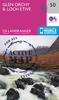
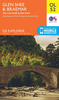
Glen Orchy And Loch Etive OS ACTIVE MAP
Map No. 50, Glen Orchy and Loch Etive, in a waterproof and tear-resistant version of the Ordnance Survey Landranger series at 1:50, 000, including Loch Lomond and the Trossachs National Park, Glen Fyne, Glen Shira, Glen Aray, Glen Kinglass, Black Mount, the peaks of Stob Dubh, Clach Leathad, Beinn Sgulaid, Ben Starav, Ben Cruachan, Ben Lui and Ben Vorlich, Loch Shira Reservoir, Lochs Lomond, Katrine, Sloy, Fyne, Awe, Lyon, Tulla and Dochard, plus Invercreran, Achallader, Bridge of Orchy, Tyndrum, Crianlarich, Inverarnan, Ardlui, Cairndow, Portsonachan, Cladich, Dalmally, Kilchrenen, Lochawe, Bridge of Awe and Taynuilt. The map also covers a section of the West Highland Way. Edition B2; Revised for selected changes 2007; Copyright date 2007 This title is
also available on our website in a paper version.Maps in this series are only published folded. Stanfords can also print flat versions of Ordnance Survey maps through the OS Select system, centring the map on a location of your choice and with a picture provided by you on the cover. For more information please click on the link at the bottom of this description.About Ordnance Survey
also available on our website in a paper version.Maps in this series are only published folded. Stanfords can also print flat versions of Ordnance Survey maps through the OS Select system, centring the map on a location of your choice and with a picture provided by you on the cover. For more information please click on the link at the bottom of this description.About Ordnance Survey
Product Description
Reviews/Comments
Add New
Intelligent Comparison
Archived Product
Glen Orchy And Loch Etive Stanfords
£5.59
Archived Product
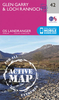
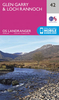
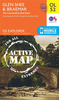
Glen Garry And Loch Rannoch OS ACTIVE Map Stanfords
£9.09
Vouchers
No voucher codes found.
Do you know a voucher code for this product or supplier? Add it to Insights for others to use.
Do you know a voucher code for this product or supplier? Add it to Insights for others to use.
 Denmark