
 United Kingdom
 France
 Germany
 Netherlands
 Sweden
 USA
USA
 Italy
Italy
 Spain
Spain
More From Contributor


Glasgow
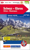
Map No. 64, Glasgow, in the Ordnance Survey Landranger series at 1:50, 000, including Motherwell, Airdrie, Stewarton, Dumlop, Chapelton, Stonehouse, Larkhall, East Kilbride, Eaglesham, Hamilton, Carmunnock, Uplawmoor, Barrhead, Rutherglen, Coatbridge, Johnstone, Paisley, Renfrew, Erskine, Bearsden, Bishopbriggs, Muirhead, Kirkintilloch, Cumbernauld, Banknock, Kilsyth, Lennoxtown, Strathblane, Bonhill and Dumbarton, with Campsie Fells, Kilpatrick Hills, Carron Valley Reservoir, Strathclyde Loch, plus a small part of the Loch Lomond and The Trossachs National Park and the start of the West Highland Way at Milngavie. Edition D2; Publication date June 2010 This title is also available on our website in a waterproof and tear-resistant version.Maps in this
series are only published folded. Stanfords can also print flat versions of Ordnance Survey maps through the OS Select system, centring the map on a location of your choice and with a picture provided by you on the cover. For more information please click on the link at the bottom of this description.About Ordnance Survey
series are only published folded. Stanfords can also print flat versions of Ordnance Survey maps through the OS Select system, centring the map on a location of your choice and with a picture provided by you on the cover. For more information please click on the link at the bottom of this description.About Ordnance Survey
Product Description
Reviews/Comments
Add New
Intelligent Comparison
Archived Product
Glasgow Stanfords
£6.39
Archived Product
Glasgow Stanfords
£7.99
Archived Product

Glasgow Stanfords
£25.00
Archived Product

Glasgow Stanfords
£2.50
Vouchers
No voucher codes found.
Do you know a voucher code for this product or supplier? Add it to Insights for others to use.
Do you know a voucher code for this product or supplier? Add it to Insights for others to use.
 Denmark