
 United Kingdom
 France
 Germany
 Netherlands
 Sweden
 USA
USA
 Italy
Italy
 Spain
Spain
More From Contributor


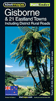
Gisborne - East Cape
Gisborne - East Cape region in a series of maps covering various districts of New Zealand, with each title combining a detailed road map with street plans of local towns, all with road and street indexes. The maps are published in two formats: handy Pocket Maps or Pathfinders with, as the publishers put it “Larger print so you don’t squint”.The road maps, typically around 1:175, 000 - 1:275, 000, show local roads and 4WD tracks. Main sightseeing routes across the country, such as the Pacific Road Highway or Thermal Explorer Highway, are identified by small icons. Railways, local airports and where appropriate, ferry routes are shown. The maps also include selected local hiking tracks. A range of symbols highlight various places of interest and sport or recreational
facilities. Topography is indicated by names of mountain ranges and selected peaks. Colouring shows forested areas, with national parks and reserves highlighted. The maps have no geographical coordinates but each one has an index listing names of local roads.Each title also includes numerous street plans of the main centres of population in the area covered by the road map. The plans are usually at 1:25, 000 to 1:35, 000, and for larger towns an enlargement of the town centre is also provided. The plans shows one way streets, public buildings and various facilities, including sport and recreational centres and, almost invariably, public toilets. Each plan has a separate street index.
facilities. Topography is indicated by names of mountain ranges and selected peaks. Colouring shows forested areas, with national parks and reserves highlighted. The maps have no geographical coordinates but each one has an index listing names of local roads.Each title also includes numerous street plans of the main centres of population in the area covered by the road map. The plans are usually at 1:25, 000 to 1:35, 000, and for larger towns an enlargement of the town centre is also provided. The plans shows one way streets, public buildings and various facilities, including sport and recreational centres and, almost invariably, public toilets. Each plan has a separate street index.

Product Description
Reviews/Comments
Add New
Vouchers
No voucher codes found.
Do you know a voucher code for this product or supplier? Add it to Insights for others to use.
Do you know a voucher code for this product or supplier? Add it to Insights for others to use.
 Denmark