
 United Kingdom
 France
 Germany
 Netherlands
 Sweden
 USA
USA
 Italy
Italy
 Spain
Spain
More From Contributor


Girvan
Map No. 76, Girvan, in the Ordnance Survey Landranger series at 1:50, 000, including Maybole, Ballantrae, Barrhill, Heronsford, Pinwherry, Colmonell, Lendalfoot, Barr, Old Dailly, Dailly, Turnberry, Crosshill and Maidens, with Galloway Forest Park, Craigenreoch, Carrick, Penwhapple Reservoir, Loch Moan, Loch Dormal, Loch Ochiltree, Stab Hill, Penderry Hill, Beneraird, Arecleoch Forest, Milleur Forest, Bennane Head, Brest Rocks and Ailsa Craig, plus the Southern Upland Way. Edition C3; Revised for selected changes 2007; Copyright date 2007 This title is also available on our website in a waterproof and tear-resistant version.Maps in this series are only published folded. Stanfords can also print flat versions of Ordnance Survey maps through the OS Select system,
centring the map on a location of your choice and with a picture provided by you on the cover. For more information please click on the link at the bottom of this description.About Ordnance Survey
centring the map on a location of your choice and with a picture provided by you on the cover. For more information please click on the link at the bottom of this description.About Ordnance Survey
Product Description
Reviews/Comments
Add New
Intelligent Comparison
Archived Product

Giant Stanfords
£6.99
Archived Product

Grant Stanfords
£30.00
Archived Product
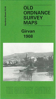
Girvan 1908 Stanfords
£3.50
Vouchers
No voucher codes found.
Do you know a voucher code for this product or supplier? Add it to Insights for others to use.
Do you know a voucher code for this product or supplier? Add it to Insights for others to use.
 Denmark