More From Contributor

£8.99
In Punta Arenas, Chile, in November 1998, Karl Bushby set out on one of the most remarkable journeys of modern times. His plan is as simple as it is extraordinary: to walk up the Americas, across the Bering Strait, through Asia, Russia & Europe, back through the Channel Tunnel & returning to Britain in 2011. It is a journey of remarkable endurance -- 20 miles a day, 3, 000 miles a year, 36, 000 miles in total. By the time Karl returns, he will have crossed four continents, twenty-five countries, a frozen sea, six deserts & seven mountain ranges. But more than that, unlike other similar expeditions, Karl is attempting it single-handed: no huge support teams, no large sponsorship deals, this is the inspiring true story of a man facing remarkable odds -- & winning. ...
Archived Product
£49.95
The Giant World Map Puzzle is a fun & informative interlocking jigsaw made up of 60 foam mat pieces. When completed, the puzzle illustrates a clear & colourful map of the world featuring world flags, time zones, & charming illustrations. The Giant World Map Puzzle provides an exciting way for children to learn the geography of the world, making an excellent teaching aid for both the classroom & the home. This puzzle is also a great way to protect expensive/hard floors by creating a play area that is safe for all ages. Made from 100% EVA foam with heat transfer printing, the Giant Map World Puzzle is non-toxic, odourless, hypoallergenic, & can be washed with soap & water. This is a great present, for a little person! ...
Archived Product
£20.00
Jonathan Glancey is a lifelong steam enthusiast who has oiled, fired & driven, as well as watched & listened to, steam locomotives around the world. In Giants of Steam, he turns his enthusiastic & knowledgeable attention to the thrilling story of the last, & greatest, generation of steam railway locomotives in regular main line service. Designed & built chiefly by the railways & workshops of Britain, France, Germany & the United States, these powerful & beautifully designed machines would take steam locomotive technology to new heights set against a backdrop of the political upheavals & military conflicts of the mid twentieth century. A celebration of the last great days of steam, Giants of Steam also commemorates the dedicated & often charismatic engineers who designed & built these effective & emotive machines & put them to use. Glancey tells the stories of the greatest of these 'steam men', among them Nigel Gresley & William Stanier in Great Britain, Andre Chapelon & Marc de Caso in France, William Woodard & Paul Kiefer in the United States & Richard Wagner & Otto Wolff in Germany. And he shows what happened as they faced up to the challenge of modernization & the notion that steam is inherently old fashioned & dirty. Giants of Steam also reveals how steam design has continued to progress against the odds in recent decades, while enthusiasm for the steam locomotive itself is far from burning out. A story of invention, skill & passion, Giants of Steam reveals how the true advocates of steam's glory days pushed its design & performance to remarkable limits. ...
Archived Product
£11.99
The thrilling story of the last, & greatest, generation of steam railway locomotives in regular main line service: a story of invention, skill & passion, Giants of Steam reveals how the true advocates of steam`s glory days pushed its design & performance to remarkable limits, taking these powerful & beautifully designed machines to new heights against a backdrop of the political upheavals & military conflicts of the mid twentieth century. Glancey tells the stories of the greatest of the `steam men`, the charismatic engineers who designed these machines & put them to use. Giants of Steam also reveals how steam design has continued to progress against the odds in recent decades, while enthusiasm for the steam locomotive itself is far from burning out. ...
Archived Product
£5.00
This title reports the findings of 15 years of conservation efforts to save the Giant Otter (known locally as the 'river wolf') in Peru. Richly illustrated, this book offers in-depth insights into the habitat, ecology, biology & natural history of these carnivores, as well as threats, past & current conservation efforts, & a look into the future of giant otter conservation. ...
Archived Product
£6.50
Topographic coverage of mainland Spain at 1:25, 000 published by the Centro Nacional de Información Geograficá, the country’s civilian survey organization. The maps have contours at 10m intervals & colouring and/or graphics to show different types of vegetation or land use. Boundaries of national parks & other protected areas are marked. In addition to all the usual information shown on topographic maps at this scale, detailed presentation of the road & rail networks, rural tracks & paths, etc, the maps also show campsites. The maps have a 1-km UTM grid, with margin ticks for latitude & longitude at 1` intervals. Map legend is in Spanish only.PLEASE NOTE: our grid for the whole of Spain is in preparation
- in the meantime, for areas other than those shown on the attached grid please use CNIG’s topographic survey at 1:50, 000 by searching for ‘SI00000832’. Each 25K map covers one quarter of the corresponding 50K map, with the numbering system: I = NW quarter, II = NE quarter, III = SW quarter & IV = SE quarter. CNIG maps in the Provincial Road Maps series at 1:200, 000 are overprinted with the grid for the 1:50, 000 survey & can be used to see the area covered by each 50K or 25K title in more detail. To see the list of titles in this series please click on the series grid
- for map numbers not yet listed on our website please contact us by email.

...
Archived Product
£6.95
Topographic coverage of mainland Spain at 1:50, 000 in the MTN50 (Mapa Topográfico Nacional) series from the Centro Nacional de Información Geografica, the country’s civilian survey organization. The maps have contours at 20m intervals, enhanced by relief shading, plus colouring and/or graphics to show different types of terrain, vegetation or land use. Boundaries of national parks & other protected areas are marked. In addition to all the usual information featured on topographic mapping at this scale, detailed presentation of the road & rail networks, rural tracks & paths, etc, the maps also show campsites & mountain refuges. On more recent editions some GRs, the official long-distance hiking routes, are also marked (although not as clearly as on hiking maps from other publishers). Each map covers 29.5x 18.5 km (with adjustments in the border or coastal areas). The maps have a 1-km UTM grid, plus margin ticks for latitude & longitude at 1` intervals. Map legend is in Spanish only.HOW TO CHOOSE THE RIGHT 50K MAP: all the titles in CNIG’s 200K Provincial Road Maps series at 1:200, 000 are overprinted with the grid for the 1:50, 000 maps & can be used to see the area covered by each 50K title. TO SEE THE LIST OF TITLES IN THIS SERIES PLEASE CLICK ON THE SERIES LINK.PLEASE NOTE
- MAP TITLES: the grids shown on our website serve both the civilian & the military 1:50, 000 topographic series. Although the areas covered by maps in both series are identical (apart from some border or coastal sheets), occasionally map titles differ – only one title is shown on the grid, usually the military one. In Galicia, the Basque country & in the Catalan speaking areas the tendency now is to use local place names rather than the often better known Castilian ones. Where possible, both versions are included in our titles. Map titles listed on our website are based on information received by us at the time of publication, but sometimes maps arrive showing a completely different title! As long as the map number is as ordered, the correct map has been supplied.
...
Archived Product
£8.50
Street plan of Gibraltar from the Spanish publishers Telstar, plus an indexed road map at 1:350, 000 of Costa del Sol with Costa de la Luz & town centre street plans of seven popular local destinations: Malaga, Torremolinos, Marbella, Estepona, Ronda, Fuengirola & Nerja. On one side two panels cover Gibraltar. A map of the whole of the Gibraltar, from the Spanish border & the airport terminal to the Europa Point has altitude colouring & graphics to show the topography & highlights various locations outside the town centre, including caves. The street network of central Gibraltar is presented on a separate panel highlighting main sights, car parks, taxi ranks, etc. Neither panel indicates the scale of the map. The two maps of Gibraltar are accompanied by notes & tips for visitors. Also provided here are seven panels with town centre street plans of popular destinations within Spain: Malaga, Torremolinos, Marbella, Estepona, Ronda, Fungirola & Nerja. On the reverse is an indexed road map of south-western Andalucía at 1:350, 000, extending along the coast beyond Cadiz to include the Doñana National Park & northwards to Seville, & along the Mediterranean beyond Motril & Granada to include the Sierra Nevada NP. Colouring & relief shading provide a very effective presentation of the topography. ...
Archived Product
£9.99
Gibraltar street plans at 1:10, 000 from ITMB, with bright altitude colouring clearly showing the city’s famous topography, plus a map at 1:80, 000 covering the European & the African side of the Straights of Gibraltar. Approximately a quarter of the whole sheet is taken by a street plan of Gibraltar at 1:10, 000. Topography of the Rock of Gibraltar is shown by bright altitude colouring with numerous spot heights (given in metres). Many streets are drawn on the plan, but only the main ones are named. Coverage stops just short of the border crossing to Spain. Symbols mark locations of various places of interest, including selected accommodation & restaurants, etc. The rest of the sheet is taken by an indexed road map at 1:80, 000 showing the Spanish & the Moroccan sides of the Straights of Gibraltar, including Ceuta. The map also has altitude colouring & in addition to the local road networks shows ferry routes between Tangier & Tarifa or Algeciras, & Ceuta & Algeciras. ...
Archived Product
£4.99
Hotspots Gibraltor highlights the best resorts within Gibraltar & the surrounding area, including the Costa del Sol, Costa de la Luz & Morocco. This book delivers: summaries of the best resorts including nearby Estepona, Puerto Banus, Marbella & Torremolinos; an Excursions section that lists the many activities on offer & places to visit such as Tangier in Morocco; advice on the wide range of leisure activities; Lists of local restaurants, bars, nightclubs & places of interest; maps of the local area showing the location of restaurants & places of interest; Lifestyle section, including a summary of the types of food available, a menu decoder, festivals, sports & activities on offer; &, these vibrant guides focus on the popular sun destinations worldwide. Highlighting the best nightlife, shopping, beaches & activities, they enable travellers to become familiar with their chosen resort, while providing details for them to get out & about to see local attractions too. It is presents in handy pocket size
- ideal for travelling light. It

Features:
full-colour maps & photographs; menu decoder, sports & activities; fun excursions & scenic trips; &, colourful descriptions of local cuisine, fiestas & markets.


...
Archived Product

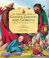
Giants, Ghosts And Goblins

Each tale in this collection comes from a different tradition or culture. Stories include one about a Norwegian giant who keeps his heart in a secret place and the tale of the terrifying demon of the Siberian Tundra, known as Korendo, who eats villages!
RIP - This product is no longer available on our network. It was last seen on 25.09.2019

This page now acts as a permanent archive for this product. Add more information using the comments box below to ensure it can still be found by future generations.

Use our search facility to see if it is available from an alternative contributor.
  • External links may include paid for promotion
  • Availability: Out Of Stock
  • Supplier: Stanfords
  • SKU: 9781846862342
Availability: In Stock
£15.99

Product Description

Each tale in this collection comes from a different tradition or culture. Stories include one about a Norwegian giant who keeps his heart in a secret place & the tale of the terrifying demon of the Siberian Tundra, known as Korendo, who eats villages!

Reviews/Comments

Add New

Intelligent Comparison

Oooops!
We couldn't find anything!
Perhaps this product's unique.... Or perhaps we are still looking for comparisons!
Click to bump this page and we'll hurry up.

Price History

Vouchers

No voucher codes found.
Do you know a voucher code for this product or supplier? Add it to Insights for others to use.

Facebook

Jargon Buster

Heart - An organ that pumps blood around the body. Usually related to love.

Supplier Information

Stanfords
Stanfords was established in 1853 and opened their iconic Covent Garden flagship store in 1901. They have become the top retailer of maps, travel books and accessories in the UK and arguably offer the largest selection of maps and travel books worldwide. Famous names such as Captain Robert Falcon Scott, Ranulph Fiennes and Michael Palin have purchased from Stanfords. They now have a shop in Bristol and both stores together with other venues operate a calendar of events including talks, book signings and exhibitions. As a specialist map retailer, the map selection is comprehensive and includes road maps, street maps and walking maps from worldwide destinations, as well as a selection of world atlases and wall maps. Books include travel guides and travel literature. Stanfords also stock globes, from miniatures made of blue marble to magnificent floor-standing globes. The website features a selection of interesting articles on travel topics.
Page Updated: 2023-11-12 20:15:36

Community Generated Product Tags

Oh No! The productWIKI community hasn't generated any tags for this product yet!
Menu