More From Contributor
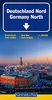
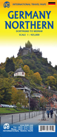
£5.99
One of the titles in a series of indexed regional maps with enlargements showing access to main cities. Bold relief shading combined with colouring for forested areas & a large number of place names make the base map rather dark & some of the small print occasionally difficult to read. Major roads do stand out well, but in more densely populated areas road information does become difficult to follow given the amount of detail, such as numbers & names of motorway junctions. Railways &, where appropriate, ferry routes are shown. National parked are marked & tourist information

Includes::
places of interest, sport & leisure facilities, etc. Latitude & longitude lines are drawn at intervals of 10

...
Archived Product
£10.99
Detailed road map of Northern Germany with extensive index. Clearly shows the national road network & selected provincial & local roads, with each class of road clearly indicated & road numbers shown. Intermediate driving distances between locations are shown in kilometres alongside the road, motorway filling stations are shown & motorway junctions are indicated. Topography is shown with relief shading & some spot heights, & colour shading is used to indicate land types such as forests or marshl&. International & provincial boundaries are clearly marked, as are National Parks, nature reserves & restricted military areas. Symbols indicate various sights & locations of tourist interest, such as churches, leisure & sports destinations, panoramas & viewing points, monuments & historic sites. Sights of particular interest are circled. Some hotels & campsites are marked. Railway lines, airports, ports & marinas are also shown. A grid divides the map at 0.5° (30’) increments, & is also grid-referenced for the accompanying index booklet. Multilingual map legend

Includes::
English

...
Archived Product
£12.99
Detailed touring map of southern Germany extending just south of Koln & Dresden. Separate plans present road access to & main routes across Berlin, Dortmund, Dusseldorf, Bremen, Duisburg/ Essen, Leipzig, Dresden, Hamburg, Hanover & Koln. The map shows seven different kinds of roads, with road names & junction numbers, intermediate driving distances in km, petrol stations, restaurants & motels along main roads. Scenic routes, railways, cable cars & airports are also marked alongside prohibited areas, national parks, waterfalls & swamps. A number of symbols also indicates places of interests, natural curiosities, viewpoints, notable buildings & ruins, monuments, campsites, spas, theme parks, & golf resorts & motor circuits. The map also

Includes::
a special ” Distoguide” incorporated into the map cover, showing at a glance road distances between several German cities. Map index is in a separate booklet attached to the cover. All texts are in six different European languages including English.

...
Archived Product
£12.99
The first water-resistant roadmap with direct access to useful additional information from the Internet Northern Germany in a scale of 1:550, 000 shown on a practical map; inclusive of the High 5 Edition app technology for calling up additional travel information & many other benefits:- practical format (11.4 x 23.5 cm)- it is water-resistant (laminated/cellophane coating)- contains a selection of the local index including postal codes; the entire index can be viewed using the QR-code It doesn’t matter what weather it is used in or how often it is folded, the condition of the “ROADMAP Germany North” will not deteriorate. Roads, ascents, woodland & mountain areas are easily recognisable thanks to the clear layout of the map. There is also a brief informative section about Germany (speed limits, area codes, emergency numbers, etc.) The “ Interactive Mobile ROADMAP Germany North” – a “paper backup” just in case...... & when used in conjunction with a smartphone, it is a great tool for planning trips. What’s not on the map is in the app By scanning the section of the map you want with the High 5 Edition app, you can get a lot of useful additional information about major attractions & cities in Northern Germany. The app is based on Augmented Reality technology & is available free of charge from the Apple App store & Google Play store. ...
Archived Product
£12.99
Northern Germany at 1:500, 000 on a double-sided map from Kümmerly + Frey printed on waterproof & tear resistant plastic, prominently highlighting locations worth visiting & providing driving distances on most local roads. The map is double-sided, with an overlap between the sides, & extends south beyond Bonn & Dresden. Road network stresses the motorways, clearly showing interchange numbers & different types of services. Scenic routes are highlighted & the map also indicates roads with seasonal closures or closed to motorized traffic. Driving distances are marked on most local roads. Railway lines & ferry connections are included & local airports are marked. Symbols indicate various places of interest, with towns & villages worth visiting prominently highlighted. Landscape is presented by unobtrusive relief shading, plus spot heights & names of mountain ranges, etc. Colouring indicates Germany’s numerous natural parks. Latitude & longitude lines are drawn at 30’ intervals & the map has an extensive index. Map legend

Includes::
English. Also provided is basic information on driving regulations. The same mapping is also available as at a reduced scale of 1:750, 000 to cover the whole of Germany on one sheet.

...
Archived Product
£12.99
Motorways are clearly depicted on this map, but the other main roads are not differentiated much from each other, & town names & road numbers jostle together, making the map rather cluttered. International borders are also difficult to pick out. However national parks are shown, as are railways, places of interest & campsites.

Includes::
index.

...
Archived Product
£11.99
Northern Germany at 1:500, 000 on a large road map from Mair Dumont with prominent highlighting of interesting locations, 10 more detailed enlargements for environs of main towns, plus an index booklet with 18 city maps & brief descriptions of 15 selected top sights, etc. Coverage extends south to Cologne, Erfurt & Dresden. Road network

Includes::
selected minor roads, highlights scenic roads & special tourist routes, shows intermediate driving distances on main roads, & indicates motorway services, toll stations, caravan & vehicle restrictions, etc. Railway lines, ferry routes & local airports are included, as well as administrative divisions with names of the states. Locations of interest are prominently highlighted, with separate colouring for towns or villages & for natural sites. Symbols show locations of campsites, youth hostels, etc. National parks & other protected areas are marked & topography is presented by relief shading with plenty of names of mountain ranges, valleys, etc. Latitude & longitude lines are drawn at 30` intervals. Multilingual map legend

Includes::
English. On the reverse are 10 large panels with enlargements showing in greater detail the environs of Berlin, Braunschweig, Bremen, Cologne
- Bonn, Dresden, Hamburg, Hannover, Leipzig, Rostock, plus the Ruhr including Dortmund, Düsseldorf & Leverkusen. A separate 95-page booklet attached to the map cover

Includes::
an index which also lists national parks, UNESCO World Heritage sites, airports & amusement parks. The booklet also contains brief descriptions of 15 most interesting locations prominently highlighted on the map, plus street plans of central Berlin, Braunschweig, Bremen, Cologne, Dortmund, Dresden, Düsseldorf, Essen, Erfurt, Hamburg, Hannover, Kiel, Leipzig, Lübeck, Magdeburg, Potsdam, Rostock & Schwerin.A fold-out flap in the cover shows for route planning an overview of the whole area covered by the map plus the adjacent regions, prominently highlighting main places of interest, with the grid reference system in the margins making it easier to find locations on the main map. Also included are a distance/driving times table & basic driving regulations.


...
Archived Product
£5.99
One of the titles in a series of indexed regional maps with enlargements showing access to main cities. Bold relief shading combined with colouring for forested areas & a large number of place names make the base map rather dark & some of the small print occasionally difficult to read. Major roads do stand out well, but in more densely populated areas road information does become difficult to follow given the amount of detail, such as numbers & names of motorway junctions. Railways &, where appropriate, ferry routes are shown. National parked are marked & tourist information

Includes::
places of interest, sport & leisure facilities, etc. Latitude & longitude lines are drawn at intervals of 10

...
Archived Product
£5.99
North-western Germany at 1:350, 000 in a series of six indexed regional road maps from Michelin. The map covers the states of Schleswig-Holstein & Lower Saxony, & has an enlargement showing in greater detail road access to Hamburg, plus street plans with main roads across Hamburg, Hannover, Kiel & Bremen; all indicate main places of interest & have a short index of main streets. The map also

Includes::
a distance/driving times table & indicates which locations have street plans in the Michelin’s Red Guide to hotels & restaurants in Germany. Maps in the Michelin’s coverage of Germany show the motorways with full or limited interchanges & service areas, indicate interregional & less congested roads, & include information such as step gradients, seasonal closures & restrictions for caravans, dangerous or difficult road sections, etc. Scenic roads & special tourist routes are highlighted. Railway lines are included & ferry connections indicate whether for cars or passengers/cyclists only. Topography is shown by relief shading with plenty of names of mountain ranges & peaks, plus colouring for woodlands. Small symbols mark various places of interest. The maps also indicate which locations have a street plan in the Michelin’s Red Guide to hotels & restaurants in Germany. Latitude & longitude lines are drawn at intervals of 20’. The index is on the reverse. Map legend

Includes::
English.


...
Archived Product

Germany North ITMB

The northern portion of Germany, covering from the Atlantic coast to well east of Hamburg and from the Danish border to Bremen on one side and from the Dutch border to Magdeburg and the Ruhr Valley to Frankfurt.Legend includes: roads by classification, international airports, domestic airports, ports, ruins, historic/archeological, hot springs, forts, lighthouses, national parks, world heritages, mountain peaks, spot heights, universities, oil fields, point of interests, beaches, camping sites, churches, viewpoints, mosques, passes, caves, border crossings, mines, hospitals and much more.
RIP - This product is no longer available on our network. It was last seen on 25.09.2019

This page now acts as a permanent archive for this product. Add more information using the comments box below to ensure it can still be found by future generations.

Use our search facility to see if it is available from an alternative contributor.
  • External links may include paid for promotion
  • Availability: Out Of Stock
  • Supplier: Stanfords
  • SKU: 9781771293105
Availability: In Stock
£9.99

Product Description

The northern portion of Germany, covering from the Atlantic coast to well east of Hamburg & from the Danish border to Bremen on one side & from the Dutch border to Magdeburg & the Ruhr Valley to Frankfurt. Legend
Includes:: roads by classification, international airports, domestic airports, ports, ruins, historic/archeological, hot springs, forts, lighthouses, national parks, world heritages, mountain peaks, spot heights, universities, oil fields, point of interests, beaches, camping sites, churches, viewpoints, mosques, passes, caves, border crossings, mines, hospitals & much more.

Reviews/Comments

Add New

Intelligent Comparison

Oooops!
We couldn't find anything!
Perhaps this product's unique.... Or perhaps we are still looking for comparisons!
Click to bump this page and we'll hurry up.

Price History

Vouchers

No voucher codes found.
Do you know a voucher code for this product or supplier? Add it to Insights for others to use.

Facebook

Jargon Buster

Oil - A hydrophobic liquid with high carbon and hydrogen content. Has many variations including; cooking oils, petrochemical oils, essential oils.
Germany - A country in Central Europe.
hot - An indication of the temperature being high and a sensation of heat to the tough
World - A physical grouping, commonly used to describe earth and everything associated with ti
Danish - a language, often spoken in the Scandinavian countries, primarily Denmark

Supplier Information

Stanfords
Stanfords was established in 1853 and opened their iconic Covent Garden flagship store in 1901. They have become the top retailer of maps, travel books and accessories in the UK and arguably offer the largest selection of maps and travel books worldwide. Famous names such as Captain Robert Falcon Scott, Ranulph Fiennes and Michael Palin have purchased from Stanfords. They now have a shop in Bristol and both stores together with other venues operate a calendar of events including talks, book signings and exhibitions. As a specialist map retailer, the map selection is comprehensive and includes road maps, street maps and walking maps from worldwide destinations, as well as a selection of world atlases and wall maps. Books include travel guides and travel literature. Stanfords also stock globes, from miniatures made of blue marble to magnificent floor-standing globes. The website features a selection of interesting articles on travel topics.
Page Updated: 2023-11-12 20:15:36

Community Generated Product Tags

Oh No! The productWIKI community hasn't generated any tags for this product yet!
Menu