
 United Kingdom
 France
 Germany
 Netherlands
 Sweden
 USA
USA
 Italy
Italy
 Spain
Spain
More From Contributor


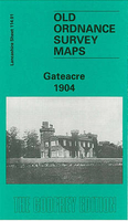
Gateacre 1904
Gateacre in 1904 in a fascinating series of reproductions of old Ordnance Survey plans in the Alan Godfrey Editions, ideal for anyone interested in the history of their neighbourhood or family. Selected towns in Great Britain and Ireland are covered by maps showing the extent of urban development in the last decades of the 19th and early 20th century.In this title: the map covers much of the village of Gateacre, south-east of Liverpool. Coverage stretches from Etopn Lodge and Gipsy Lane eastward to St Stephen's church, and from Childwall Hall southward to Beaconsfield Road. Features include a stretch of Cheshire Lines Railway with Gateacre & Woolton station; many substantial villas around Gateacre incl The Grange, Ashleigh House, The Priory, Woolton Hill House Manhattan and others;
Druids Cross, Belle Vale Hall, Belle Vale Farm, Gorsey Cop Farm, Childwall Park. On the reverse are directory entries for Beaconsfield Road, Cuckoo Lane, Gateacre Brow, Grange Lane and Halewood Road. About the Alan Godfrey Editions of the 25
Druids Cross, Belle Vale Hall, Belle Vale Farm, Gorsey Cop Farm, Childwall Park. On the reverse are directory entries for Beaconsfield Road, Cuckoo Lane, Gateacre Brow, Grange Lane and Halewood Road. About the Alan Godfrey Editions of the 25
Product Description
Reviews/Comments
Add New
Intelligent Comparison
Archived Product
Gateacre 1904 Stanfords
£3.50
Vouchers
No voucher codes found.
Do you know a voucher code for this product or supplier? Add it to Insights for others to use.
Do you know a voucher code for this product or supplier? Add it to Insights for others to use.
 Denmark