
 United Kingdom
 France
 Germany
 Netherlands
 Sweden
 USA
USA
 Italy
Italy
 Spain
Spain
More From Contributor


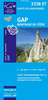
Gap - Briançon - Barcelonnette - Ecrins NP - PNR Du Queyras IGN
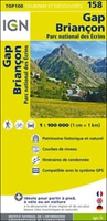
Top100 Map 158
Map No. 158, Gap - Briançon, at 1:100, 000, part of the TOP100 series from the Institut Géographique National (IGN). These exceptionally detailed, contoured and GPS compatible road maps which include English language map legend are ideal for exploring the French countryside by car, by bike, or even on foot. Used by millions of locals and tourists alike, this series provides an excellent balance between coverage of a sufficiently wide area and detailed road presentation, plus topographic information not found on other road maps of France. For several decades now these maps, previously known as Série Verte, have been one of Stanfords’ leading bestsellers.PLEASE NOTE: to see the full specifications of the cartography (contour interval, GPS compatibility, etc) and the list of
all the titles in this series please click on the series link.This title covers the area shown on our coverage image, including Ecrins National Park, Queyras PNR, and the northern part of the Mercantour National Park, La Mure, Superdévoluy, St-Etienne-en-Dévoluy, St-Disdier, Ambel, Corps, Vizille, Vif, Dt-Georges-de-Commiers, Le Bourg-d’Oisans, L’Alpe-d’Huez, Les Deux Alpes, St-Bonnet-en-Champsaur, St-Firmin, Le Périer, La Grave, La Chapelle-en-Valgaudémar, Orcières-Merlette, Chaillol, Vallouise, Puy-St-Vincent, L’Argentière-le-Bessèe, Guillestre, La Salle-les-Alpes, Névache, Val-les-Prés, Le Monetier-les-Bains, Molines-en-Queyras, Château-Queyras, Ceillac, St-Véran, Arvieux, Station de Vars, Ste-Marie, Station Risoul 1850,
St-Paul-sur Ubaye, Jausiers, Pra-Loup, Allos, la Foux d’Allos, le Super-Sauze, Station des Orres, Crévoux, Embrun, Le Lauzet-Ubaye, Seyne, Chriges, Ancelle, St-Léger-les-Mélezes, Crots, Réalion, Tallard, La Motte-du-Caire, Bay0ons, Veynes, Serres, Larage-Montéglin, Lus-la-Croix-Haute, Savournon, as well as the ski runs of Serre-Chevalier, Lac se Serre-Ponçon, Col de la Croix Haute, Col de Galibier, Coal de Lautaret, Col de Montgenèvre, Co d’Izoard, Col Agnel, Col de la Bonette, Col de la Cayolle, Col Bayard, etc.

Product Description
Reviews/Comments
Add New
Vouchers
No voucher codes found.
Do you know a voucher code for this product or supplier? Add it to Insights for others to use.
Do you know a voucher code for this product or supplier? Add it to Insights for others to use.
 Denmark