More From Contributor
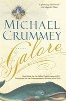
£14.99
Galloway Forest Park South, Glen Trool, Clatteringshaws Loch & Newton Stewart area on a detailed topographic & GPS compatible map No. 319, waterproof version, from the Ordnance Survey’s 1:25, 000 Explorer series.MOBILE DOWNLOADS: this title & all the other OS Explorer maps include a code for downloading after purchase the digital version onto your smartphone or tablet for viewing on the OS smartphone app.OS EXPLORER SERIES: to see the list of all the titles in the OS Explorer series, both paper & waterproof versions, please click on the series link. The Explorer series, Ordnance Survey’s most detailed maps recommended for anyone enjoying outdoor activities, provides topographic coverage of Great Britain at 1:25, 000 on GPS compatible maps with hiking trails, cycling routes & extensive tourist information. Each printed map is available either on paper or as a waterproof & tear-resistant OS Active Map, as indicated in its title. Britain’s National Parks & other areas of particular tourist interest are presented on often double-sided OL (Outdoor Leisure) maps, whilst most standard format Explorers cover an area of 30 x 20km (approx. 19 x 12 miles). All three versions (paper, waterproof & digital) are the same & provide plenty of recreational & tourist information, indicating the traditional public right of way paths (except in Scotland where different laws apply), including bridleways & byways. National Trails & other long-distance paths are marked, as well as permissive footpaths or bridleways & on-road or traffic-free cycle routes with, where appropriate, their National/ Regional Cycle Network numbers. Boundaries of access land are clearly marked. A wide range of symbols provides additional tourist information, highlighting camping & caravanning sites, information offices & visitors’ centres, parking & picnicking places, country pubs, sport & recreational facilities including cycle hire locations & mountain biking trails, historic buildings & museums, etc. Exceptionally clear presentation of the landscape is provided by contours at 5m or in the uplands at 10m intervals, with additional spot heights plus colouring and/or graphics for different types of woodlands, orchards, heath, marshl&, scree or boulders, & other topographic features. For GPS users the maps have British National Grid lines at 1km intervals, with latitude & longitude given by margin ticks at 1`. Clearly laid out map legend

Includes::
French & German translations for the tourist information symbols.

...
Archived Product
£8.99
Galloway Forest Park South, Glen Trool, Clatteringshaws Loch & Newton Stewart area on a detailed topographic & GPS compatible map No. 319, paper version, from the Ordnance Survey’s 1:25, 000 Explorer series.MOBILE DOWNLOADS: this title & all the other OS Explorer maps include a code for downloading after purchase the digital version onto your smartphone or tablet for viewing on the OS smartphone app.OS EXPLORER SERIES: to see the list of all the titles in the OS Explorer series, both paper & waterproof versions, please click on the series link. The Explorer series, Ordnance Survey’s most detailed maps recommended for anyone enjoying outdoor activities, provides topographic coverage of Great Britain at 1:25, 000 on GPS compatible maps with hiking trails, cycling routes & extensive tourist information. Each printed map is available either on paper or as a waterproof & tear-resistant OS Active Map, as indicated in its title. Britain’s National Parks & other areas of particular tourist interest are presented on often double-sided OL (Outdoor Leisure) maps, whilst most standard format Explorers cover an area of 30 x 20km (approx. 19 x 12 miles). All three versions (paper, waterproof & digital) are the same & provide plenty of recreational & tourist information, indicating the traditional public right of way paths (except in Scotland where different laws apply), including bridleways & byways. National Trails & other long-distance paths are marked, as well as permissive footpaths or bridleways & on-road or traffic-free cycle routes with, where appropriate, their National/ Regional Cycle Network numbers. Boundaries of access land are clearly marked. A wide range of symbols provides additional tourist information, highlighting camping & caravanning sites, information offices & visitors’ centres, parking & picnicking places, country pubs, sport & recreational facilities including cycle hire locations & mountain biking trails, historic buildings & museums, etc. Exceptionally clear presentation of the landscape is provided by contours at 5m or in the uplands at 10m intervals, with additional spot heights plus colouring and/or graphics for different types of woodlands, orchards, heath, marshl&, scree or boulders, & other topographic features. For GPS users the maps have British National Grid lines at 1km intervals, with latitude & longitude given by margin ticks at 1`. Clearly laid out map legend

Includes::
French & German translations for the tourist information symbols.

...
Archived Product
£11.19
Laminated waterproof edition of a detailed topographic map of Galloway Forest Park South from the Ordnance Survey Explorer series, covering Glen Trool & Clatteringshaws Loch. Newton Stewart Edition A1; Publication date August 2006 About this series: These highly detailed maps show all the administrative boundaries, settlements as small as isolated farms, the road network down to unfenced roads & country tracks, & field boundaries (hedges & drystone walls) which make navigation across the countryside much easier. Steep gradients on roads are indicated. Various landmarks, e.g. powerlines, archaeological sites, windmills, churches & lighthouses are shown & additional graphics indicate natural terrain features such as cliffs, scree, mud & vegetation variations. The contour interval is 5 metres in the lower parts of the country & 10 metres in the uplands, & spot heights are marked. Each map covers an area of 30 x 20km (i.e. approx. 19 x 12 miles), with some double-sided maps covering more, as indicated in the individual descriptions. The maps are fully GPS compatible, with the National Grid shown at 1km intervals & latitude & longitude indicated by margin ticks at 1'. The Explorer series has replaced the earlier, green-cover Pathfinder maps. The Explorer series is now complete & covers all of Engl&, Wales & Scotl&. Some sheets for popular areas like the National Parks are still branded as Outdoor Leisure (OL) maps, but are now included in this series as the cartography is the same as that in the Explorer Maps. The Explorer maps offer a substantial improvement on the Pathfinder series, with greater use of colour, larger area per map, & stronger emphasis on information for ramblers & tourists. This series is ideal for walking & other outdoor pursuits & each map shows a large amount of information for ramblers & tourists. Public rights of way are shown (except in Scotland), together with other routes with public access: National Trails & Recreational Paths, permitted paths & bridleways, & selected cycle routes. Open access land created under the Countryside & Rights of Way Act 2000 is marked. Tourist information

Includes::
caravan & camp sites, Park & Ride locations, recreation/leisure/sport centres, museums, historic buildings, English Heritage & National Trust sites, rural pubs, etc. The map legend is in English only, except for the tourist information content which is also in French & German.

...
Archived Product
£10.95
Galloway Hills at 1:25, 000 on a waterproof & tear-resistant, GPS compatible map from Harvey Map Services in their Superwalker series covering popular hiking areas of Great Britain & Irel&, annotated with additional information for walkers. The maps have contours at 15m intervals, with additional graphics for various types of terrain (crags, large boulders, scattered rocks) & colouring for different kinds of land use or vegetation (pastures, bogs, forests or woodl&, etc). The maps show local hiking paths, indicating, where appropriate, long-distance routes & boundaries of national parks or other protected areas. Scottish titles also indicate Munro, Corbett & Graham hills. Some maps in addition highlight local cycle routes.A range of symbols mark various facilities for walkers including youth or independent hostels, campsites & caravan sites, information points, etc. Each map has a 1-km with British or Irish national grid. ...
Archived Product
£12.95
Revered walker Paddy Dillon’s Cicerone guide to Walking the Galloway Hills explores the south-west of Scotland & its almost unlimited access for walkers
- some have described it as a walker’s paradise. The Galloway Hills provide walks that vary from gentle way-marked forest trails to strenuous bothy-based treks. The wild qualities of the hills are equally matched in the area’s colourful & turbulent history of the Scottish clans
- this is Robert the Bruce territory. The guide is organized into 33 circular day walks of between 5 & 12 miles which can be interlinked with other walks. Evocative sounding names such as the Rhinns of Kells, Rig of Jarkness, Nieve of the Spit, Shallock on Minnoch, Point of the Snibe, Mullwharchar & Craigeazle are standard fare in the Galloways & serve to stir walkers’ imaginations. A detailed introduction provides information on the Galloway Forest Park, Flora & fauna, Access & Accommodation, Familiarisation with the area & general practical tourist advice. Detailed route descriptions are accompanied by gradient diagrams mapping the route in addition to colour & black & white photographs illustrating some of the highlights of the region.

...
Archived Product
£6.50
Galveston, Texas City & South Suburban Houston area of Texas on an indexed street plan from Rand Mc Nally in their extensive range of maps covering cities in the United States. Other communities covered by this map include Alvin, Friendswood, La Marque, League City, Manvel, Pearl&, Santa Fe & Webster. Rand Mc Nally street plans provide coverage of cities with their outer suburbs, clearly indicating main traffic arteries: highways (distinguishing between free & toll access), plus primary & secondary routes. Road numbers and/or names are clearly displayed & exit numbers are indicated. Locations of service & rest areas are marked & one way streets are shown. Longer streets are annotated with block numbers for easier identification of addresses. The maps show railway, bus &, where appropriate, metro stations. A range of symbols indicate various places of interest including cultural & academic institutions, various municipal facilities, golf courses, etc. The plans have extensive street indexes, supplemented by lists of points of interest, parks & recreational areas, shopping malls, stations, schools, etc. Descriptions of individual titles indicate if an enlargement of the downtown area or any other additional features are also provided. ...
Archived Product
£7.50
Galway an indexed street plan at 1:12, 000 from the Ordnance Survey of Irel&. OSI street plans highlight main traffic arteries in each town: national primary & secondary routes, regional roads & main streets, with one way & pedestrianized streets. Colouring indicates public buildings, highlighting the more important ones, railway/bus stations & medical centres. A range of symbols indicate various facilities, including An ...
Archived Product
£7.50
Galway on an indexed street plan at 1:12, 000 from the Ordnance Survey of Ireland with an enlargement showing the city centre in greater detail. Street index, placed under the main map, where appropriate lists streets with both their names in Irish & English.OSI street plans highlight main traffic arteries in each town, national primary & secondary routes, regional roads & main streets, & ishow one way & pedestrianized streets. Colouring indicates public buildings, highlighting the more important ones, railway/bus stations & medical centres. A range of symbols indicate various facilities, including An ...
Archived Product
£8.25
Map No. 39, Galway North-East in the Discovery series from the OSI, the Ordnance Survey of Irel&, which presents the country on detailed topographic maps at 1:50, 000, with additional overprint highlighting campsites & caravan parks, youth hostels, etc. Current 3rd edition of this title was published in March 2011. Maps in the Discovery series have contours at 10m intervals, with plenty of spot heights & additional altitude colouring. Graphics indicate different types of woodlands. An overprint highlights waymarked or unmarked walking trails as well as cycle routes. National or forest parks & nature reserves are marked & a range of symbols provide tourist information: campsites, caravan parks, youth hostels (An Óige & independent), tourist offices, parking & picnic places, & viewpoints. Golf courses indicate the number of holes. The maps also highlight antiquities & historical sites such as megalithic tombs, standing stones, battlefields, etc. Road network grades third class roads according to their widths &

Includes::
local tracks. Railways are shown with stations & the maps include other details expected of topographic mapping at this scale. Where appropriate, place names are given in both Irish & English. Each map covers an area of 40 x 30km (25 x 19 miles approximately) & has a 1km ITM (Irish Transverse Mercator) grid, plus latitude & longitude margin ticks at 1` intervals. Map legend is in Irish & English. To see the list of all the titles in this series please click on the series link.

...
Archived Product
£8.25
Map No. 38, Mayo South-Central
- Galway North in the Discovery series from the OSI, the Ordnance Survey of Irel&, which presents
...
Archived Product

Galore

An intricate family saga and love story spanning two centuries, ”Galore” is a portrait of the improbable medieval world that was rural Newfoundland, a place almost too harrowing and extravagant to be real. Remote and isolated, exposed to savage extremes of climate and fate, the people of Paradise Deep persist in a realm where the line between the everyday and the otherworldly is impossible to distinguish. Propelled by the disputes and alliances, grievances and trade-offs that bind the Sellers and Devine families through generations, ”Galore” is alive with singular characters, and an uncommon insight into the complexities of human nature. Sprawling and intimate, stark and fantastical, ”Galore” is a novel about the power of stories to shape and sustain us. This is
Michael Crummey`s most ambitious and accomplished work to date.
RIP - This product is no longer available on our network. It was last seen on 25.09.2019

This page now acts as a permanent archive for this product. Add more information using the comments box below to ensure it can still be found by future generations.

Use our search facility to see if it is available from an alternative contributor.
  • External links may include paid for promotion
  • Availability: Out Of Stock
  • Supplier: Stanfords
  • SKU: 9781780336183
Availability: In Stock
£12.99

Product Description

An intricate family saga & love story spanning two centuries, ” Galore” is a portrait of the improbable medieval world that was rural Newfoundl&, a place almost too harrowing & extravagant to be real. Remote & isolated, exposed to savage extremes of climate & fate, the people of Paradise Deep persist in a realm where the line between the everyday & the otherworldly is impossible to distinguish. Propelled by the disputes & alliances, grievances & trade-offs that bind the Sellers & Devine families through generations, ” Galore” is alive with singular characters, & an uncommon insight into the complexities of human nature. Sprawling & intimate, stark & fantastical, ” Galore” is a novel about the power of stories to shape & sustain us. This is Michael Crummey`s most ambitious & accomplished work to date.

Reviews/Comments

Add New

Intelligent Comparison

Oooops!
We couldn't find anything!
Perhaps this product's unique.... Or perhaps we are still looking for comparisons!
Click to bump this page and we'll hurry up.

Price History

Vouchers

No voucher codes found.
Do you know a voucher code for this product or supplier? Add it to Insights for others to use.

Facebook

Jargon Buster

Date - A day on a calendar
Date - A social activity whith a current or potential partner
Human - A highly developed and adapted mamal and deminant species on earth
World - A physical grouping, commonly used to describe earth and everything associated with ti
Love - Someone who shows deep affection for someone else.
Family - A group of people that live together made up from parents and children.

Supplier Information

Stanfords
Stanfords was established in 1853 and opened their iconic Covent Garden flagship store in 1901. They have become the top retailer of maps, travel books and accessories in the UK and arguably offer the largest selection of maps and travel books worldwide. Famous names such as Captain Robert Falcon Scott, Ranulph Fiennes and Michael Palin have purchased from Stanfords. They now have a shop in Bristol and both stores together with other venues operate a calendar of events including talks, book signings and exhibitions. As a specialist map retailer, the map selection is comprehensive and includes road maps, street maps and walking maps from worldwide destinations, as well as a selection of world atlases and wall maps. Books include travel guides and travel literature. Stanfords also stock globes, from miniatures made of blue marble to magnificent floor-standing globes. The website features a selection of interesting articles on travel topics.
Page Updated: 2023-11-12 20:15:36

Community Generated Product Tags

Oh No! The productWIKI community hasn't generated any tags for this product yet!
Menu