
 United Kingdom
 France
 Germany
 Netherlands
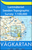
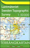
 Sweden
 USA
USA
 Italy
Italy
 Spain
Spain
More From Contributor


Góry Stolowe
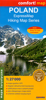
Góry Stolowe in a series covering Poland’s best hiking areas on waterproof and tear-resistant, laminated maps, specially designed to withstand repeated re-folding and even the worst weather conditions. Each map is double-sided and has clear, well presented cartography with a contoured base (20m interval) and, where appropriate, relief shading, graphic relief in rocky areas, and spot heights. Extensive overprint highlights waymarked hiking trails and on many titles also cycling, skiing or canoeing routes. Symbols show accommodation facilities including hotels, campsites, youth hostels, mountain refuges, etc., restaurants and bars in more remote areas, local bus stops, petrol stations, medical facilities, etc. Many titles include street plans of holiday resorts. The maps
have either a UTM or latitude/longitude grid. *Map legend includes English.**In this title:* overprint includes cycling routes.
have either a UTM or latitude/longitude grid. *Map legend includes English.**In this title:* overprint includes cycling routes.

Product Description
Reviews/Comments
Add New
Vouchers
No voucher codes found.
Do you know a voucher code for this product or supplier? Add it to Insights for others to use.
Do you know a voucher code for this product or supplier? Add it to Insights for others to use.
 Denmark