More From Contributor
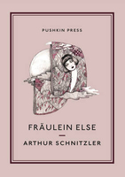
£8.99
Paper version of map No. 30 from the Ordnance Survey’s Landranger series at 1:50, 000, with contoured & GPS compatible topographic mapping plus tourist information.MOBILE DOWNLOADS: As well as the physical edition of the map, each Landranger title now

Includes::
a code for downloading after purchase its digital version onto your smartphone or tablet for viewing on the OS smartphone app.OS LANDRANGER SERIES: to see the list of all the titles in the OS Landranger series, both paper & waterproof versions, please click on the series link. Maps in the Landranger series provide plenty of recreational & tourist information, indicating the traditional public right of way paths (except in Scotland where different laws apply), including bridleways & byways restricted or open to motorized traffic. National Trails & selected other long-distance paths are marked, as well as on-road & traffic-free cycle routes with their National/ Regional Cycle Network numbers. National Trust/ National Trust for Scotland & Forestry Commission land is clearly marked, indicating open or restricted access. A range of symbols highlights camping & caravanning sites, youth hostels, tourist information offices & visitors’ centres, parking & picnicking places, World Heritage sites, sport & recreational facilities, etc. The maps provide detailed presentation of topography with contours at 10m intervals, numerous spot heights & additional colouring and/or graphics for different types of woodlands, orchards or parkl&, rock features including scree & cliffs, water features inland & along the sea shore with marshl&, dunes, s&, mud, shingle & the high water mark. All the standard information expected of survey mapping at this scale is included: finely graded road network, railway lines with stations, cuttings, embankments, etc; individual isolated buildings; archaeological & historical sites, etc. For GPS users the British National Grid is shown at 1km intervals, with latitude & longitude given by margin ticks at 1` & cross hairs on the map at 5`. Each map covers an area of 40 x 40km, (approx. 25 x 25 miles).

...
Archived Product
£11.50
Frauenau in a series of GPS compatible recreational editions of the Bavarian topographic survey at 1:25, 000, with waymarked hiking trails & cycling routes, campsites & youth hostels, etc. Coverage

Includes::
Bayerisch Eisenstein, Lindberg, Großer Rachel, Zwiesel, Großer Falkenstein. Contours used in this map vary between 5 to 20m according to the terrain, with 20m interval predominantly used for hilly areas. Varied colouring show different types of landscape: woods, vineyards, fields etc. Maps in this series feature extensive overprint highlighting local & long-distance footpaths & cycle routes, including King Ludwig Way or different variants of the Way of St James, indicating their waymarking. Symbols highlight different types of accommodation (campsites, youth hostels, refuges, etc), sport & recreational facilities, various places of interest, etc. The maps have a 1-km UTM grid. Map legend & all the text are in German only. To see other titles in this series please click on the series link.

...
Archived Product
£12.99
Map No. 1053, Frauenfeld, in the topographic survey of Switzerland at 1:25, 000 from Bundesamt für Landestopographie (swisstopo), covering the whole country on 247 small format sheets, with special larger maps published for popular regions including some titles now available in hiking versions. Highly regarded for their superb use of graphic relief & hill shading, the maps give an almost 3-D picture of Switzerland`s mountainous terrain. Contours are at 10 m intervals, with 20m intervals in the mountainous areas. All the maps have a 1-km grid for Swiss national coordinates (datum CH 1903). * Small format sheets (Nos. 1011
- 1374)* Map legend in the language of the area covered by the map. Additional margin ticks show latitude & longitude in steps of 2`. The area covered by each map is 17 x 12 km (11 x 7 miles approx). * Special larger sheets (Nos. from 2501 onwards) – STANDARD editions:* No map legend is included but a separate leaflet can be provided instead. The area covered by each map is 25 x 17 km (15 x 11 miles approx).* Special larger sheets (Nos. from 2501 onwards) – HIKING editions:* An overprint highlights hiking, mountain & alpine paths, including regional & national long-distance trails. The maps also show bus routes with bus stops, plus inns in remote locations. The area covered by each map is 25 x 17 km (15 x 11 miles approx).
...
Archived Product
£12.99
Frauenfeld, map No. 216, in the standard topographic survey of Switzerland at 1:50, 000 from Swisstopo, i.e. without the special overprint highlighting walking trails, local bus stops, etc, presented in Swisstopo’s hiking editions of the 50K survey. Highly regarded for their superb use of graphic relief & hill shading, the maps give an almost 3-D picture of Switzerland`s mountainous terrain. Contours are at 20m intervals. All the maps have a 1-km grid with the Swiss national coordinates. This standard version of the 50K survey covers the whole country on 78 small format sheets, with special larger format maps published for several popular tourist destinations. Small format sheets cover an area of 35 x 24 km (21 x 15 miles approx) & have map legend in the language of the area covered by the map. The special larger sheets cover 50 x 35 km (31 x 22 miles approx) & have no map legend, but a separate leaflet can be provided instead.PLEASE NOTE: the hiking editions of the 1:50, 000 Swisstopo survey are listed on our website in a separate series. ...
Archived Product
£18.99
Frauenfeld area, map No. 216T, at 1:50, 000 in a special hiking edition of the country’s topographic survey, published by Swisstopo in cooperation with the Swiss Hiking Federation. Cartography, identical to the standard version of the survey, is highly regarded for its superb use of graphic relief & hill shading to provide an almost 3-D picture of Switzerland`s mountainous terrain. Contours are at 20m intervals. An overprint highlights routes maintained by the SHF, distinguishing between hiking routes, mountain routes requiring proper footwear, & alpine routes where equipment is needed. Paths which are part of the national or regional network of long-distance hiking routes are specially marked & in the more recent editions are annotated with their official numbers. The maps show mountain huts, refuges & in remote areas also inns, plus roads with bus service & the positions of bus stops. All the maps have a 1-km grid of the Swiss national coordinates. For a list of all the titles in this series, please click on the series link. ...
Archived Product
£8.99
What on earth could have induced Mr Anstruther to fall in love with Fraulein Schmidt? He is an eligible English bachelor from a good family with great expectations; she is the plain, poor, `spinster` daughter of a German scholar. But Rose-Marie Schmidt is also funny, intelligent, brave & gifted with an irrepressible talent for happiness. The real question is, does Mr Anstruther know how lucky he is? ...
Archived Product
£11.50
Fränkische Alb Central (No. 175), a detailed, GPS compatible map at 1:50, 000 from Kompass with local & long-distance footpaths, cycling routes, accommodation, etc, printed on durable, waterproof & tear-resistant synthetic paper. KOMPASS HIKING & RECREATIONAL MAPS: This title is part of an extensive series covering Austria, much of Germany & the Slovenian Alps. Kompass are Europe’s largest publishers of hiking maps; their mapping of other countries, including expanding coverage of Italy, is listed on our website separately.CARTOGRAPHY: The maps are contoured with additional shading, graphic relief & colouring to provide a more detailed picture of the terrain, vegetation and/or land use. Contour interval varies from 10m in the coastal areas of Northern Germany to 40 or 50 metres in the mountainous regions. All the maps highlight local & long-distance waymarked footpaths, including climbing trails. Most titles also show cycling routes, mountain bike trails, &, the in mountainous areas, ski routes. The maps indicate various types of accommodation (selected inns & hotels, youth hostels, campsites, mountain refuges), as well as recreational facilities, places of interest, etc. Latest editions also show access by public transport with bus stops and/or Park+ Ride facilities.GEOGRAPHICAL COORDINATES: Unless indicated to the contrary in the individual description, the maps have a UTM grid for GPS users. MAP LEGEND: Most maps now include full English legend, particularly titles covering the Alpine areas. Some maps covering mainly eastern Austria or the less popular parts of Germany may still have a legend in German only.OTHER
Features: Selected titles include on the reverse panorama drawings of their area with names of villages, peaks, valleys, etc. and/or have a booklet with pictures of local wild flowers with their Latin names. Many titles are now published as competitively priced sets of two or more maps, offering a wider coverage.BOOKLETS: PLEASE NOTE BEFORE ORDERING! Many titles come with a booklet describing the area and/or various hiking routes. Unless indicated in the individual description that the booklet

Includes::
English, these booklets are IN GERMAN only. The booklets are not necessary to use the maps since, as stated above, full English language map legend is provided.


...
Archived Product
£12.99
Fränkische Schweiz region of the Franconian Jura in northern Bavaria at 1:35, 000 from Kümmerly+ Frey in a series GPS compatible, double-sided maps printed on durable, waterproof & tear-resistant plastic paper; contoured, with hiking & cycle routes, other recreational activities, etc. Maps in this series are at a scale of either 1:50, 000 or 1:35, 000. Contour interval varies from 10m to 40m according to the area &, where appropriate, the maps have finely drawn additional graphic relief to provide an excellent representation of the terrain, with plenty of names of peaks, valleys, etc, national parks or other protected areas, plus colouring/graphics indicating different types of vegetation. An overprint, graded according to the difficulty of the route, highlights hiking trails indicating their waymarking. Also marked are local & long-distance cycle routes, plus a selection of mountain-bike trails, cross-country & alpine ski routes & horse-riding paths. A wide range of symbols indicate locations for other outdoor activities: climbing, paragliding, toboggan runs, sailing or surfing, etc. Also marked are various sport facilities, different types of accommodations including alpine huts, campsites, youth hostels, sites of botanical or cultural interest, etc. For access the maps show local bus stops, car parks/park+ride facilities, roads with entry restrictions, etc. The maps have a 1km UTM grid. Map legend

Includes::
English. Each title also provides a road map of the region around the area covered by it. To see the complete list of titles in this series please click on the series link.

...
Archived Product
£9.50
Map No. 174, Fränkisches Seenl&, in a series of hiking maps from Kompass providing extensive coverage of Austria & Germany plus the Slovenian Alps, with hiking routes on a topographic base, various types of accommodation, recreational facilities, places of interest, etc. Many titles are now published as competitively priced sets of two or more maps, offering a wider coverage. Kompass are Europe’s largest publishers of walking maps, with extensive coverage of hiking areas in other countries, all listed on our website. * Cartography:* all the maps are contoured with additional shading & graphic relief to provide a more detailed picture of the terrain, vegetation and/or land use. Contour interval varies from 10 metres in the coastal areas of Northern Germany to 40 or 50 metres in the mountainous parts of the two countries. All the maps highlight local & long-distance waymarked footpaths, including climbing trails. Most titles also show cycling routes, mountain bike trails, &, the in mountainous areas, ski routes. The maps indicate various types of accommodation (selected inns & hotels, youth hostels, campsites, mountain refuges), as well as recreational facilities, places of interest, etc. New editions also show access by public transport with bus stops and/or Park+ Ride facilities.* Geographical coordinates:* this title has no GPS coordinates.* Map legend:* most maps now include full English legend, particularly titles covering the Alpine areas. Some maps covering mainly eastern Austria or the less popular parts of Germany may still have a legend in German only.* Other
Features:* some titles now include on the reverse panorama drawings of their area with names of villages, peaks, valleys, etc. and/or have booklets with pictures of local wild flowers with their Latin names.*PLEASE NOTE BEFORE ORDERING!* * Booklets:* many titles come with booklets describing the area and/or various hiking routes. These booklets are in * German only*, apart from a handful of titles where an English language booklet is specifically indicated in the individual description. So, unless English language booklet is actually mentioned, the map can only be supplied with a German booklet. These booklets are not necessary to use the maps since, as stated above, most titles now include * full English language map legend.*
...
Archived Product
£12.99
Fränkisches Weinland
- Würzburg
- Kitzingen
- Ochsenfurt
- Volkach region of northern Bavaria at 1:50, 000 from Kümmerly+


...
Archived Product

Fraulein Else

Depicting the evolution of a moral dilemma in dazzling stream-of-consciousness narrative, Arthur Schnitzler`s Fraulein Else is a darkly witty exploration of Viennese social mores. Fraulein Else is the story of a young woman who, while staying with her aunt at a fashionable spa, receives a telegram from her mother begging her to save her father from debtor`s jail by approaching an elderly acquaintance in order to borrow money from him. Forced by the exigencies of her family into the reality of a world entirely at odds with her romantic imagination, we are brought unremittingly to the horrific consequences of Else`s realisation that her world is one in which everything has a price and where the veneer of morality is as brittle and transparent as glass. Translated from the German by F.H.
Lyon, Arthur Schnitzler`s modernist novella Fraulein Else is published by Pushkin Press. Arthur Schnitzler (b.1862) was born in Vienna, the son of a prominent Jewish doctor, and studied medicine at the University of Vienna. In later years he devoted his life to writing and was successful as a novelist, dramatist and short story writer.Schnitzler`s work shows a remarkable ability to create atmosphere and a profound understanding of human motives.
RIP - This product is no longer available on our network. It was last seen on 25.09.2019

This page now acts as a permanent archive for this product. Add more information using the comments box below to ensure it can still be found by future generations.

Use our search facility to see if it is available from an alternative contributor.
  • Availability: Out Of Stock
  • Supplier: Stanfords
  • SKU: 9781908968326
Availability: In Stock
£10.00

Product Description

Depicting the evolution of a moral dilemma in dazzling stream-of-consciousness narrative, Arthur Schnitzler`s Fraulein Else is a darkly witty exploration of Viennese social mores. Fraulein Else is the story of a young woman who, while staying with her aunt at a fashionable spa, receives a telegram from her mother begging her to save her father from debtor`s jail by approaching an elderly acquaintance in order to borrow money from him. Forced by the exigencies of her family into the reality of a world entirely at odds with her romantic imagination, we are brought unremittingly to the horrific consequences of Else`s realisation that her world is one in which everything has a price & where the veneer of morality is as brittle & transparent as glass. Translated from the German by F.H. Lyon, Arthur Schnitzler`s modernist novella Fraulein Else is published by Pushkin Press. Arthur Schnitzler (b.1862) was born in Vienna, the son of a prominent Jewish doctor, & studied medicine at the University of Vienna. In later years he devoted his life to writing & was successful as a novelist, dramatist & short story writer. Schnitzler`s work shows a remarkable ability to create atmosphere & a profound understanding of human motives.

Reviews/Comments

Add New

Intelligent Comparison

Oooops!
We couldn't find anything!
Perhaps this product's unique.... Or perhaps we are still looking for comparisons!
Click to bump this page and we'll hurry up.

Price History

Vouchers

No voucher codes found.
Do you know a voucher code for this product or supplier? Add it to Insights for others to use.

Facebook

Jargon Buster

Glass - A solid, typically transparent. Brittle and used in windows. The first patent granted in the UK was for Glass.
Human - A highly developed and adapted mamal and deminant species on earth
World - A physical grouping, commonly used to describe earth and everything associated with ti
Medicine - A biological substance used for health benefits
Family - A group of people that live together made up from parents and children.

Supplier Information

Stanfords
Stanfords was established in 1853 and opened their iconic Covent Garden flagship store in 1901. They have become the top retailer of maps, travel books and accessories in the UK and arguably offer the largest selection of maps and travel books worldwide. Famous names such as Captain Robert Falcon Scott, Ranulph Fiennes and Michael Palin have purchased from Stanfords. They now have a shop in Bristol and both stores together with other venues operate a calendar of events including talks, book signings and exhibitions. As a specialist map retailer, the map selection is comprehensive and includes road maps, street maps and walking maps from worldwide destinations, as well as a selection of world atlases and wall maps. Books include travel guides and travel literature. Stanfords also stock globes, from miniatures made of blue marble to magnificent floor-standing globes. The website features a selection of interesting articles on travel topics.
Page Updated: 2023-11-12 20:15:36

Community Generated Product Tags

Oh No! The productWIKI community hasn't generated any tags for this product yet!
Menu