
 United Kingdom
 France
 Germany
 Netherlands
 Sweden
 USA
USA
 Italy
Italy
 Spain
Spain
More From Contributor


Fraserburgh
Map No. 30, Fraserburgh, in the Ordnance Survey Landranger series at 1:50, 000, including Peterhead, Ellon, Rosehearty, Gardenstown, Netherbrae, New Aberdour, Rathen, Inverallochy, St Combs, New Pitsligo, New Byth, Strichen, Crimond, St Fergus, Inverugie, Mintlaw, Maud, Cuminestown, New Deer, Stuartfield, Clola, Boddam, Auchnagatt, South Quilquox, Woodhead, Methlick, Barthol Chapel, Tarves, Berefold, Hatton, Whinnyfold and Cruden May, with the Buchan, Loch Strathbeg and Rattray Head.Edition B2 with minor changes; Publications date April 2012About Ordnance Survey
Product Description
Reviews/Comments
Add New
Intelligent Comparison
Archived Product
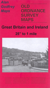
Fraserburgh 1901 Stanfords
£3.50
Vouchers
No voucher codes found.
Do you know a voucher code for this product or supplier? Add it to Insights for others to use.
Do you know a voucher code for this product or supplier? Add it to Insights for others to use.
 Denmark